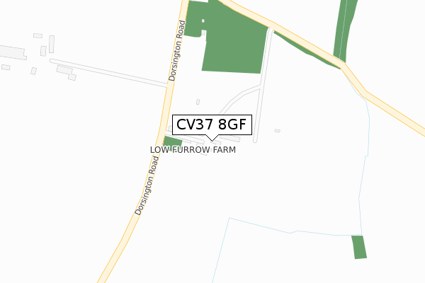
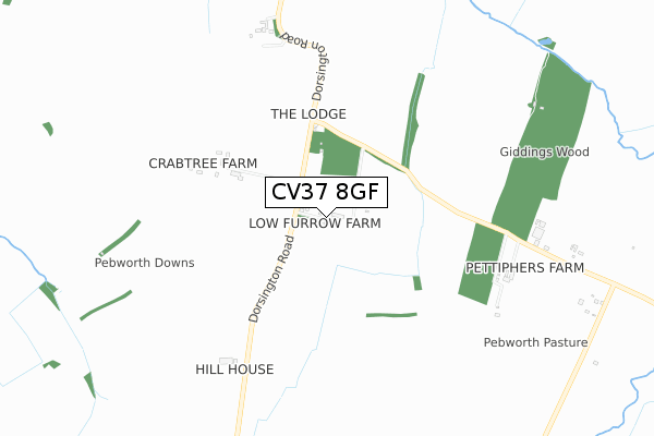
CV37 8GF is located in the Honeybourne, Pebworth & The Littletons electoral ward, within the local authority district of Wychavon and the English Parliamentary constituency of Mid Worcestershire. The Sub Integrated Care Board (ICB) Location is NHS Herefordshire and Worcestershire ICB - 18C and the police force is West Mercia. This postcode has been in use since July 2018.


GetTheData
Source: OS Open Zoomstack (Ordnance Survey)
Licence: Open Government Licence (requires attribution)
Attribution: Contains OS data © Crown copyright and database right 2024
Source: Open Postcode Geo
Licence: Open Government Licence (requires attribution)
Attribution: Contains OS data © Crown copyright and database right 2024; Contains Royal Mail data © Royal Mail copyright and database right 2024; Source: Office for National Statistics licensed under the Open Government Licence v.3.0
| Easting | 413329 |
| Northing | 248633 |
| Latitude | 52.135851 |
| Longitude | -1.806664 |
GetTheData
Source: Open Postcode Geo
Licence: Open Government Licence
| Country | England |
| Postcode District | CV37 |
| ➜ CV37 open data dashboard ➜ See where CV37 is on a map | |
GetTheData
Source: Land Registry Price Paid Data
Licence: Open Government Licence
| Ward | Honeybourne, Pebworth & The Littletons |
| Constituency | Mid Worcestershire |
GetTheData
Source: ONS Postcode Database
Licence: Open Government Licence
| Dorsington Road (Braggington Lane) | Dorsington | 1,119m |
| Dorsington Road (Braggington Lane) | Dorsington | 1,134m |
| Honeybourne Station | 4.2km |
GetTheData
Source: NaPTAN
Licence: Open Government Licence
| Percentage of properties with Next Generation Access | 100.0% |
| Percentage of properties with Superfast Broadband | 0.0% |
| Percentage of properties with Ultrafast Broadband | 0.0% |
| Percentage of properties with Full Fibre Broadband | 0.0% |
Superfast Broadband is between 30Mbps and 300Mbps
Ultrafast Broadband is > 300Mbps
| Percentage of properties unable to receive 2Mbps | 0.0% |
| Percentage of properties unable to receive 5Mbps | 0.0% |
| Percentage of properties unable to receive 10Mbps | 100.0% |
| Percentage of properties unable to receive 30Mbps | 100.0% |
GetTheData
Source: Ofcom
Licence: Ofcom Terms of Use (requires attribution)
GetTheData
Source: ONS Postcode Database
Licence: Open Government Licence


➜ Get more ratings from the Food Standards Agency
GetTheData
Source: Food Standards Agency
Licence: FSA terms & conditions
| Last Collection | |||
|---|---|---|---|
| Location | Mon-Fri | Sat | Distance |
| Pebworth Corner | 16:00 | 07:30 | 411m |
| Dorsington | 16:00 | 07:30 | 1,108m |
| Pebworth Post Office | 16:15 | 10:00 | 1,842m |
GetTheData
Source: Dracos
Licence: Creative Commons Attribution-ShareAlike
| Facility | Distance |
|---|---|
| Bidford Grange Golf Club Stratford Road, Bidford-on-avon, Alcester Golf | 3.4km |
| Welford-on-avon Indoor Bowls Club Mill Lane, Welford On Avon, Stratford-upon-avon Indoor Bowls | 3.6km |
| Meon Vale Leisure Centre Wellington Avenue, Meon Vale, Stratford-upon-avon Health and Fitness Gym, Sports Hall, Artificial Grass Pitch, Grass Pitches | 3.6km |
GetTheData
Source: Active Places
Licence: Open Government Licence
| School | Phase of Education | Distance |
|---|---|---|
| Pebworth First School Back Lane, Pebworth, Stratford-upon-Avon, CV37 8XA | Primary | 1.8km |
| Tudor Grange Primary Academy Meon Vale Bailey Avenue, Meon Vale, Stratford-upon-Avon, CV37 8QR | Primary | 3.3km |
| Welford-on-Avon Primary School Headland Road, Welford-on-Avon, Stratford-upon-Avon, CV37 8ER | Primary | 3.6km |
GetTheData
Source: Edubase
Licence: Open Government Licence
The below table lists the International Territorial Level (ITL) codes (formerly Nomenclature of Territorial Units for Statistics (NUTS) codes) and Local Administrative Units (LAU) codes for CV37 8GF:
| ITL 1 Code | Name |
|---|---|
| TLG | West Midlands (England) |
| ITL 2 Code | Name |
| TLG1 | Herefordshire, Worcestershire and Warwickshire |
| ITL 3 Code | Name |
| TLG12 | Worcestershire CC |
| LAU 1 Code | Name |
| E07000238 | Wychavon |
GetTheData
Source: ONS Postcode Directory
Licence: Open Government Licence
The below table lists the Census Output Area (OA), Lower Layer Super Output Area (LSOA), and Middle Layer Super Output Area (MSOA) for CV37 8GF:
| Code | Name | |
|---|---|---|
| OA | E00165207 | |
| LSOA | E01032390 | Wychavon 011A |
| MSOA | E02006758 | Wychavon 011 |
GetTheData
Source: ONS Postcode Directory
Licence: Open Government Licence
| CV37 8AP | Dorsington Road | 378m |
| CV37 8AW | Dorsington Road | 717m |
| CV37 8AR | 916m | |
| CV37 8AX | 1082m | |
| CV37 8AY | 1245m | |
| CV37 8AT | Barton Road | 1274m |
| CV37 8UX | Mill Field | 1305m |
| CV37 8AZ | Glebe Cottages | 1353m |
| CV37 8BB | 1558m | |
| CV37 8XD | Dorsington Road | 1595m |
GetTheData
Source: Open Postcode Geo; Land Registry Price Paid Data
Licence: Open Government Licence