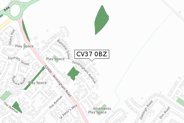
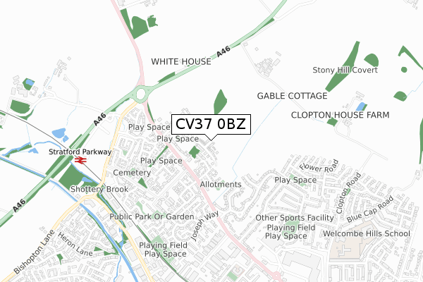
CV37 0BZ is located in the Stratford Avenue electoral ward, within the local authority district of Stratford-on-Avon and the English Parliamentary constituency of Stratford-on-Avon. The Sub Integrated Care Board (ICB) Location is NHS Coventry and Warwickshire ICB - B2M3M and the police force is Warwickshire. This postcode has been in use since July 2019.


GetTheData
Source: OS Open Zoomstack (Ordnance Survey)
Licence: Open Government Licence (requires attribution)
Attribution: Contains OS data © Crown copyright and database right 2024
Source: Open Postcode Geo
Licence: Open Government Licence (requires attribution)
Attribution: Contains OS data © Crown copyright and database right 2024; Contains Royal Mail data © Royal Mail copyright and database right 2024; Source: Office for National Statistics licensed under the Open Government Licence v.3.0
| Easting | 419203 |
| Northing | 256691 |
| Latitude | 52.208125 |
| Longitude | -1.720392 |
GetTheData
Source: Open Postcode Geo
Licence: Open Government Licence
| Country | England |
| Postcode District | CV37 |
| ➜ CV37 open data dashboard ➜ See where CV37 is on a map ➜ Where is Stratford-upon-Avon? | |
GetTheData
Source: Land Registry Price Paid Data
Licence: Open Government Licence
| Ward | Stratford Avenue |
| Constituency | Stratford-on-avon |
GetTheData
Source: ONS Postcode Database
Licence: Open Government Licence
| November 2023 | Anti-social behaviour | On or near Oakleigh Road | 470m |
| November 2023 | Vehicle crime | On or near Oakleigh Road | 470m |
| November 2023 | Vehicle crime | On or near Oakleigh Road | 470m |
| ➜ Get more crime data in our Crime section | |||
GetTheData
Source: data.police.uk
Licence: Open Government Licence
| St Peters Way (Birmingham Road) | Stratford-upon-avon | 190m |
| Birmingham Road | Stratford-upon-avon | 209m |
| Birmingham Road | Stratford-upon-avon | 222m |
| Joseph Way (Birmingham Road) | Stratford-upon-avon | 434m |
| Park & Ride (Bishopton Road) | Stratford-upon-avon | 570m |
| Stratford-upon-Avon Parkway Station | 0.7km |
| Stratford-upon-Avon Station | 1.6km |
| Wilmcote Station | 2.9km |
GetTheData
Source: NaPTAN
Licence: Open Government Licence
GetTheData
Source: ONS Postcode Database
Licence: Open Government Licence


➜ Get more ratings from the Food Standards Agency
GetTheData
Source: Food Standards Agency
Licence: FSA terms & conditions
| Last Collection | |||
|---|---|---|---|
| Location | Mon-Fri | Sat | Distance |
| Joseph Way | 17:30 | 12:15 | 556m |
| Birmingham Road Post Office | 17:30 | 12:30 | 645m |
| Clopton Estate | 17:30 | 12:30 | 767m |
GetTheData
Source: Dracos
Licence: Creative Commons Attribution-ShareAlike
| Facility | Distance |
|---|---|
| Puregym (Stratford-upon-avon) Birmingham Road, Stratford-upon-avon Health and Fitness Gym | 973m |
| Anytime Fitness (Stratford Upon Avon) Maybrook Industrial Estate, Birmingham Road, Birmingham Road, Stratford-upon-avon Health and Fitness Gym | 1km |
| Royal Mail Delivery Offices Maybrook Road, Stratford-upon-avon Sports Hall | 1.1km |
GetTheData
Source: Active Places
Licence: Open Government Licence
| School | Phase of Education | Distance |
|---|---|---|
| Thomas Jolyffe Primary School Clopton Road, Stratford-upon-Avon, CV37 6TE | Primary | 1.1km |
| Welcombe Hills School Blue Cap Road, Stratford-upon-Avon, CV37 6TQ | Not applicable | 1.1km |
| Bishopton Primary School Drayton Avenue, Stratford-upon-Avon, CV37 9PB | Primary | 1.3km |
GetTheData
Source: Edubase
Licence: Open Government Licence
The below table lists the International Territorial Level (ITL) codes (formerly Nomenclature of Territorial Units for Statistics (NUTS) codes) and Local Administrative Units (LAU) codes for CV37 0BZ:
| ITL 1 Code | Name |
|---|---|
| TLG | West Midlands (England) |
| ITL 2 Code | Name |
| TLG1 | Herefordshire, Worcestershire and Warwickshire |
| ITL 3 Code | Name |
| TLG13 | Warwickshire CC |
| LAU 1 Code | Name |
| E07000221 | Stratford-on-Avon |
GetTheData
Source: ONS Postcode Directory
Licence: Open Government Licence
The below table lists the Census Output Area (OA), Lower Layer Super Output Area (LSOA), and Middle Layer Super Output Area (MSOA) for CV37 0BZ:
| Code | Name | |
|---|---|---|
| OA | E00172289 | |
| LSOA | E01031230 | Stratford-on-Avon 009C |
| MSOA | E02006512 | Stratford-on-Avon 009 |
GetTheData
Source: ONS Postcode Directory
Licence: Open Government Licence
| CV37 0RE | Birmingham Road | 159m |
| CV37 0RF | Birmingham Road | 237m |
| CV37 0UQ | Hares Leap | 285m |
| CV37 0RS | Coopers Close | 300m |
| CV37 0RY | Marsh Lane | 302m |
| CV37 0RR | Worths Way | 310m |
| CV37 0UL | Squirrels Street | 335m |
| CV37 0RZ | Lattimore Road | 350m |
| CV37 0DS | Highfield Road | 381m |
| CV37 0DR | Ash Grove | 394m |
GetTheData
Source: Open Postcode Geo; Land Registry Price Paid Data
Licence: Open Government Licence