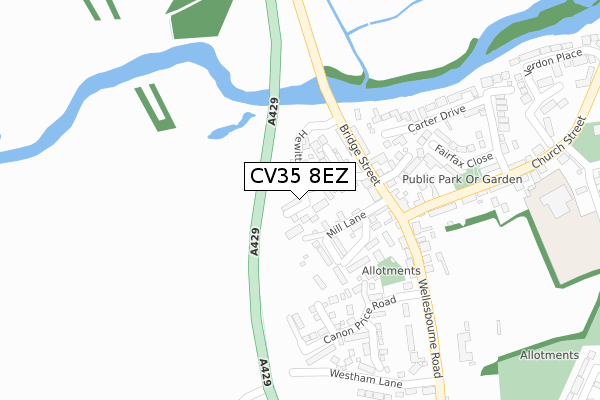
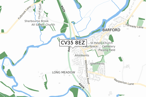
CV35 8EZ is located in the Budbrooke electoral ward, within the local authority district of Warwick and the English Parliamentary constituency of Warwick and Leamington. The Sub Integrated Care Board (ICB) Location is NHS Coventry and Warwickshire ICB - B2M3M and the police force is Warwickshire. This postcode has been in use since November 2017.


GetTheData
Source: OS Open Zoomstack (Ordnance Survey)
Licence: Open Government Licence (requires attribution)
Attribution: Contains OS data © Crown copyright and database right 2024
Source: Open Postcode Geo
Licence: Open Government Licence (requires attribution)
Attribution: Contains OS data © Crown copyright and database right 2024; Contains Royal Mail data © Royal Mail copyright and database right 2024; Source: Office for National Statistics licensed under the Open Government Licence v.3.0
| Easting | 426735 |
| Northing | 260790 |
| Latitude | 52.244663 |
| Longitude | -1.609845 |
GetTheData
Source: Open Postcode Geo
Licence: Open Government Licence
| Country | England |
| Postcode District | CV35 |
| ➜ CV35 open data dashboard ➜ See where CV35 is on a map ➜ Where is Barford? | |
GetTheData
Source: Land Registry Price Paid Data
Licence: Open Government Licence
| Ward | Budbrooke |
| Constituency | Warwick And Leamington |
GetTheData
Source: ONS Postcode Database
Licence: Open Government Licence
2023 20 JUL £950,000 |
2022 1 FEB £820,000 |
8, HEWITT ROAD, BARFORD, WARWICK, CV35 8EZ 2018 20 DEC £675,000 |
1, HEWITT ROAD, BARFORD, WARWICK, CV35 8EZ 2018 27 SEP £795,000 |
7, HEWITT ROAD, BARFORD, WARWICK, CV35 8EZ 2018 14 SEP £620,000 |
2018 29 MAR £700,000 |
2018 28 FEB £780,000 |
5, HEWITT ROAD, BARFORD, WARWICK, CV35 8EZ 2017 22 DEC £618,000 |
23, HEWITT ROAD, BARFORD, WARWICK, CV35 8EZ 2017 21 DEC £400,000 |
3, HEWITT ROAD, BARFORD, WARWICK, CV35 8EZ 2017 20 DEC £690,000 |
GetTheData
Source: HM Land Registry Price Paid Data
Licence: Contains HM Land Registry data © Crown copyright and database right 2024. This data is licensed under the Open Government Licence v3.0.
| June 2022 | Other crime | On or near Wilkins Close | 82m |
| June 2022 | Public order | On or near Hemmings Mill | 128m |
| June 2022 | Public order | On or near Hemmings Mill | 128m |
| ➜ Get more crime data in our Crime section | |||
GetTheData
Source: data.police.uk
Licence: Open Government Licence
| Joseph Arch (Bridge Street) | Barford | 128m |
| Joseph Arch (Bridge Street) | Barford | 137m |
| Brick Bus Shelter (Wellesbourne Road) | Barford | 248m |
| Brick Bus Shelter (Wellesbourne Road) | Barford | 261m |
| Granville (Wellesbourne Road) | Barford | 504m |
| Warwick Parkway Station | 4.6km |
| Warwick Station | 5km |
| Leamington Spa Station | 6.7km |
GetTheData
Source: NaPTAN
Licence: Open Government Licence
➜ Broadband speed and availability dashboard for CV35 8EZ
| Percentage of properties with Next Generation Access | 100.0% |
| Percentage of properties with Superfast Broadband | 100.0% |
| Percentage of properties with Ultrafast Broadband | 0.0% |
| Percentage of properties with Full Fibre Broadband | 0.0% |
Superfast Broadband is between 30Mbps and 300Mbps
Ultrafast Broadband is > 300Mbps
| Median download speed | 77.5Mbps |
| Average download speed | 59.3Mbps |
| Maximum download speed | 80.00Mbps |
| Median upload speed | 19.5Mbps |
| Average upload speed | 14.1Mbps |
| Maximum upload speed | 20.00Mbps |
| Percentage of properties unable to receive 2Mbps | 0.0% |
| Percentage of properties unable to receive 5Mbps | 0.0% |
| Percentage of properties unable to receive 10Mbps | 0.0% |
| Percentage of properties unable to receive 30Mbps | 0.0% |
➜ Broadband speed and availability dashboard for CV35 8EZ
GetTheData
Source: Ofcom
Licence: Ofcom Terms of Use (requires attribution)
GetTheData
Source: ONS Postcode Database
Licence: Open Government Licence


➜ Get more ratings from the Food Standards Agency
GetTheData
Source: Food Standards Agency
Licence: FSA terms & conditions
| Last Collection | |||
|---|---|---|---|
| Location | Mon-Fri | Sat | Distance |
| Barford Post Office | 17:30 | 10:00 | 189m |
| High Street | 15:30 | 11:00 | 585m |
| Church Road | 15:45 | 07:15 | 977m |
GetTheData
Source: Dracos
Licence: Creative Commons Attribution-ShareAlike
| Facility | Distance |
|---|---|
| King George V Playing Field (Barford) Church Lane, Barford, Warwick Grass Pitches, Outdoor Tennis Courts | 561m |
| Livingwell Health Club (Warwick) Stratford Road, Warwick Health and Fitness Gym, Swimming Pool | 1.9km |
| Aylesford School Tapping Way, Warwick Sports Hall, Health and Fitness Gym, Artificial Grass Pitch, Grass Pitches | 2.9km |
GetTheData
Source: Active Places
Licence: Open Government Licence
| School | Phase of Education | Distance |
|---|---|---|
| Barford St Peter's CofE Primary School Church Street, Barford, Warwick, CV35 8EW | Primary | 407m |
| Aylesford School Warwick Tapping Way, Warwick, CV34 6XR | All-through | 2.9km |
| Newburgh Primary School Kipling Avenue, Warwick, CV34 6LD | Primary | 3.1km |
GetTheData
Source: Edubase
Licence: Open Government Licence
The below table lists the International Territorial Level (ITL) codes (formerly Nomenclature of Territorial Units for Statistics (NUTS) codes) and Local Administrative Units (LAU) codes for CV35 8EZ:
| ITL 1 Code | Name |
|---|---|
| TLG | West Midlands (England) |
| ITL 2 Code | Name |
| TLG1 | Herefordshire, Worcestershire and Warwickshire |
| ITL 3 Code | Name |
| TLG13 | Warwickshire CC |
| LAU 1 Code | Name |
| E07000222 | Warwick |
GetTheData
Source: ONS Postcode Directory
Licence: Open Government Licence
The below table lists the Census Output Area (OA), Lower Layer Super Output Area (LSOA), and Middle Layer Super Output Area (MSOA) for CV35 8EZ:
| Code | Name | |
|---|---|---|
| OA | E00159420 | |
| LSOA | E01031269 | Warwick 014E |
| MSOA | E02006532 | Warwick 014 |
GetTheData
Source: ONS Postcode Directory
Licence: Open Government Licence
| CV35 8EX | Wilkins Close | 94m |
| CV35 8EJ | Mill Lane | 98m |
| CV35 8BG | Mill Lane | 101m |
| CV35 8EH | Bridge Street | 141m |
| CV35 8BP | Hemmings Mill | 146m |
| CV35 8DZ | Steeds Court | 158m |
| CV35 8ED | Elliotts Orchard | 176m |
| CV35 8EL | Wellesbourne Road | 220m |
| CV35 8EQ | Canon Price Road | 221m |
| CV35 8ET | Carter Drive | 225m |
GetTheData
Source: Open Postcode Geo; Land Registry Price Paid Data
Licence: Open Government Licence