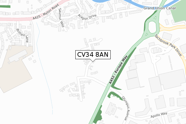
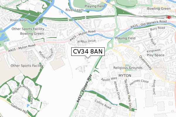
CV34 8AN is located in the Warwick Myton & Heathcote electoral ward, within the local authority district of Warwick and the English Parliamentary constituency of Warwick and Leamington. The Sub Integrated Care Board (ICB) Location is NHS Coventry and Warwickshire ICB - B2M3M and the police force is Warwickshire. This postcode has been in use since January 2020.


GetTheData
Source: OS Open Zoomstack (Ordnance Survey)
Licence: Open Government Licence (requires attribution)
Attribution: Contains OS data © Crown copyright and database right 2024
Source: Open Postcode Geo
Licence: Open Government Licence (requires attribution)
Attribution: Contains OS data © Crown copyright and database right 2024; Contains Royal Mail data © Royal Mail copyright and database right 2024; Source: Office for National Statistics licensed under the Open Government Licence v.3.0
| Easting | 430664 |
| Northing | 264709 |
| Latitude | 52.279691 |
| Longitude | -1.551947 |
GetTheData
Source: Open Postcode Geo
Licence: Open Government Licence
| Country | England |
| Postcode District | CV34 |
| ➜ CV34 open data dashboard ➜ See where CV34 is on a map ➜ Where is Warwick? | |
GetTheData
Source: Land Registry Price Paid Data
Licence: Open Government Licence
| Ward | Warwick Myton & Heathcote |
| Constituency | Warwick And Leamington |
GetTheData
Source: ONS Postcode Database
Licence: Open Government Licence
2022 14 NOV £404,950 |
2022 5 JUL £530,000 |
2022 18 MAR £534,995 |
32, CONRAD LEWIS WAY, WARWICK, CV34 8AN 2021 23 DEC £371,250 |
64, CONRAD LEWIS WAY, WARWICK, CV34 8AN 2021 6 SEP £384,950 |
66, CONRAD LEWIS WAY, WARWICK, CV34 8AN 2021 24 MAR £399,950 |
68, CONRAD LEWIS WAY, WARWICK, CV34 8AN 2020 16 DEC £560,000 |
2020 8 DEC £479,000 |
36, CONRAD LEWIS WAY, WARWICK, CV34 8AN 2020 30 OCT £390,000 |
20, CONRAD LEWIS WAY, WARWICK, CV34 8AN 2020 16 OCT £369,950 |
GetTheData
Source: HM Land Registry Price Paid Data
Licence: Contains HM Land Registry data © Crown copyright and database right 2024. This data is licensed under the Open Government Licence v3.0.
| June 2022 | Other theft | On or near Shopping Area | 224m |
| June 2022 | Other theft | On or near Shopping Area | 224m |
| June 2022 | Other crime | On or near Shopping Area | 224m |
| ➜ Get more crime data in our Crime section | |||
GetTheData
Source: data.police.uk
Licence: Open Government Licence
| Olympus Avenue | Leamington Spa | 221m |
| Olympus Avenue | Leamington Spa | 234m |
| Shires Retail Park | Leamington Spa | 299m |
| Apollo Way | Warwick | 355m |
| Apollo Way | Leamington Spa | 366m |
| Leamington Spa Station | 1.2km |
| Warwick Station | 2.2km |
| Warwick Parkway Station | 4.2km |
GetTheData
Source: NaPTAN
Licence: Open Government Licence
GetTheData
Source: ONS Postcode Database
Licence: Open Government Licence


➜ Get more ratings from the Food Standards Agency
GetTheData
Source: Food Standards Agency
Licence: FSA terms & conditions
| Last Collection | |||
|---|---|---|---|
| Location | Mon-Fri | Sat | Distance |
| Myton Road East | 17:30 | 12:15 | 390m |
| Kingsway | 16:00 | 11:45 | 692m |
| Collins Road Business Box | 766m | ||
GetTheData
Source: Dracos
Licence: Creative Commons Attribution-ShareAlike
| Facility | Distance |
|---|---|
| Evergreen School Brittain Lane, Warwick Grass Pitches | 480m |
| Bury Road (Closed) Bury Road, Leamington Spa Grass Pitches | 493m |
| Sikh Cultural & Sports Community Centre Queensway Trading Estate, Queensway, Leamington Spa Health and Fitness Gym | 599m |
GetTheData
Source: Active Places
Licence: Open Government Licence
| School | Phase of Education | Distance |
|---|---|---|
| Myton School Myton Road, Warwick, CV34 6PJ | Secondary | 916m |
| Kingsway Community Primary School Baker Avenue, Leamington Spa, CV31 3HB | Primary | 932m |
| St Patrick's Catholic Primary School Cashmore Avenue, Leamington Spa, CV31 3EU | Primary | 1km |
GetTheData
Source: Edubase
Licence: Open Government Licence
The below table lists the International Territorial Level (ITL) codes (formerly Nomenclature of Territorial Units for Statistics (NUTS) codes) and Local Administrative Units (LAU) codes for CV34 8AN:
| ITL 1 Code | Name |
|---|---|
| TLG | West Midlands (England) |
| ITL 2 Code | Name |
| TLG1 | Herefordshire, Worcestershire and Warwickshire |
| ITL 3 Code | Name |
| TLG13 | Warwickshire CC |
| LAU 1 Code | Name |
| E07000222 | Warwick |
GetTheData
Source: ONS Postcode Directory
Licence: Open Government Licence
The below table lists the Census Output Area (OA), Lower Layer Super Output Area (LSOA), and Middle Layer Super Output Area (MSOA) for CV34 8AN:
| Code | Name | |
|---|---|---|
| OA | E00159686 | |
| LSOA | E01031315 | Warwick 012A |
| MSOA | E02006530 | Warwick 012 |
GetTheData
Source: ONS Postcode Directory
Licence: Open Government Licence
| CV34 6LR | Aragon Drive | 212m |
| CV34 6LS | Seymour Grove | 224m |
| CV34 6NB | Aragon Drive | 271m |
| CV34 6NE | Parr Close | 285m |
| CV34 6LH | Saumur Way | 292m |
| CV34 6ND | Howard Walk | 293m |
| CV34 6RH | Tachbrook Park Drive | 299m |
| CV34 6LT | Cleeves Avenue | 308m |
| CV34 6LP | Boleyn Close | 349m |
| CV31 3QD | The Moorings | 371m |
GetTheData
Source: Open Postcode Geo; Land Registry Price Paid Data
Licence: Open Government Licence