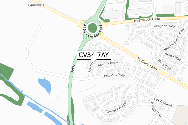
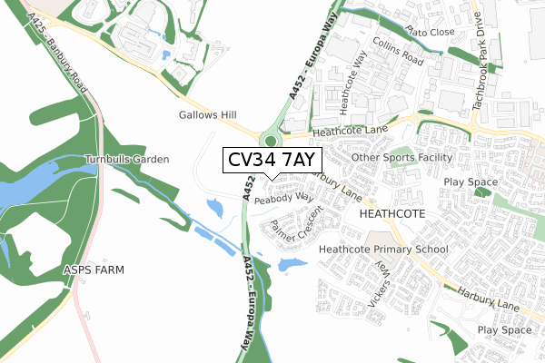
CV34 7AY is located in the Bishop's Tachbrook electoral ward, within the local authority district of Warwick and the English Parliamentary constituency of Warwick and Leamington. The Sub Integrated Care Board (ICB) Location is NHS Coventry and Warwickshire ICB - B2M3M and the police force is Warwickshire. This postcode has been in use since April 2019.


GetTheData
Source: OS Open Zoomstack (Ordnance Survey)
Licence: Open Government Licence (requires attribution)
Attribution: Contains OS data © Crown copyright and database right 2024
Source: Open Postcode Geo
Licence: Open Government Licence (requires attribution)
Attribution: Contains OS data © Crown copyright and database right 2024; Contains Royal Mail data © Royal Mail copyright and database right 2024; Source: Office for National Statistics licensed under the Open Government Licence v.3.0
| Easting | 430224 |
| Northing | 263428 |
| Latitude | 52.268199 |
| Longitude | -1.558510 |
GetTheData
Source: Open Postcode Geo
Licence: Open Government Licence
| Country | England |
| Postcode District | CV34 |
| ➜ CV34 open data dashboard ➜ See where CV34 is on a map ➜ Where is Warwick? | |
GetTheData
Source: Land Registry Price Paid Data
Licence: Open Government Licence
| Ward | Bishop's Tachbrook |
| Constituency | Warwick And Leamington |
GetTheData
Source: ONS Postcode Database
Licence: Open Government Licence
1, OAKLEY DRIVE, WARWICK, CV34 7AY 2021 16 JUL £685,995 |
9, OAKLEY DRIVE, WARWICK, CV34 7AY 2021 12 FEB £349,995 |
3, OAKLEY DRIVE, WARWICK, CV34 7AY 2020 27 NOV £509,995 |
5, OAKLEY DRIVE, WARWICK, CV34 7AY 2020 27 NOV £529,995 |
7, OAKLEY DRIVE, WARWICK, CV34 7AY 2020 4 SEP £359,995 |
17, OAKLEY DRIVE, WARWICK, CV34 7AY 2019 20 DEC £399,995 |
8, OAKLEY DRIVE, WARWICK, CV34 7AY 2019 29 AUG £549,995 |
6, OAKLEY DRIVE, WARWICK, CV34 7AY 2019 23 AUG £500,000 |
4, OAKLEY DRIVE, WARWICK, CV34 7AY 2019 12 JUL £739,995 |
2, OAKLEY DRIVE, WARWICK, CV34 7AY 2019 22 MAR £599,995 |
GetTheData
Source: HM Land Registry Price Paid Data
Licence: Contains HM Land Registry data © Crown copyright and database right 2024. This data is licensed under the Open Government Licence v3.0.
| June 2022 | Criminal damage and arson | On or near Bird Road | 425m |
| June 2022 | Anti-social behaviour | On or near Bird Road | 425m |
| June 2022 | Violence and sexual offences | On or near Bird Road | 425m |
| ➜ Get more crime data in our Crime section | |||
GetTheData
Source: data.police.uk
Licence: Open Government Licence
| Harbury Lane (Nightingale Avenue) | Warwick Gates | 273m |
| Bird Road (Heathcote Way) | Warwick | 456m |
| Blick Road (Heathcote Way) | Warwick | 539m |
| Earl Rivers Avenue (Harbury Lane) | Warwick Gates | 647m |
| Earl Rivers Avenue | Warwick Gates | 677m |
| Leamington Spa Station | 2.4km |
| Warwick Station | 2.6km |
| Warwick Parkway Station | 4.2km |
GetTheData
Source: NaPTAN
Licence: Open Government Licence
| Percentage of properties with Next Generation Access | 100.0% |
| Percentage of properties with Superfast Broadband | 100.0% |
| Percentage of properties with Ultrafast Broadband | 100.0% |
| Percentage of properties with Full Fibre Broadband | 100.0% |
Superfast Broadband is between 30Mbps and 300Mbps
Ultrafast Broadband is > 300Mbps
| Percentage of properties unable to receive 2Mbps | 0.0% |
| Percentage of properties unable to receive 5Mbps | 0.0% |
| Percentage of properties unable to receive 10Mbps | 0.0% |
| Percentage of properties unable to receive 30Mbps | 0.0% |
GetTheData
Source: Ofcom
Licence: Ofcom Terms of Use (requires attribution)
GetTheData
Source: ONS Postcode Database
Licence: Open Government Licence


➜ Get more ratings from the Food Standards Agency
GetTheData
Source: Food Standards Agency
Licence: FSA terms & conditions
| Last Collection | |||
|---|---|---|---|
| Location | Mon-Fri | Sat | Distance |
| Heathcote Way | 18:30 | 07:30 | 480m |
| Collins Road Business Box | 865m | ||
| Romeo Arbour | 17:00 | 10:30 | 989m |
GetTheData
Source: Dracos
Licence: Creative Commons Attribution-ShareAlike
| Facility | Distance |
|---|---|
| Nuffield Health (Warwick) Macbeth Approach, Gallagher Business Park, Warwick Swimming Pool, Health and Fitness Gym, Studio | 609m |
| Heathcote Primary School Vickers Way, Vickers Way, Warwick Grass Pitches | 628m |
| John Atkinson Sports Centre Myton Road, Warwick Health and Fitness Gym, Grass Pitches, Sports Hall, Artificial Grass Pitch, Studio | 1.3km |
GetTheData
Source: Active Places
Licence: Open Government Licence
| School | Phase of Education | Distance |
|---|---|---|
| Heathcote Primary School Vickers Way, Heathcote, Warwick, CV34 7AP | Primary | 611m |
| Myton School Myton Road, Warwick, CV34 6PJ | Secondary | 1.4km |
| King's High School Banbury Road, Warwick, Warwickshire, Warwickshire, CV34 6YE | Not applicable | 1.5km |
GetTheData
Source: Edubase
Licence: Open Government Licence
The below table lists the International Territorial Level (ITL) codes (formerly Nomenclature of Territorial Units for Statistics (NUTS) codes) and Local Administrative Units (LAU) codes for CV34 7AY:
| ITL 1 Code | Name |
|---|---|
| TLG | West Midlands (England) |
| ITL 2 Code | Name |
| TLG1 | Herefordshire, Worcestershire and Warwickshire |
| ITL 3 Code | Name |
| TLG13 | Warwickshire CC |
| LAU 1 Code | Name |
| E07000222 | Warwick |
GetTheData
Source: ONS Postcode Directory
Licence: Open Government Licence
The below table lists the Census Output Area (OA), Lower Layer Super Output Area (LSOA), and Middle Layer Super Output Area (MSOA) for CV34 7AY:
| Code | Name | |
|---|---|---|
| OA | E00159698 | |
| LSOA | E01031318 | Warwick 012D |
| MSOA | E02006530 | Warwick 012 |
GetTheData
Source: ONS Postcode Directory
Licence: Open Government Licence
| CV34 6XL | Swallow Drive | 309m |
| CV34 6WP | Peregrine Way | 346m |
| CV34 6SP | Heathcote Lane | 384m |
| CV34 6XN | Wren Close | 388m |
| CV34 6WS | Peregrine Way | 401m |
| CV34 6WH | Heron Way | 412m |
| CV34 6TD | Hurlbutt Road | 447m |
| CV34 6WN | Nightingale Avenue | 470m |
| CV34 6SL | Harbury Lane | 474m |
| CV34 6WL | Macbeth Approach | 498m |
GetTheData
Source: Open Postcode Geo; Land Registry Price Paid Data
Licence: Open Government Licence