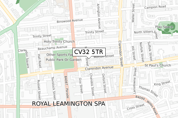
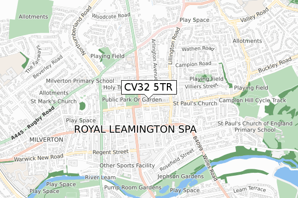
CV32 5TR is located in the Leamington Clarendon electoral ward, within the local authority district of Warwick and the English Parliamentary constituency of Warwick and Leamington. The Sub Integrated Care Board (ICB) Location is NHS Coventry and Warwickshire ICB - B2M3M and the police force is Warwickshire. This postcode has been in use since April 2018.


GetTheData
Source: OS Open Zoomstack (Ordnance Survey)
Licence: Open Government Licence (requires attribution)
Attribution: Contains OS data © Crown copyright and database right 2024
Source: Open Postcode Geo
Licence: Open Government Licence (requires attribution)
Attribution: Contains OS data © Crown copyright and database right 2024; Contains Royal Mail data © Royal Mail copyright and database right 2024; Source: Office for National Statistics licensed under the Open Government Licence v.3.0
| Easting | 431872 |
| Northing | 266334 |
| Latitude | 52.294232 |
| Longitude | -1.534089 |
GetTheData
Source: Open Postcode Geo
Licence: Open Government Licence
| Country | England |
| Postcode District | CV32 |
| ➜ CV32 open data dashboard ➜ See where CV32 is on a map ➜ Where is Royal Leamington Spa? | |
GetTheData
Source: Land Registry Price Paid Data
Licence: Open Government Licence
| Ward | Leamington Clarendon |
| Constituency | Warwick And Leamington |
GetTheData
Source: ONS Postcode Database
Licence: Open Government Licence
| January 2024 | Shoplifting | On or near Parking Area | 305m |
| January 2024 | Shoplifting | On or near Parking Area | 305m |
| January 2024 | Shoplifting | On or near Parking Area | 305m |
| ➜ Get more crime data in our Crime section | |||
GetTheData
Source: data.police.uk
Licence: Open Government Licence
| Beauchamp Avenue (Kenilworth Road) | Leamington Spa | 91m |
| Oxford Street (Clarendon Avenue) | Leamington Spa | 114m |
| Oxford Street (Clarendon Avenue) | Leamington Spa | 123m |
| Trinity Street (Kenilworth Road) | Leamington Spa | 139m |
| Argos (Guy Street) | Leamington Spa | 176m |
| Leamington Spa Station | 1.1km |
| Warwick Station | 3.4km |
GetTheData
Source: NaPTAN
Licence: Open Government Licence
| Percentage of properties with Next Generation Access | 100.0% |
| Percentage of properties with Superfast Broadband | 100.0% |
| Percentage of properties with Ultrafast Broadband | 100.0% |
| Percentage of properties with Full Fibre Broadband | 0.0% |
Superfast Broadband is between 30Mbps and 300Mbps
Ultrafast Broadband is > 300Mbps
| Percentage of properties unable to receive 2Mbps | 0.0% |
| Percentage of properties unable to receive 5Mbps | 0.0% |
| Percentage of properties unable to receive 10Mbps | 0.0% |
| Percentage of properties unable to receive 30Mbps | 0.0% |
GetTheData
Source: Ofcom
Licence: Ofcom Terms of Use (requires attribution)
GetTheData
Source: ONS Postcode Database
Licence: Open Government Licence


➜ Get more ratings from the Food Standards Agency
GetTheData
Source: Food Standards Agency
Licence: FSA terms & conditions
| Last Collection | |||
|---|---|---|---|
| Location | Mon-Fri | Sat | Distance |
| The Parade | 18:30 | 12:30 | 206m |
| The Parade Post Office | 18:30 | 12:30 | 207m |
| Binswood Avenue | 18:15 | 12:15 | 220m |
GetTheData
Source: Dracos
Licence: Creative Commons Attribution-ShareAlike
| Facility | Distance |
|---|---|
| Christchurch Gardens Beauchamp Avenue, Leamington Spa Outdoor Tennis Courts | 142m |
| Regency Health Club (Leamington Spa) (Closed) Bedford Street, Leamington Spa Studio, Health and Fitness Gym, Swimming Pool | 508m |
| Core Gym Bedford Street, Leamington Spa Health and Fitness Gym, Swimming Pool, Studio | 589m |
GetTheData
Source: Active Places
Licence: Open Government Licence
| School | Phase of Education | Distance |
|---|---|---|
| The Kingsley School Beauchamp Avenue, Leamington Spa, CV32 5RD | Not applicable | 260m |
| Arnold Lodge School 15-17 Kenilworth Road, Leamington Spa, CV32 5TW | Not applicable | 363m |
| Milverton Primary School Greatheed Road, Leamington Spa, CV32 6ES | Primary | 612m |
GetTheData
Source: Edubase
Licence: Open Government Licence
The below table lists the International Territorial Level (ITL) codes (formerly Nomenclature of Territorial Units for Statistics (NUTS) codes) and Local Administrative Units (LAU) codes for CV32 5TR:
| ITL 1 Code | Name |
|---|---|
| TLG | West Midlands (England) |
| ITL 2 Code | Name |
| TLG1 | Herefordshire, Worcestershire and Warwickshire |
| ITL 3 Code | Name |
| TLG13 | Warwickshire CC |
| LAU 1 Code | Name |
| E07000222 | Warwick |
GetTheData
Source: ONS Postcode Directory
Licence: Open Government Licence
The below table lists the Census Output Area (OA), Lower Layer Super Output Area (LSOA), and Middle Layer Super Output Area (MSOA) for CV32 5TR:
| Code | Name | |
|---|---|---|
| OA | E00172319 | |
| LSOA | E01033253 | Warwick 007H |
| MSOA | E02006525 | Warwick 007 |
GetTheData
Source: ONS Postcode Directory
Licence: Open Government Licence
| CV32 5SZ | Morrell Street | 35m |
| CV32 4SG | Clarendon Avenue | 38m |
| CV32 5TF | Kenilworth Road | 47m |
| CV32 5HX | Beauchamp Mews | 50m |
| CV32 4SB | Gladstone Court | 64m |
| CV32 5TE | Kenilworth Road | 65m |
| CV32 5TA | Beauchamp Avenue | 68m |
| CV32 4RY | Clarendon Avenue | 77m |
| CV32 4RZ | Clarendon Avenue | 79m |
| CV32 5SY | Morton Street | 86m |
GetTheData
Source: Open Postcode Geo; Land Registry Price Paid Data
Licence: Open Government Licence