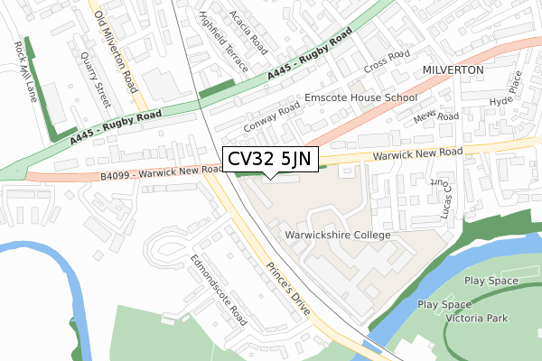
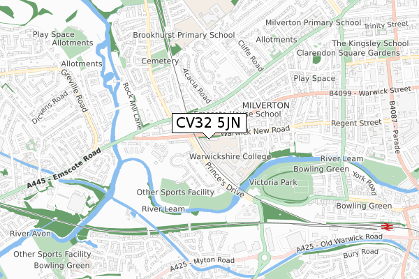
CV32 5JN is located in the Leamington Clarendon electoral ward, within the local authority district of Warwick and the English Parliamentary constituency of Warwick and Leamington. The Sub Integrated Care Board (ICB) Location is NHS Coventry and Warwickshire ICB - B2M3M and the police force is Warwickshire. This postcode has been in use since April 2018.


GetTheData
Source: OS Open Zoomstack (Ordnance Survey)
Licence: Open Government Licence (requires attribution)
Attribution: Contains OS data © Crown copyright and database right 2024
Source: Open Postcode Geo
Licence: Open Government Licence (requires attribution)
Attribution: Contains OS data © Crown copyright and database right 2024; Contains Royal Mail data © Royal Mail copyright and database right 2024; Source: Office for National Statistics licensed under the Open Government Licence v.3.0
| Easting | 430707 |
| Northing | 265791 |
| Latitude | 52.289416 |
| Longitude | -1.551219 |
GetTheData
Source: Open Postcode Geo
Licence: Open Government Licence
| Country | England |
| Postcode District | CV32 |
| ➜ CV32 open data dashboard ➜ See where CV32 is on a map ➜ Where is Royal Leamington Spa? | |
GetTheData
Source: Land Registry Price Paid Data
Licence: Open Government Licence
| Ward | Leamington Clarendon |
| Constituency | Warwick And Leamington |
GetTheData
Source: ONS Postcode Database
Licence: Open Government Licence
| May 2023 | Vehicle crime | On or near Lucas Court | 259m |
| January 2023 | Violence and sexual offences | On or near Lucas Court | 259m |
| January 2023 | Violence and sexual offences | On or near Lucas Court | 259m |
| ➜ Get more crime data in our Crime section | |||
GetTheData
Source: data.police.uk
Licence: Open Government Licence
| Warwick New Road (Princes Drive) | Leamington Spa | 132m |
| Warwick New Road (Princes Drive) | Leamington Spa | 146m |
| Warwickshire College (Private Road) | Leamington Spa | 151m |
| Oswald Road (Warwick Place) | Leamington Spa | 189m |
| Oswald Road (Warwick Place) | Leamington Spa | 219m |
| Leamington Spa Station | 1.2km |
| Warwick Station | 2.1km |
| Warwick Parkway Station | 4.2km |
GetTheData
Source: NaPTAN
Licence: Open Government Licence
GetTheData
Source: ONS Postcode Database
Licence: Open Government Licence


➜ Get more ratings from the Food Standards Agency
GetTheData
Source: Food Standards Agency
Licence: FSA terms & conditions
| Last Collection | |||
|---|---|---|---|
| Location | Mon-Fri | Sat | Distance |
| Warwick New Road | 17:45 | 11:30 | 251m |
| Warwick Place | 17:45 | 11:30 | 306m |
| Rugby Road | 16:00 | 11:45 | 325m |
GetTheData
Source: Dracos
Licence: Creative Commons Attribution-ShareAlike
| Facility | Distance |
|---|---|
| Warwickshire College (Leamington Spa Campus) Warwick New Road, Leamington Spa Sports Hall, Health and Fitness Gym | 234m |
| Edmondscote Athletics Track River Close, Leamington Spa Athletics | 346m |
| Leamington Tennis And Squash Club Guys Cliffe Avenue, Leamington Spa Health and Fitness Gym, Squash Courts, Outdoor Tennis Courts | 404m |
GetTheData
Source: Active Places
Licence: Open Government Licence
| School | Phase of Education | Distance |
|---|---|---|
| Warwickshire College Group Warwick New Road, Royal Leamington Spa, CV32 5JE | 16 plus | 112m |
| Brookhurst Primary School Ullswater Avenue, Leamington Spa, CV32 6NH | Primary | 675m |
| Trinity Catholic School Guy's Cliffe Avenue, Leamington Spa, CV32 6NB | Secondary | 741m |
GetTheData
Source: Edubase
Licence: Open Government Licence
The below table lists the International Territorial Level (ITL) codes (formerly Nomenclature of Territorial Units for Statistics (NUTS) codes) and Local Administrative Units (LAU) codes for CV32 5JN:
| ITL 1 Code | Name |
|---|---|
| TLG | West Midlands (England) |
| ITL 2 Code | Name |
| TLG1 | Herefordshire, Worcestershire and Warwickshire |
| ITL 3 Code | Name |
| TLG13 | Warwickshire CC |
| LAU 1 Code | Name |
| E07000222 | Warwick |
GetTheData
Source: ONS Postcode Directory
Licence: Open Government Licence
The below table lists the Census Output Area (OA), Lower Layer Super Output Area (LSOA), and Middle Layer Super Output Area (MSOA) for CV32 5JN:
| Code | Name | |
|---|---|---|
| OA | E00159550 | |
| LSOA | E01031293 | Warwick 009D |
| MSOA | E02006527 | Warwick 009 |
GetTheData
Source: ONS Postcode Directory
Licence: Open Government Licence
| CV32 5DF | Warwick Place | 99m |
| CV32 5JJ | Warwick New Road | 102m |
| CV32 5PA | Conway Road | 135m |
| CV32 6AE | Princes Drive | 151m |
| CV32 6EA | Westgrove Terrace | 154m |
| CV32 6DY | Rugby Road | 164m |
| CV32 5JW | Copps Road | 184m |
| CV32 5JH | Copps Road | 187m |
| CV32 6AF | Princes Drive | 204m |
| CV32 6DZ | Rugby Road | 210m |
GetTheData
Source: Open Postcode Geo; Land Registry Price Paid Data
Licence: Open Government Licence