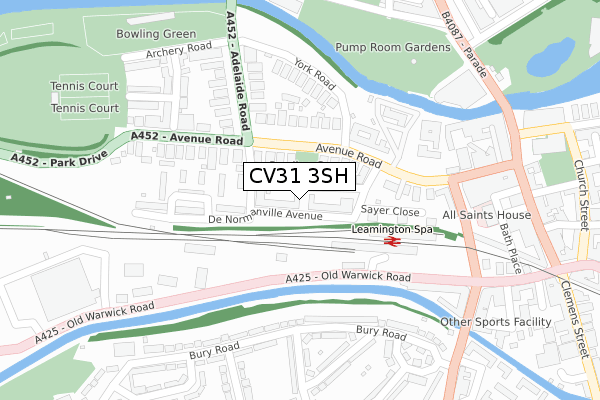
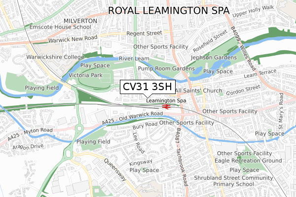
CV31 3SH is located in the Leamington Clarendon electoral ward, within the local authority district of Warwick and the English Parliamentary constituency of Warwick and Leamington. The Sub Integrated Care Board (ICB) Location is NHS Coventry and Warwickshire ICB - B2M3M and the police force is Warwickshire. This postcode has been in use since August 2019.


GetTheData
Source: OS Open Zoomstack (Ordnance Survey)
Licence: Open Government Licence (requires attribution)
Attribution: Contains OS data © Crown copyright and database right 2024
Source: Open Postcode Geo
Licence: Open Government Licence (requires attribution)
Attribution: Contains OS data © Crown copyright and database right 2024; Contains Royal Mail data © Royal Mail copyright and database right 2024; Source: Office for National Statistics licensed under the Open Government Licence v.3.0
| Easting | 431661 |
| Northing | 265321 |
| Latitude | 52.285137 |
| Longitude | -1.537277 |
GetTheData
Source: Open Postcode Geo
Licence: Open Government Licence
| Country | England |
| Postcode District | CV31 |
| ➜ CV31 open data dashboard ➜ See where CV31 is on a map ➜ Where is Royal Leamington Spa? | |
GetTheData
Source: Land Registry Price Paid Data
Licence: Open Government Licence
| Ward | Leamington Clarendon |
| Constituency | Warwick And Leamington |
GetTheData
Source: ONS Postcode Database
Licence: Open Government Licence
| January 2024 | Anti-social behaviour | On or near Parking Area | 103m |
| January 2024 | Violence and sexual offences | On or near Parking Area | 228m |
| January 2024 | Anti-social behaviour | On or near Park/Open Space | 422m |
| ➜ Get more crime data in our Crime section | |||
GetTheData
Source: data.police.uk
Licence: Open Government Licence
| Old Library (Avenue Road) | Leamington Spa | 98m |
| Station Approach (Avenue Road) | Leamington Spa | 107m |
| Railway Station Forecourt (Railway Station) | Leamington Spa | 118m |
| Railway Station (Old Warwick Road) | Leamington Spa | 169m |
| Railway Station (Old Warwick Road) | Leamington Spa | 182m |
| Leamington Spa Station | 0.1km |
| Warwick Station | 3km |
GetTheData
Source: NaPTAN
Licence: Open Government Licence
GetTheData
Source: ONS Postcode Database
Licence: Open Government Licence


➜ Get more ratings from the Food Standards Agency
GetTheData
Source: Food Standards Agency
Licence: FSA terms & conditions
| Last Collection | |||
|---|---|---|---|
| Location | Mon-Fri | Sat | Distance |
| Leamington Station | 16:00 | 11:45 | 124m |
| Adelaide Road | 17:00 | 11:30 | 211m |
| Gas Works | 16:00 | 11:45 | 320m |
GetTheData
Source: Dracos
Licence: Creative Commons Attribution-ShareAlike
| Facility | Distance |
|---|---|
| Fwx Leamington Spencer Street, Leamington Spa Health and Fitness Gym, Studio | 209m |
| The Workout Mill Regent Place, Leamington Spa Health and Fitness Gym | 363m |
| Core Gym Bedford Street, Leamington Spa Health and Fitness Gym, Swimming Pool, Studio | 456m |
GetTheData
Source: Active Places
Licence: Open Government Licence
| School | Phase of Education | Distance |
|---|---|---|
| St Peter's Catholic Primary School Augusta Place, Leamington Spa, CV32 5EL | Primary | 406m |
| Kingsway Community Primary School Baker Avenue, Leamington Spa, CV31 3HB | Primary | 755m |
| St Patrick's Catholic Primary School Cashmore Avenue, Leamington Spa, CV31 3EU | Primary | 831m |
GetTheData
Source: Edubase
Licence: Open Government Licence
The below table lists the International Territorial Level (ITL) codes (formerly Nomenclature of Territorial Units for Statistics (NUTS) codes) and Local Administrative Units (LAU) codes for CV31 3SH:
| ITL 1 Code | Name |
|---|---|
| TLG | West Midlands (England) |
| ITL 2 Code | Name |
| TLG1 | Herefordshire, Worcestershire and Warwickshire |
| ITL 3 Code | Name |
| TLG13 | Warwickshire CC |
| LAU 1 Code | Name |
| E07000222 | Warwick |
GetTheData
Source: ONS Postcode Directory
Licence: Open Government Licence
The below table lists the Census Output Area (OA), Lower Layer Super Output Area (LSOA), and Middle Layer Super Output Area (MSOA) for CV31 3SH:
| Code | Name | |
|---|---|---|
| OA | E00159552 | |
| LSOA | E01031291 | Warwick 009B |
| MSOA | E02006527 | Warwick 009 |
GetTheData
Source: ONS Postcode Directory
Licence: Open Government Licence
| CV31 3NH | Avenue Road | 83m |
| CV31 3PG | Avenue Road | 88m |
| CV31 3PS | Avenue Road | 120m |
| CV31 3NW | Avenue Road | 122m |
| CV31 3SE | Station Approach | 151m |
| CV31 3PQ | Avenue Road | 172m |
| CV31 3NL | Manor Court | 180m |
| CV31 3ND | Avenue Road | 181m |
| CV31 3HN | Bury Road | 193m |
| CV31 3HR | Bury Road | 213m |
GetTheData
Source: Open Postcode Geo; Land Registry Price Paid Data
Licence: Open Government Licence