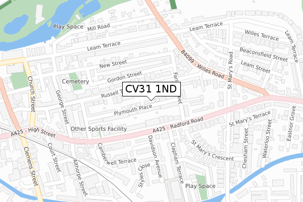
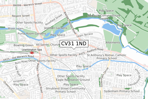
CV31 1ND is located in the Leamington Willes electoral ward, within the local authority district of Warwick and the English Parliamentary constituency of Warwick and Leamington. The Sub Integrated Care Board (ICB) Location is NHS Coventry and Warwickshire ICB - B2M3M and the police force is Warwickshire. This postcode has been in use since June 2018.


GetTheData
Source: OS Open Zoomstack (Ordnance Survey)
Licence: Open Government Licence (requires attribution)
Attribution: Contains OS data © Crown copyright and database right 2024
Source: Open Postcode Geo
Licence: Open Government Licence (requires attribution)
Attribution: Contains OS data © Crown copyright and database right 2024; Contains Royal Mail data © Royal Mail copyright and database right 2024; Source: Office for National Statistics licensed under the Open Government Licence v.3.0
| Easting | 432448 |
| Northing | 265320 |
| Latitude | 52.285082 |
| Longitude | -1.525741 |
GetTheData
Source: Open Postcode Geo
Licence: Open Government Licence
| Country | England |
| Postcode District | CV31 |
| ➜ CV31 open data dashboard ➜ See where CV31 is on a map ➜ Where is Royal Leamington Spa? | |
GetTheData
Source: Land Registry Price Paid Data
Licence: Open Government Licence
| Ward | Leamington Willes |
| Constituency | Warwick And Leamington |
GetTheData
Source: ONS Postcode Database
Licence: Open Government Licence
| January 2024 | Anti-social behaviour | On or near St Mary'S Road | 263m |
| January 2024 | Anti-social behaviour | On or near Parking Area | 403m |
| December 2023 | Anti-social behaviour | On or near St Mary'S Road | 263m |
| ➜ Get more crime data in our Crime section | |||
GetTheData
Source: data.police.uk
Licence: Open Government Licence
| Farley Street (Radford Road) | Leamington Spa | 103m |
| Farley Street (Radford Road) | Leamington Spa | 192m |
| Forfield Place (High Street) | Leamington Spa | 218m |
| Sainsburys (Radford Road) | Leamington Spa | 322m |
| Court Street (High Street) | Leamington Spa | 341m |
| Leamington Spa Station | 0.7km |
| Warwick Station | 3.8km |
GetTheData
Source: NaPTAN
Licence: Open Government Licence
| Percentage of properties with Next Generation Access | 100.0% |
| Percentage of properties with Superfast Broadband | 100.0% |
| Percentage of properties with Ultrafast Broadband | 100.0% |
| Percentage of properties with Full Fibre Broadband | 0.0% |
Superfast Broadband is between 30Mbps and 300Mbps
Ultrafast Broadband is > 300Mbps
| Percentage of properties unable to receive 2Mbps | 0.0% |
| Percentage of properties unable to receive 5Mbps | 0.0% |
| Percentage of properties unable to receive 10Mbps | 0.0% |
| Percentage of properties unable to receive 30Mbps | 0.0% |
GetTheData
Source: Ofcom
Licence: Ofcom Terms of Use (requires attribution)
GetTheData
Source: ONS Postcode Database
Licence: Open Government Licence


➜ Get more ratings from the Food Standards Agency
GetTheData
Source: Food Standards Agency
Licence: FSA terms & conditions
| Last Collection | |||
|---|---|---|---|
| Location | Mon-Fri | Sat | Distance |
| Leamington Terrace | 16:00 | 11:45 | 217m |
| St Marys Road | 16:00 | 12:45 | 323m |
| High Street | 16:00 | 12:30 | 367m |
GetTheData
Source: Dracos
Licence: Creative Commons Attribution-ShareAlike
| Facility | Distance |
|---|---|
| The Workout Mill Regent Place, Leamington Spa Health and Fitness Gym | 428m |
| Eagle Recreation Ground Eagle Street, Leamington Spa Grass Pitches | 523m |
| Fwx Leamington Spencer Street, Leamington Spa Health and Fitness Gym, Studio | 579m |
GetTheData
Source: Active Places
Licence: Open Government Licence
| School | Phase of Education | Distance |
|---|---|---|
| Clapham Terrace Community Primary School and Nursery Clapham Terrace, Leamington Spa, CV31 1HZ | Primary | 281m |
| St Anthony's Catholic Primary School Sydenham Drive, St. Anthony's Catholic Primary Scho, Leamington Spa, CV31 1NJ | Primary | 586m |
| Shrubland Street Community Primary School Shrubland Street, Shrubland Street Community School, Leamington Spa, CV31 2AR | Primary | 686m |
GetTheData
Source: Edubase
Licence: Open Government Licence
The below table lists the International Territorial Level (ITL) codes (formerly Nomenclature of Territorial Units for Statistics (NUTS) codes) and Local Administrative Units (LAU) codes for CV31 1ND:
| ITL 1 Code | Name |
|---|---|
| TLG | West Midlands (England) |
| ITL 2 Code | Name |
| TLG1 | Herefordshire, Worcestershire and Warwickshire |
| ITL 3 Code | Name |
| TLG13 | Warwickshire CC |
| LAU 1 Code | Name |
| E07000222 | Warwick |
GetTheData
Source: ONS Postcode Directory
Licence: Open Government Licence
The below table lists the Census Output Area (OA), Lower Layer Super Output Area (LSOA), and Middle Layer Super Output Area (MSOA) for CV31 1ND:
| Code | Name | |
|---|---|---|
| OA | E00159784 | |
| LSOA | E01031336 | Warwick 010F |
| MSOA | E02006528 | Warwick 010 |
GetTheData
Source: ONS Postcode Directory
Licence: Open Government Licence
| CV31 1HE | Russell Terrace | 32m |
| CV31 1HW | Plymouth Place | 35m |
| CV31 1NE | Radford Road | 71m |
| CV31 1HJ | Farley Street | 111m |
| CV31 1EY | Russell Terrace | 116m |
| CV31 1HR | Gordon Street | 121m |
| CV31 1LZ | Radford Road | 123m |
| CV31 1NF | Radford Road | 125m |
| CV31 1LL | Warneford Mews | 132m |
| CV31 1HL | New Street | 134m |
GetTheData
Source: Open Postcode Geo; Land Registry Price Paid Data
Licence: Open Government Licence