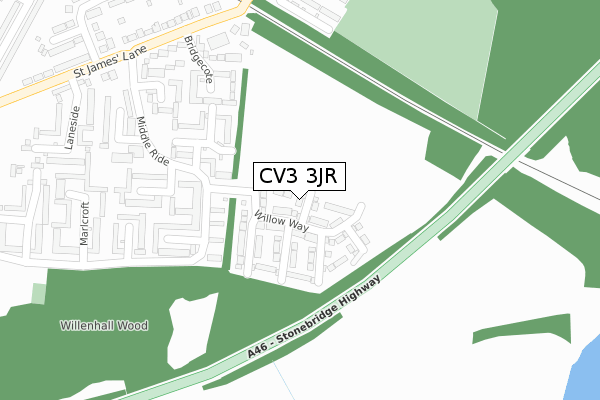
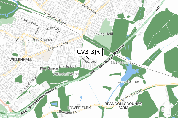
CV3 3JR is located in the Binley and Willenhall electoral ward, within the metropolitan district of Coventry and the English Parliamentary constituency of Coventry South. The Sub Integrated Care Board (ICB) Location is NHS Coventry and Warwickshire ICB - B2M3M and the police force is West Midlands. This postcode has been in use since June 2019.


GetTheData
Source: OS Open Zoomstack (Ordnance Survey)
Licence: Open Government Licence (requires attribution)
Attribution: Contains OS data © Crown copyright and database right 2024
Source: Open Postcode Geo
Licence: Open Government Licence (requires attribution)
Attribution: Contains OS data © Crown copyright and database right 2024; Contains Royal Mail data © Royal Mail copyright and database right 2024; Source: Office for National Statistics licensed under the Open Government Licence v.3.0
| Easting | 437522 |
| Northing | 276539 |
| Latitude | 52.385619 |
| Longitude | -1.450115 |
GetTheData
Source: Open Postcode Geo
Licence: Open Government Licence
| Country | England |
| Postcode District | CV3 |
| ➜ CV3 open data dashboard ➜ See where CV3 is on a map ➜ Where is Coventry? | |
GetTheData
Source: Land Registry Price Paid Data
Licence: Open Government Licence
| Ward | Binley And Willenhall |
| Constituency | Coventry South |
GetTheData
Source: ONS Postcode Database
Licence: Open Government Licence
10, CAMPBELL WALK, COVENTRY, CV3 3JR 2020 31 MAR £260,000 |
12, CAMPBELL WALK, COVENTRY, CV3 3JR 2020 30 MAR £264,995 |
8, CAMPBELL WALK, COVENTRY, CV3 3JR 2019 28 NOV £256,995 |
7, CAMPBELL WALK, COVENTRY, CV3 3JR 2019 26 JUN £240,000 |
GetTheData
Source: HM Land Registry Price Paid Data
Licence: Contains HM Land Registry data © Crown copyright and database right 2024. This data is licensed under the Open Government Licence v3.0.
| June 2022 | Violence and sexual offences | On or near Leyside | 201m |
| June 2022 | Vehicle crime | On or near Leyside | 201m |
| June 2022 | Violence and sexual offences | On or near Leyside | 201m |
| ➜ Get more crime data in our Crime section | |||
GetTheData
Source: data.police.uk
Licence: Open Government Licence
| Winnallthorpe (Middle Ride) | Binley | 280m |
| Winnallthorpe (Middle Ride) | Binley | 281m |
| Harcourt (Middle Ride) | Willenhall | 285m |
| Harcourt (Middle Ride) | Willenhall | 316m |
| Middle Ride (St James Lane) | Binley | 354m |
| Coventry Station | 4.6km |
GetTheData
Source: NaPTAN
Licence: Open Government Licence
| Percentage of properties with Next Generation Access | 100.0% |
| Percentage of properties with Superfast Broadband | 100.0% |
| Percentage of properties with Ultrafast Broadband | 0.0% |
| Percentage of properties with Full Fibre Broadband | 0.0% |
Superfast Broadband is between 30Mbps and 300Mbps
Ultrafast Broadband is > 300Mbps
| Percentage of properties unable to receive 2Mbps | 0.0% |
| Percentage of properties unable to receive 5Mbps | 0.0% |
| Percentage of properties unable to receive 10Mbps | 0.0% |
| Percentage of properties unable to receive 30Mbps | 0.0% |
GetTheData
Source: Ofcom
Licence: Ofcom Terms of Use (requires attribution)
GetTheData
Source: ONS Postcode Database
Licence: Open Government Licence


➜ Get more ratings from the Food Standards Agency
GetTheData
Source: Food Standards Agency
Licence: FSA terms & conditions
| Last Collection | |||
|---|---|---|---|
| Location | Mon-Fri | Sat | Distance |
| Meadfoot Road | 17:00 | 11:15 | 589m |
| Herald Way | 18:30 | 10:15 | 998m |
| Siskin Drive | 16:30 | 10:00 | 1,773m |
GetTheData
Source: Dracos
Licence: Creative Commons Attribution-ShareAlike
| Facility | Distance |
|---|---|
| John White Community Centre Grange Avenue, Binley, Coventry Sports Hall, Grass Pitches | 627m |
| Willenhall Community Primary School St. James Lane, Coventry Grass Pitches, Artificial Grass Pitch | 676m |
| St Bartholomews Church Of England Academy Bredon Avenue, Binley, Coventry Grass Pitches | 960m |
GetTheData
Source: Active Places
Licence: Open Government Licence
| School | Phase of Education | Distance |
|---|---|---|
| Willenhall Community Primary School St James Lane, Coventry, CV3 3DB | Primary | 661m |
| St Bartholomew's Church of England Academy Bredon Avenue, Binley, Coventry, CV3 2LP | Primary | 952m |
| Sowe Valley Primary School Princethorpe Way, Coventry, CV3 2QX | Primary | 1.1km |
GetTheData
Source: Edubase
Licence: Open Government Licence
The below table lists the International Territorial Level (ITL) codes (formerly Nomenclature of Territorial Units for Statistics (NUTS) codes) and Local Administrative Units (LAU) codes for CV3 3JR:
| ITL 1 Code | Name |
|---|---|
| TLG | West Midlands (England) |
| ITL 2 Code | Name |
| TLG3 | West Midlands |
| ITL 3 Code | Name |
| TLG33 | Coventry |
| LAU 1 Code | Name |
| E08000026 | Coventry |
GetTheData
Source: ONS Postcode Directory
Licence: Open Government Licence
The below table lists the Census Output Area (OA), Lower Layer Super Output Area (LSOA), and Middle Layer Super Output Area (MSOA) for CV3 3JR:
| Code | Name | |
|---|---|---|
| OA | E00048312 | |
| LSOA | E01009539 | Coventry 039A |
| MSOA | E02001996 | Coventry 039 |
GetTheData
Source: ONS Postcode Directory
Licence: Open Government Licence
| CV3 3FN | Fieldmarch | 153m |
| CV3 3FJ | Jamescroft | 186m |
| CV3 3FL | Pondthorpe | 205m |
| CV3 3FP | Leyside | 209m |
| CV3 3FF | Bridgecote | 252m |
| CV3 3FH | Jamescroft | 288m |
| CV3 3FD | Sandythorpe | 290m |
| CV3 3FQ | Harcourt | 314m |
| CV3 3FS | Marl Croft | 329m |
| CV3 3FE | St James Lane | 329m |
GetTheData
Source: Open Postcode Geo; Land Registry Price Paid Data
Licence: Open Government Licence