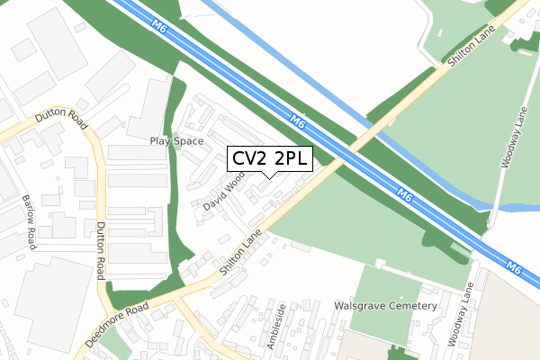
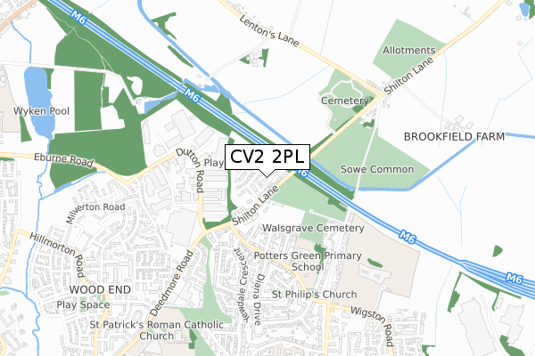
CV2 2PL is located in the Henley electoral ward, within the metropolitan district of Coventry and the English Parliamentary constituency of Coventry North East. The Sub Integrated Care Board (ICB) Location is NHS Coventry and Warwickshire ICB - B2M3M and the police force is West Midlands. This postcode has been in use since August 2017.


GetTheData
Source: OS Open Zoomstack (Ordnance Survey)
Licence: Open Government Licence (requires attribution)
Attribution: Contains OS data © Crown copyright and database right 2024
Source: Open Postcode Geo
Licence: Open Government Licence (requires attribution)
Attribution: Contains OS data © Crown copyright and database right 2024; Contains Royal Mail data © Royal Mail copyright and database right 2024; Source: Office for National Statistics licensed under the Open Government Licence v.3.0
| Easting | 437292 |
| Northing | 282978 |
| Latitude | 52.443520 |
| Longitude | -1.452780 |
GetTheData
Source: Open Postcode Geo
Licence: Open Government Licence
| Country | England |
| Postcode District | CV2 |
| ➜ CV2 open data dashboard ➜ See where CV2 is on a map ➜ Where is Coventry? | |
GetTheData
Source: Land Registry Price Paid Data
Licence: Open Government Licence
| Ward | Henley |
| Constituency | Coventry North East |
GetTheData
Source: ONS Postcode Database
Licence: Open Government Licence
4, GEORGE EBBURN CLOSE, COVENTRY, CV2 2PL 2017 31 AUG £239,995 |
GetTheData
Source: HM Land Registry Price Paid Data
Licence: Contains HM Land Registry data © Crown copyright and database right 2024. This data is licensed under the Open Government Licence v3.0.
| June 2022 | Criminal damage and arson | On or near Sports/Recreation Area | 73m |
| June 2022 | Violence and sexual offences | On or near Sports/Recreation Area | 73m |
| June 2022 | Violence and sexual offences | On or near Sports/Recreation Area | 73m |
| ➜ Get more crime data in our Crime section | |||
GetTheData
Source: data.police.uk
Licence: Open Government Licence
| The Boat Inn (Shilton Lane) | Potters Green | 90m |
| The Boat Inn (Shilton Lane) | Potters Green | 122m |
| Deedmore Rd (Ringwood Highway) | Potters Green | 292m |
| Deedmore Rd (Ringwood Highway) | Potters Green | 307m |
| Potters Green Primary School (Ringwood Highway) | Potters Green | 528m |
| Coventry Arena Station | 2.8km |
| Bedworth Station | 4.1km |
| Coventry Station | 6.3km |
GetTheData
Source: NaPTAN
Licence: Open Government Licence
| Percentage of properties with Next Generation Access | 100.0% |
| Percentage of properties with Superfast Broadband | 100.0% |
| Percentage of properties with Ultrafast Broadband | 100.0% |
| Percentage of properties with Full Fibre Broadband | 100.0% |
Superfast Broadband is between 30Mbps and 300Mbps
Ultrafast Broadband is > 300Mbps
| Percentage of properties unable to receive 2Mbps | 0.0% |
| Percentage of properties unable to receive 5Mbps | 0.0% |
| Percentage of properties unable to receive 10Mbps | 0.0% |
| Percentage of properties unable to receive 30Mbps | 0.0% |
GetTheData
Source: Ofcom
Licence: Ofcom Terms of Use (requires attribution)
GetTheData
Source: ONS Postcode Database
Licence: Open Government Licence


➜ Get more ratings from the Food Standards Agency
GetTheData
Source: Food Standards Agency
Licence: FSA terms & conditions
| Last Collection | |||
|---|---|---|---|
| Location | Mon-Fri | Sat | Distance |
| Hillmorton Road Post Office | 18:15 | 11:30 | 934m |
| Hillmorton Road | 16:30 | 11:30 | 1,184m |
| Co-operative Street | 17:30 | 11:30 | 1,392m |
GetTheData
Source: Dracos
Licence: Creative Commons Attribution-ShareAlike
| Facility | Distance |
|---|---|
| Sowe Common South Shilton Lane, Coventry Grass Pitches | 168m |
| Potters Green Primary School Ringwood Highway, Coventry Swimming Pool, Sports Hall, Grass Pitches | 403m |
| Sowe Common Sports Ground Woodway Lane, Coventry Grass Pitches | 464m |
GetTheData
Source: Active Places
Licence: Open Government Licence
| School | Phase of Education | Distance |
|---|---|---|
| Potters Green Primary School Ringwood Highway, Coventry, CV2 2GF | Primary | 408m |
| Moat House Primary School Deedmore Road, Coventry, CV2 1EQ | Primary | 692m |
| Grace Academy Coventry Wigston Road, Coventry, CV2 2RH | Secondary | 790m |
GetTheData
Source: Edubase
Licence: Open Government Licence
The below table lists the International Territorial Level (ITL) codes (formerly Nomenclature of Territorial Units for Statistics (NUTS) codes) and Local Administrative Units (LAU) codes for CV2 2PL:
| ITL 1 Code | Name |
|---|---|
| TLG | West Midlands (England) |
| ITL 2 Code | Name |
| TLG3 | West Midlands |
| ITL 3 Code | Name |
| TLG33 | Coventry |
| LAU 1 Code | Name |
| E08000026 | Coventry |
GetTheData
Source: ONS Postcode Directory
Licence: Open Government Licence
The below table lists the Census Output Area (OA), Lower Layer Super Output Area (LSOA), and Middle Layer Super Output Area (MSOA) for CV2 2PL:
| Code | Name | |
|---|---|---|
| OA | E00048483 | |
| LSOA | E01009584 | Coventry 007D |
| MSOA | E02001964 | Coventry 007 |
GetTheData
Source: ONS Postcode Directory
Licence: Open Government Licence
| CV2 2AB | Shilton Lane | 123m |
| CV2 2GA | Rowan Grove | 265m |
| CV2 2GD | Ambleside | 279m |
| CV2 2GB | Ringwood Highway | 312m |
| CV2 2GE | Kentmere Close | 315m |
| CV2 2GT | Ringwood Highway | 357m |
| CV2 2NH | Laurel Close | 389m |
| CV2 2GF | Ringwood Highway | 391m |
| CV2 2FS | Yewdale Crescent | 400m |
| CV2 2GN | Ringwood Highway | 423m |
GetTheData
Source: Open Postcode Geo; Land Registry Price Paid Data
Licence: Open Government Licence