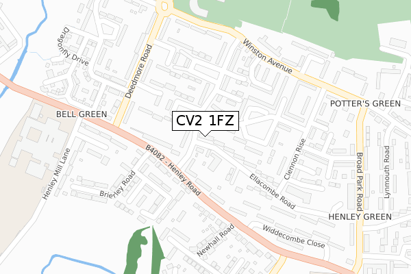
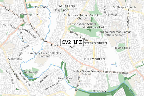
CV2 1FZ is located in the Henley electoral ward, within the metropolitan district of Coventry and the English Parliamentary constituency of Coventry North East. The Sub Integrated Care Board (ICB) Location is NHS Coventry and Warwickshire ICB - B2M3M and the police force is West Midlands. This postcode has been in use since March 2018.


GetTheData
Source: OS Open Zoomstack (Ordnance Survey)
Licence: Open Government Licence (requires attribution)
Attribution: Contains OS data © Crown copyright and database right 2024
Source: Open Postcode Geo
Licence: Open Government Licence (requires attribution)
Attribution: Contains OS data © Crown copyright and database right 2024; Contains Royal Mail data © Royal Mail copyright and database right 2024; Source: Office for National Statistics licensed under the Open Government Licence v.3.0
| Easting | 436600 |
| Northing | 281724 |
| Latitude | 52.432293 |
| Longitude | -1.463097 |
GetTheData
Source: Open Postcode Geo
Licence: Open Government Licence
| Country | England |
| Postcode District | CV2 |
| ➜ CV2 open data dashboard ➜ See where CV2 is on a map ➜ Where is Coventry? | |
GetTheData
Source: Land Registry Price Paid Data
Licence: Open Government Licence
| Ward | Henley |
| Constituency | Coventry North East |
GetTheData
Source: ONS Postcode Database
Licence: Open Government Licence
| June 2022 | Burglary | On or near Pangbourne Road | 174m |
| June 2022 | Vehicle crime | On or near Pangbourne Road | 174m |
| June 2022 | Violence and sexual offences | On or near Eccles Close | 184m |
| ➜ Get more crime data in our Crime section | |||
GetTheData
Source: data.police.uk
Licence: Open Government Licence
| Newhall Rd (Henley Rd) | Henley Green | 171m |
| Deedmore Rd (Henley Rd) | Henley Green | 190m |
| Henley Rd (Deedmore Rd) | Bell Green | 217m |
| Clennon Rise (Winston Avenue) | Henley Green | 259m |
| Newhall Rd (Henley Rd) | Henley Green | 274m |
| Coventry Arena Station | 2.7km |
| Coventry Station | 4.9km |
GetTheData
Source: NaPTAN
Licence: Open Government Licence
| Percentage of properties with Next Generation Access | 100.0% |
| Percentage of properties with Superfast Broadband | 100.0% |
| Percentage of properties with Ultrafast Broadband | 100.0% |
| Percentage of properties with Full Fibre Broadband | 100.0% |
Superfast Broadband is between 30Mbps and 300Mbps
Ultrafast Broadband is > 300Mbps
| Percentage of properties unable to receive 2Mbps | 0.0% |
| Percentage of properties unable to receive 5Mbps | 0.0% |
| Percentage of properties unable to receive 10Mbps | 0.0% |
| Percentage of properties unable to receive 30Mbps | 0.0% |
GetTheData
Source: Ofcom
Licence: Ofcom Terms of Use (requires attribution)
GetTheData
Source: ONS Postcode Database
Licence: Open Government Licence

➜ Get more ratings from the Food Standards Agency
GetTheData
Source: Food Standards Agency
Licence: FSA terms & conditions
| Last Collection | |||
|---|---|---|---|
| Location | Mon-Fri | Sat | Distance |
| Broad Park Road Post Office | 18:00 | 11:30 | 411m |
| Hillmorton Road | 16:30 | 11:30 | 414m |
| Heath Crescent | 17:30 | 10:00 | 514m |
GetTheData
Source: Dracos
Licence: Creative Commons Attribution-ShareAlike
| Facility | Distance |
|---|---|
| Moat House Leisure & Neighbourhood Centre Winston Avenue, Coventry Sports Hall, Health and Fitness Gym, Artificial Grass Pitch, Studio | 349m |
| Henley College Coventry (Closed) Henley Road, Coventry Sports Hall, Health and Fitness Gym, Grass Pitches, Studio, Artificial Grass Pitch, Outdoor Tennis Courts | 395m |
| Moat House Primary School Alpha Business Park, Deedmore Road, Coventry Grass Pitches | 493m |
GetTheData
Source: Active Places
Licence: Open Government Licence
| School | Phase of Education | Distance |
|---|---|---|
| Henley Green Primary Wyken Croft, Coventry, CV2 1HQ | Primary | 405m |
| Castle Wood Special School 50 Deedmore Road, Coventry, CV2 1FN | Not applicable | 417m |
| St Patrick's Catholic Primary School Deedmore Road, Wood End, Coventry, CV2 1EQ | Primary | 570m |
GetTheData
Source: Edubase
Licence: Open Government Licence
The below table lists the International Territorial Level (ITL) codes (formerly Nomenclature of Territorial Units for Statistics (NUTS) codes) and Local Administrative Units (LAU) codes for CV2 1FZ:
| ITL 1 Code | Name |
|---|---|
| TLG | West Midlands (England) |
| ITL 2 Code | Name |
| TLG3 | West Midlands |
| ITL 3 Code | Name |
| TLG33 | Coventry |
| LAU 1 Code | Name |
| E08000026 | Coventry |
GetTheData
Source: ONS Postcode Directory
Licence: Open Government Licence
The below table lists the Census Output Area (OA), Lower Layer Super Output Area (LSOA), and Middle Layer Super Output Area (MSOA) for CV2 1FZ:
| Code | Name | |
|---|---|---|
| OA | E00048514 | |
| LSOA | E01009579 | Coventry 007B |
| MSOA | E02001964 | Coventry 007 |
GetTheData
Source: ONS Postcode Directory
Licence: Open Government Licence
| CV2 1BL | Monkswood Crescent | 96m |
| CV2 1BP | Ellacombe Road | 108m |
| CV2 1DT | Roselands Avenue | 114m |
| CV2 1BE | Monkswood Crescent | 115m |
| CV2 1BQ | Ellacombe Road | 115m |
| CV2 1BX | Henley Road | 127m |
| CV2 1EF | Eccles Close | 148m |
| CV2 1RQ | Pangbourne Road | 156m |
| CV2 1AW | Henley Road | 164m |
| CV2 1DU | Roselands Avenue | 169m |
GetTheData
Source: Open Postcode Geo; Land Registry Price Paid Data
Licence: Open Government Licence