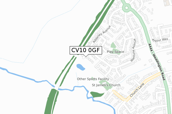
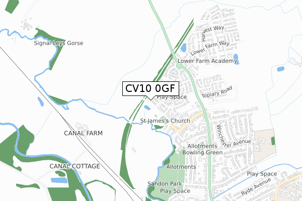
CV10 0GF is located in the Weddington electoral ward, within the local authority district of Nuneaton and Bedworth and the English Parliamentary constituency of Nuneaton. The Sub Integrated Care Board (ICB) Location is NHS Coventry and Warwickshire ICB - B2M3M and the police force is Warwickshire. This postcode has been in use since December 2017.


GetTheData
Source: OS Open Zoomstack (Ordnance Survey)
Licence: Open Government Licence (requires attribution)
Attribution: Contains OS data © Crown copyright and database right 2024
Source: Open Postcode Geo
Licence: Open Government Licence (requires attribution)
Attribution: Contains OS data © Crown copyright and database right 2024; Contains Royal Mail data © Royal Mail copyright and database right 2024; Source: Office for National Statistics licensed under the Open Government Licence v.3.0
| Easting | 435852 |
| Northing | 293725 |
| Latitude | 52.540226 |
| Longitude | -1.472810 |
GetTheData
Source: Open Postcode Geo
Licence: Open Government Licence
| Country | England |
| Postcode District | CV10 |
| ➜ CV10 open data dashboard ➜ See where CV10 is on a map ➜ Where is Nuneaton? | |
GetTheData
Source: Land Registry Price Paid Data
Licence: Open Government Licence
| Ward | Weddington |
| Constituency | Nuneaton |
GetTheData
Source: ONS Postcode Database
Licence: Open Government Licence
2023 31 MAR £405,000 |
2020 28 OCT £515,000 |
9, VINES LANE, NUNEATON, CV10 0GF 2018 25 MAY £356,995 |
5, VINES LANE, NUNEATON, CV10 0GF 2018 27 APR £379,995 |
7, VINES LANE, NUNEATON, CV10 0GF 2018 27 APR £371,995 |
3, VINES LANE, NUNEATON, CV10 0GF 2018 29 MAR £332,995 |
2018 29 MAR £359,995 |
2018 16 MAR £489,995 |
6, VINES LANE, NUNEATON, CV10 0GF 2017 15 DEC £372,995 |
4, VINES LANE, NUNEATON, CV10 0GF 2017 15 DEC £371,995 |
GetTheData
Source: HM Land Registry Price Paid Data
Licence: Contains HM Land Registry data © Crown copyright and database right 2024. This data is licensed under the Open Government Licence v3.0.
| June 2022 | Other theft | On or near Church Lane | 347m |
| June 2022 | Other theft | On or near Swinnerton Heritage | 385m |
| June 2022 | Criminal damage and arson | On or near Cresswell Close | 478m |
| ➜ Get more crime data in our Crime section | |||
GetTheData
Source: data.police.uk
Licence: Open Government Licence
| Church Fields (Weddington Road) | Weddington | 367m |
| Church Fields (Weddington Road) | Weddington | 383m |
| Church Fields (Weddington Road) | Weddington | 385m |
| Church Fields (Weddington Road) | Weddington | 394m |
| Bramdene Avenue (Weddington Road) | Weddington | 481m |
| Nuneaton Station | 1.7km |
| Bermuda Park Station | 4.3km |
GetTheData
Source: NaPTAN
Licence: Open Government Licence
➜ Broadband speed and availability dashboard for CV10 0GF
| Percentage of properties with Next Generation Access | 100.0% |
| Percentage of properties with Superfast Broadband | 100.0% |
| Percentage of properties with Ultrafast Broadband | 100.0% |
| Percentage of properties with Full Fibre Broadband | 0.0% |
Superfast Broadband is between 30Mbps and 300Mbps
Ultrafast Broadband is > 300Mbps
| Median download speed | 200.0Mbps |
| Average download speed | 190.0Mbps |
| Maximum download speed | 350.00Mbps |
Ofcom does not currently provide upload speed data for CV10 0GF. This is because there are less than four broadband connections in this postcode.
| Percentage of properties unable to receive 2Mbps | 0.0% |
| Percentage of properties unable to receive 5Mbps | 0.0% |
| Percentage of properties unable to receive 10Mbps | 0.0% |
| Percentage of properties unable to receive 30Mbps | 0.0% |
➜ Broadband speed and availability dashboard for CV10 0GF
GetTheData
Source: Ofcom
Licence: Ofcom Terms of Use (requires attribution)
GetTheData
Source: ONS Postcode Database
Licence: Open Government Licence


➜ Get more ratings from the Food Standards Agency
GetTheData
Source: Food Standards Agency
Licence: FSA terms & conditions
| Last Collection | |||
|---|---|---|---|
| Location | Mon-Fri | Sat | Distance |
| Weddington Post Office | 17:15 | 12:15 | 629m |
| Central Avenue | 17:15 | 11:50 | 1,453m |
| Manor Court Road | 17:15 | 11:30 | 1,472m |
GetTheData
Source: Dracos
Licence: Creative Commons Attribution-ShareAlike
| Facility | Distance |
|---|---|
| Lower Farm Academy Milking Lane, Nuneaton Grass Pitches | 570m |
| Sandon Park Shawe Avenue, Nuneaton Grass Pitches | 655m |
| Weddington Primary School Winchester Avenue, Nuneaton Grass Pitches | 946m |
GetTheData
Source: Active Places
Licence: Open Government Licence
| School | Phase of Education | Distance |
|---|---|---|
| Lower Farm Academy Milking Lane, Nuneaton, CV10 0FG | Primary | 671m |
| Weddington Primary School Winchester Avenue, Weddington, Nuneaton, CV10 0DR | Primary | 823m |
| Abbey CofE Infant School Aston Road, Nuneaton, CV11 5EL | Primary | 1.3km |
GetTheData
Source: Edubase
Licence: Open Government Licence
The below table lists the International Territorial Level (ITL) codes (formerly Nomenclature of Territorial Units for Statistics (NUTS) codes) and Local Administrative Units (LAU) codes for CV10 0GF:
| ITL 1 Code | Name |
|---|---|
| TLG | West Midlands (England) |
| ITL 2 Code | Name |
| TLG1 | Herefordshire, Worcestershire and Warwickshire |
| ITL 3 Code | Name |
| TLG13 | Warwickshire CC |
| LAU 1 Code | Name |
| E07000219 | Nuneaton and Bedworth |
GetTheData
Source: ONS Postcode Directory
Licence: Open Government Licence
The below table lists the Census Output Area (OA), Lower Layer Super Output Area (LSOA), and Middle Layer Super Output Area (MSOA) for CV10 0GF:
| Code | Name | |
|---|---|---|
| OA | E00158594 | |
| LSOA | E01031113 | Nuneaton and Bedworth 001D |
| MSOA | E02006475 | Nuneaton and Bedworth 001 |
GetTheData
Source: ONS Postcode Directory
Licence: Open Government Licence
| CV10 0DQ | Adderley Avenue | 188m |
| CV10 0DG | Watitune Avenue | 265m |
| CV10 0EE | Red Cross Way | 271m |
| CV10 0BF | Watitune Avenue | 287m |
| CV10 0EY | Church Lane | 292m |
| CV10 0EX | Church Lane | 347m |
| CV10 0EB | Meulan Lane | 351m |
| CV10 0AF | Swinnerton Heritage | 405m |
| CV10 0EU | Weddington Road | 406m |
| CV10 0HA | Weddington Road | 415m |
GetTheData
Source: Open Postcode Geo; Land Registry Price Paid Data
Licence: Open Government Licence