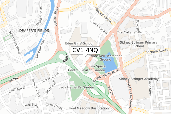
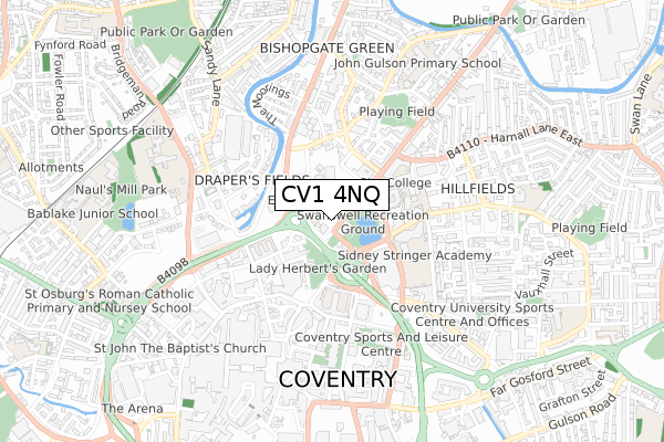
CV1 4NQ is located in the Foleshill electoral ward, within the metropolitan district of Coventry and the English Parliamentary constituency of Coventry North East. The Sub Integrated Care Board (ICB) Location is NHS Coventry and Warwickshire ICB - B2M3M and the police force is West Midlands. This postcode has been in use since January 2020.


GetTheData
Source: OS Open Zoomstack (Ordnance Survey)
Licence: Open Government Licence (requires attribution)
Attribution: Contains OS data © Crown copyright and database right 2024
Source: Open Postcode Geo
Licence: Open Government Licence (requires attribution)
Attribution: Contains OS data © Crown copyright and database right 2024; Contains Royal Mail data © Royal Mail copyright and database right 2024; Source: Office for National Statistics licensed under the Open Government Licence v.3.0
| Easting | 433637 |
| Northing | 279593 |
| Latitude | 52.413325 |
| Longitude | -1.506889 |
GetTheData
Source: Open Postcode Geo
Licence: Open Government Licence
| Country | England |
| Postcode District | CV1 |
| ➜ CV1 open data dashboard ➜ See where CV1 is on a map ➜ Where is Coventry? | |
GetTheData
Source: Land Registry Price Paid Data
Licence: Open Government Licence
| Ward | Foleshill |
| Constituency | Coventry North East |
GetTheData
Source: ONS Postcode Database
Licence: Open Government Licence
| January 2024 | Criminal damage and arson | On or near Park/Open Space | 317m |
| January 2024 | Theft from the person | On or near Parking Area | 431m |
| January 2024 | Violence and sexual offences | On or near Parking Area | 431m |
| ➜ Get more crime data in our Crime section | |||
GetTheData
Source: data.police.uk
Licence: Open Government Licence
| Swanswell St (Stoney Stanton Rd) | Hillfields | 29m |
| Swanswell St (Stoney Stanton Rd) | Hillfields | 37m |
| Bus Garage (White St) | Hillfields | 161m |
| City College (Swanswell St) | Hillfields | 195m |
| Bus Garage (White St) | Hillfields | 200m |
| Coventry Station | 1.5km |
| Canley Station | 3.2km |
| Coventry Arena Station | 3.9km |
GetTheData
Source: NaPTAN
Licence: Open Government Licence
GetTheData
Source: ONS Postcode Database
Licence: Open Government Licence


➜ Get more ratings from the Food Standards Agency
GetTheData
Source: Food Standards Agency
Licence: FSA terms & conditions
| Last Collection | |||
|---|---|---|---|
| Location | Mon-Fri | Sat | Distance |
| Bishopsgate Green | 18:45 | 09:45 | 250m |
| Primrose Hill Street P.o. | 18:30 | 12:00 | 278m |
| Bishop Street | 19:30 | 14:30 | 349m |
GetTheData
Source: Dracos
Licence: Creative Commons Attribution-ShareAlike
| Facility | Distance |
|---|---|
| Eden Girls School Coventry Stoney Stanton Road, Coventry Sports Hall | 76m |
| Sidney Stringer Academy Primrose Hill Street, Coventry Health and Fitness Gym, Sports Hall, Studio, Artificial Grass Pitch, Outdoor Tennis Courts | 286m |
| Shree Hindu Satsang Temple Sports Hall (Closed) Harnall Lane West, Coventry Sports Hall | 328m |
GetTheData
Source: Active Places
Licence: Open Government Licence
| School | Phase of Education | Distance |
|---|---|---|
| Coventry College 50 Swanswell Street, Coventry, CV1 5DG | 16 plus | 220m |
| Eden Girls' School Coventry Stoney Stanton Rd, Coventry, CV1 4FS | Secondary | 270m |
| Sidney Stringer Primary Academy Bath Street, Coventry, CV1 5GU | Primary | 326m |
GetTheData
Source: Edubase
Licence: Open Government Licence
The below table lists the International Territorial Level (ITL) codes (formerly Nomenclature of Territorial Units for Statistics (NUTS) codes) and Local Administrative Units (LAU) codes for CV1 4NQ:
| ITL 1 Code | Name |
|---|---|
| TLG | West Midlands (England) |
| ITL 2 Code | Name |
| TLG3 | West Midlands |
| ITL 3 Code | Name |
| TLG33 | Coventry |
| LAU 1 Code | Name |
| E08000026 | Coventry |
GetTheData
Source: ONS Postcode Directory
Licence: Open Government Licence
The below table lists the Census Output Area (OA), Lower Layer Super Output Area (LSOA), and Middle Layer Super Output Area (MSOA) for CV1 4NQ:
| Code | Name | |
|---|---|---|
| OA | E00048428 | |
| LSOA | E01009574 | Coventry 015F |
| MSOA | E02001972 | Coventry 015 |
GetTheData
Source: ONS Postcode Directory
Licence: Open Government Licence
| CV1 4AL | Leicester Row | 225m |
| CV1 4LJ | Leicester Row | 247m |
| CV1 4LL | Leicester Row | 247m |
| CV1 4GE | Howard Street | 251m |
| CV1 4EZ | Harnall Lane West | 263m |
| CV1 4FZ | Arthur Street | 282m |
| CV1 4GG | Jenner Street | 283m |
| CV1 5LY | Primrose Hill Street | 283m |
| CV1 4GD | Russell Street North | 286m |
| CV1 4RB | Drapers Fields | 317m |
GetTheData
Source: Open Postcode Geo; Land Registry Price Paid Data
Licence: Open Government Licence