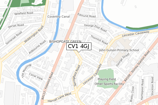
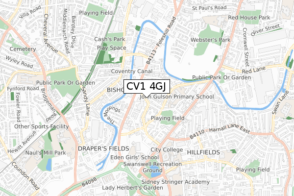
CV1 4GJ is located in the St Michael's electoral ward, within the metropolitan district of Coventry and the English Parliamentary constituency of Coventry South. The Sub Integrated Care Board (ICB) Location is NHS Coventry and Warwickshire ICB - B2M3M and the police force is West Midlands. This postcode has been in use since September 2019.


GetTheData
Source: OS Open Zoomstack (Ordnance Survey)
Licence: Open Government Licence (requires attribution)
Attribution: Contains OS data © Crown copyright and database right 2024
Source: Open Postcode Geo
Licence: Open Government Licence (requires attribution)
Attribution: Contains OS data © Crown copyright and database right 2024; Contains Royal Mail data © Royal Mail copyright and database right 2024; Source: Office for National Statistics licensed under the Open Government Licence v.3.0
| Easting | 433087 |
| Northing | 279332 |
| Latitude | 52.411012 |
| Longitude | -1.515000 |
GetTheData
Source: Open Postcode Geo
Licence: Open Government Licence
| Country | England |
| Postcode District | CV1 |
| ➜ CV1 open data dashboard ➜ See where CV1 is on a map ➜ Where is Coventry? | |
GetTheData
Source: Land Registry Price Paid Data
Licence: Open Government Licence
| Ward | St Michael's |
| Constituency | Coventry South |
GetTheData
Source: ONS Postcode Database
Licence: Open Government Licence
| January 2024 | Public order | On or near Parking Area | 260m |
| January 2024 | Violence and sexual offences | On or near Parking Area | 260m |
| January 2024 | Criminal damage and arson | On or near Park/Open Space | 352m |
| ➜ Get more crime data in our Crime section | |||
GetTheData
Source: data.police.uk
Licence: Open Government Licence
| Belgrade Theatre (Upper Well St) | Coventry | 38m |
| Belgrade Theatre (Upper Well St) | Coventry | 53m |
| Belgrade Theatre (Upper Well St) | Coventry | 64m |
| Belgrade Theatre (Upper Well St) | Coventry | 88m |
| Belgrade Theatre (Upper Well St) | Coventry | 103m |
| Coventry Station | 1.1km |
| Canley Station | 2.6km |
| Coventry Arena Station | 4.3km |
GetTheData
Source: NaPTAN
Licence: Open Government Licence
| Percentage of properties with Next Generation Access | 0.0% |
| Percentage of properties with Superfast Broadband | 0.0% |
| Percentage of properties with Ultrafast Broadband | 0.0% |
| Percentage of properties with Full Fibre Broadband | 0.0% |
Superfast Broadband is between 30Mbps and 300Mbps
Ultrafast Broadband is > 300Mbps
| Percentage of properties unable to receive 2Mbps | 0.0% |
| Percentage of properties unable to receive 5Mbps | 0.0% |
| Percentage of properties unable to receive 10Mbps | 0.0% |
| Percentage of properties unable to receive 30Mbps | 0.0% |
GetTheData
Source: Ofcom
Licence: Ofcom Terms of Use (requires attribution)
GetTheData
Source: ONS Postcode Database
Licence: Open Government Licence


➜ Get more ratings from the Food Standards Agency
GetTheData
Source: Food Standards Agency
Licence: FSA terms & conditions
| Last Collection | |||
|---|---|---|---|
| Location | Mon-Fri | Sat | Distance |
| Co-op Corporation Street | 18:30 | 12:00 | 201m |
| Co-op Corporation Street P.o. | 18:30 | 12:00 | 202m |
| Fleet Street | 18:30 | 09:45 | 243m |
GetTheData
Source: Dracos
Licence: Creative Commons Attribution-ShareAlike
| Facility | Distance |
|---|---|
| Jd Gyms (Coventry) Upper Well Street, Coventry Health and Fitness Gym, Studio | 103m |
| Puregym (Coventry Bishop Street) Bishop Street, Coventry Health and Fitness Gym, Studio | 279m |
| St Osburg's Catholic Primary School Upper Hill Street, Coventry Grass Pitches | 300m |
GetTheData
Source: Active Places
Licence: Open Government Licence
| School | Phase of Education | Distance |
|---|---|---|
| St Osburg's Catholic Primary School Upper Hill Street, Coventry, CV1 4AP | Primary | 302m |
| Barr's Hill School and Community College Radford Road, Coventry, CV1 4BU | Secondary | 475m |
| Bablake School Coundon Road, Coventry, CV1 4AU | Not applicable | 536m |
GetTheData
Source: Edubase
Licence: Open Government Licence
The below table lists the International Territorial Level (ITL) codes (formerly Nomenclature of Territorial Units for Statistics (NUTS) codes) and Local Administrative Units (LAU) codes for CV1 4GJ:
| ITL 1 Code | Name |
|---|---|
| TLG | West Midlands (England) |
| ITL 2 Code | Name |
| TLG3 | West Midlands |
| ITL 3 Code | Name |
| TLG33 | Coventry |
| LAU 1 Code | Name |
| E08000026 | Coventry |
GetTheData
Source: ONS Postcode Directory
Licence: Open Government Licence
The below table lists the Census Output Area (OA), Lower Layer Super Output Area (LSOA), and Middle Layer Super Output Area (MSOA) for CV1 4GJ:
| Code | Name | |
|---|---|---|
| OA | E00172175 | |
| LSOA | E01009642 | Coventry 031C |
| MSOA | E02001988 | Coventry 031 |
GetTheData
Source: ONS Postcode Directory
Licence: Open Government Licence
| CV1 4AE | Lamb Street | 81m |
| CV1 1GU | Corporation Street | 166m |
| CV1 4AN | Hill Street | 173m |
| CV1 1FZ | Smithford Way | 198m |
| CV1 4DD | Middleborough Road | 218m |
| CV1 1HU | Bishop Street | 222m |
| CV1 3AU | Lower Holyhead Road | 250m |
| CV1 4AP | Upper Hill Street | 270m |
| CV1 4BZ | Middleborough Road | 276m |
| CV1 4DA | Middleborough Road | 276m |
GetTheData
Source: Open Postcode Geo; Land Registry Price Paid Data
Licence: Open Government Licence