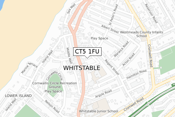
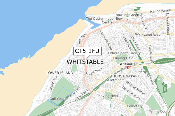
CT5 1FU is located in the Gorrell electoral ward, within the local authority district of Canterbury and the English Parliamentary constituency of Canterbury. The Sub Integrated Care Board (ICB) Location is NHS Kent and Medway ICB - 91Q and the police force is Kent. This postcode has been in use since April 2020.


GetTheData
Source: OS Open Zoomstack (Ordnance Survey)
Licence: Open Government Licence (requires attribution)
Attribution: Contains OS data © Crown copyright and database right 2024
Source: Open Postcode Geo
Licence: Open Government Licence (requires attribution)
Attribution: Contains OS data © Crown copyright and database right 2024; Contains Royal Mail data © Royal Mail copyright and database right 2024; Source: Office for National Statistics licensed under the Open Government Licence v.3.0
| Easting | 610713 |
| Northing | 166552 |
| Latitude | 51.358947 |
| Longitude | 1.025183 |
GetTheData
Source: Open Postcode Geo
Licence: Open Government Licence
| Country | England |
| Postcode District | CT5 |
| ➜ CT5 open data dashboard ➜ See where CT5 is on a map ➜ Where is Whitstable? | |
GetTheData
Source: Land Registry Price Paid Data
Licence: Open Government Licence
| Ward | Gorrell |
| Constituency | Canterbury |
GetTheData
Source: ONS Postcode Database
Licence: Open Government Licence
| January 2024 | Shoplifting | On or near Harts Lane | 189m |
| January 2024 | Violence and sexual offences | On or near Harts Lane | 189m |
| January 2024 | Violence and sexual offences | On or near Parking Area | 297m |
| ➜ Get more crime data in our Crime section | |||
GetTheData
Source: data.police.uk
Licence: Open Government Licence
| St Alphege Church (High Street) | Whitstable | 103m |
| St Alphege Church (High Street) | Whitstable | 152m |
| Horsebridge (Horsebridge Road) | Whitstable | 196m |
| Harbour Street | Whitstable | 215m |
| Library (Oxford Street) | Whitstable | 310m |
| Whitstable Station | 0.6km |
| Chestfield & Swalecliffe Station | 2.9km |
GetTheData
Source: NaPTAN
Licence: Open Government Licence
GetTheData
Source: ONS Postcode Database
Licence: Open Government Licence


➜ Get more ratings from the Food Standards Agency
GetTheData
Source: Food Standards Agency
Licence: FSA terms & conditions
| Last Collection | |||
|---|---|---|---|
| Location | Mon-Fri | Sat | Distance |
| Whitstable Post Office | 17:45 | 12:30 | 7m |
| Harbour Street | 17:30 | 12:00 | 222m |
| Oxford Street | 17:30 | 12:00 | 359m |
GetTheData
Source: Dracos
Licence: Creative Commons Attribution-ShareAlike
| Facility | Distance |
|---|---|
| Westmeads Recreation Ground Cromwell Road, Whitstable Grass Pitches | 417m |
| Whitstable And Seasalter Golf Course Collingwood Road, Whitstable Golf | 471m |
| Oyster Indoor Bowling Club Whitstable Harbour, Whitstable Indoor Bowls | 613m |
GetTheData
Source: Active Places
Licence: Open Government Licence
| School | Phase of Education | Distance |
|---|---|---|
| Whitstable and Seasalter Endowed Church of England Junior School High Street, Whitstable, CT5 1AY | Primary | 96m |
| ISP Polar Restart Centre ISP Centre, Regent Street, Whitstable, Kent, CT5 1JD | Not applicable | 142m |
| St Alphege Church of England Infant School Oxford Street, Whitstable, CT5 1DA | Primary | 304m |
GetTheData
Source: Edubase
Licence: Open Government Licence
The below table lists the International Territorial Level (ITL) codes (formerly Nomenclature of Territorial Units for Statistics (NUTS) codes) and Local Administrative Units (LAU) codes for CT5 1FU:
| ITL 1 Code | Name |
|---|---|
| TLJ | South East (England) |
| ITL 2 Code | Name |
| TLJ4 | Kent |
| ITL 3 Code | Name |
| TLJ44 | East Kent |
| LAU 1 Code | Name |
| E07000106 | Canterbury |
GetTheData
Source: ONS Postcode Directory
Licence: Open Government Licence
The below table lists the Census Output Area (OA), Lower Layer Super Output Area (LSOA), and Middle Layer Super Output Area (MSOA) for CT5 1FU:
| Code | Name | |
|---|---|---|
| OA | E00122219 | |
| LSOA | E01024070 | Canterbury 008C |
| MSOA | E02005017 | Canterbury 008 |
GetTheData
Source: ONS Postcode Directory
Licence: Open Government Licence
| CT5 1JG | Gladstone Road | 59m |
| CT5 1BB | High Street | 62m |
| CT5 1AP | High Street | 74m |
| CT5 1FH | Victoria Mews | 76m |
| CT5 1JD | Regent Street | 89m |
| CT5 1JF | Regent Street | 90m |
| CT5 1AY | High Street | 110m |
| CT5 1BN | Middle Wall | 113m |
| CT5 1BQ | High Street | 119m |
| CT5 1AZ | High Street | 126m |
GetTheData
Source: Open Postcode Geo; Land Registry Price Paid Data
Licence: Open Government Licence