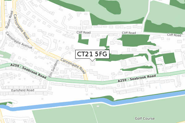
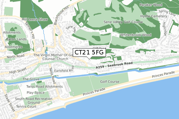
CT21 5FG is located in the Hythe electoral ward, within the local authority district of Folkestone and Hythe and the English Parliamentary constituency of Folkestone and Hythe. The Sub Integrated Care Board (ICB) Location is NHS Kent and Medway ICB - 91Q and the police force is Kent. This postcode has been in use since February 2020.


GetTheData
Source: OS Open Zoomstack (Ordnance Survey)
Licence: Open Government Licence (requires attribution)
Attribution: Contains OS data © Crown copyright and database right 2024
Source: Open Postcode Geo
Licence: Open Government Licence (requires attribution)
Attribution: Contains OS data © Crown copyright and database right 2024; Contains Royal Mail data © Royal Mail copyright and database right 2024; Source: Office for National Statistics licensed under the Open Government Licence v.3.0
| Easting | 617257 |
| Northing | 134934 |
| Latitude | 51.072596 |
| Longitude | 1.099894 |
GetTheData
Source: Open Postcode Geo
Licence: Open Government Licence
| Country | England |
| Postcode District | CT21 |
| ➜ CT21 open data dashboard ➜ See where CT21 is on a map ➜ Where is Hythe? | |
GetTheData
Source: Land Registry Price Paid Data
Licence: Open Government Licence
| Ward | Hythe |
| Constituency | Folkestone And Hythe |
GetTheData
Source: ONS Postcode Database
Licence: Open Government Licence
| January 2024 | Violence and sexual offences | On or near Cannongate Gardens | 255m |
| December 2023 | Public order | On or near Cannongate Close | 84m |
| May 2023 | Vehicle crime | On or near Cannongate Close | 84m |
| ➜ Get more crime data in our Crime section | |||
GetTheData
Source: data.police.uk
Licence: Open Government Licence
| Cannongate Road (Seabrook Road) | Seabrook | 127m |
| Cannongate Road (Seabrook Road) | Seabrook | 134m |
| Saxon Close (Seabrook Road) | Seabrook | 271m |
| Saxon Close (Seabrook Road) | Seabrook | 327m |
| Mill Road (Seabrook Road) | Hythe | 348m |
| Sandling Station | 3.1km |
| Folkestone West Station | 4km |
| Westenhanger Station | 5km |
GetTheData
Source: NaPTAN
Licence: Open Government Licence
GetTheData
Source: ONS Postcode Database
Licence: Open Government Licence


➜ Get more ratings from the Food Standards Agency
GetTheData
Source: Food Standards Agency
Licence: FSA terms & conditions
| Last Collection | |||
|---|---|---|---|
| Location | Mon-Fri | Sat | Distance |
| Cannongate Road | 16:30 | 12:00 | 63m |
| Seabrook Hall | 16:00 | 11:45 | 435m |
| Sene Park | 16:30 | 11:45 | 532m |
GetTheData
Source: Dracos
Licence: Creative Commons Attribution-ShareAlike
| Facility | Distance |
|---|---|
| Foxwood School (Closed) Seabrook Road, Hythe Sports Hall | 301m |
| Hythe Imperial Health Club & Spa Princes Parade, Hythe Swimming Pool, Health and Fitness Gym, Studio, Squash Courts, Outdoor Tennis Courts | 604m |
| Sene Valley Golf Club Blackhouse Hill, Newington, Folkestone Golf | 713m |
GetTheData
Source: Active Places
Licence: Open Government Licence
| School | Phase of Education | Distance |
|---|---|---|
| Seabrook Church of England Primary School Seabrook Road, Hythe, CT21 5RL | Primary | 1.4km |
| Hythe Bay CofE Primary School Cinque Ports Avenue, Hythe, CT21 6HS | Primary | 1.6km |
| Saltwood CofE Primary School Grange Road, Saltwood, Hythe, CT21 4QS | Primary | 1.7km |
GetTheData
Source: Edubase
Licence: Open Government Licence
The below table lists the International Territorial Level (ITL) codes (formerly Nomenclature of Territorial Units for Statistics (NUTS) codes) and Local Administrative Units (LAU) codes for CT21 5FG:
| ITL 1 Code | Name |
|---|---|
| TLJ | South East (England) |
| ITL 2 Code | Name |
| TLJ4 | Kent |
| ITL 3 Code | Name |
| TLJ44 | East Kent |
| LAU 1 Code | Name |
| E07000112 | Folkestone and Hythe |
GetTheData
Source: ONS Postcode Directory
Licence: Open Government Licence
The below table lists the Census Output Area (OA), Lower Layer Super Output Area (LSOA), and Middle Layer Super Output Area (MSOA) for CT21 5FG:
| Code | Name | |
|---|---|---|
| OA | E00124494 | |
| LSOA | E01024527 | Shepway 008C |
| MSOA | E02005109 | Shepway 008 |
GetTheData
Source: ONS Postcode Directory
Licence: Open Government Licence
| CT21 5EF | Cannongate Road | 73m |
| CT21 5QE | Seabrook Road | 96m |
| CT21 5PZ | Cannongate Close | 106m |
| CT21 5QD | Seabrook Road | 145m |
| CT21 5QA | Seabrook Road | 159m |
| CT21 5QB | Seabrook Road | 171m |
| CT21 5XQ | Cliff Road | 184m |
| CT21 5PY | Elm Gardens | 185m |
| CT21 5PX | Cannongate Road | 194m |
| CT21 5LY | Elm Gardens | 195m |
GetTheData
Source: Open Postcode Geo; Land Registry Price Paid Data
Licence: Open Government Licence