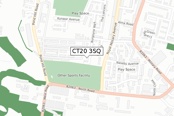
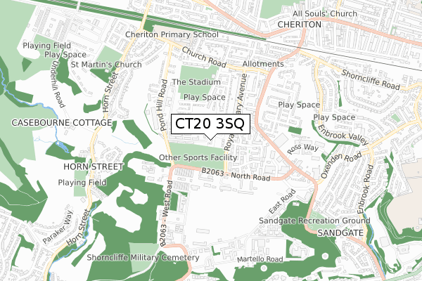
CT20 3SQ is located in the Cheriton electoral ward, within the local authority district of Folkestone and Hythe and the English Parliamentary constituency of Folkestone and Hythe. The Sub Integrated Care Board (ICB) Location is NHS Kent and Medway ICB - 91Q and the police force is Kent. This postcode has been in use since November 2018.


GetTheData
Source: OS Open Zoomstack (Ordnance Survey)
Licence: Open Government Licence (requires attribution)
Attribution: Contains OS data © Crown copyright and database right 2025
Source: Open Postcode Geo
Licence: Open Government Licence (requires attribution)
Attribution: Contains OS data © Crown copyright and database right 2025; Contains Royal Mail data © Royal Mail copyright and database right 2025; Source: Office for National Statistics licensed under the Open Government Licence v.3.0
| Easting | 619582 |
| Northing | 136056 |
| Latitude | 51.081786 |
| Longitude | 1.133710 |
GetTheData
Source: Open Postcode Geo
Licence: Open Government Licence
| Country | England |
| Postcode District | CT20 |
➜ See where CT20 is on a map ➜ Where is Folkestone? | |
GetTheData
Source: Land Registry Price Paid Data
Licence: Open Government Licence
| Ward | Cheriton |
| Constituency | Folkestone And Hythe |
GetTheData
Source: ONS Postcode Database
Licence: Open Government Licence
2022 21 DEC £425,000 |
11, GARRISON CLOSE, FOLKESTONE, CT20 3SQ 2022 4 NOV £376,995 |
9, GARRISON CLOSE, FOLKESTONE, CT20 3SQ 2022 28 OCT £375,000 |
15, GARRISON CLOSE, FOLKESTONE, CT20 3SQ 2022 28 OCT £379,995 |
7, GARRISON CLOSE, FOLKESTONE, CT20 3SQ 2022 26 OCT £328,500 |
1, GARRISON CLOSE, FOLKESTONE, CT20 3SQ 2022 14 OCT £379,995 |
2018 18 DEC £336,500 |
12, GARRISON CLOSE, FOLKESTONE, CT20 3SQ 2018 13 DEC £266,500 |
14, GARRISON CLOSE, FOLKESTONE, CT20 3SQ 2018 30 NOV £275,000 |
GetTheData
Source: HM Land Registry Price Paid Data
Licence: Contains HM Land Registry data © Crown copyright and database right 2025. This data is licensed under the Open Government Licence v3.0.
| Shorncliffe Post Office (Royal Military Avenue) | Shorncliffe | 135m |
| Tower Theatre (North Road) | Shorncliffe | 246m |
| Alma Road | Shorncliffe | 264m |
| Cromwell Park Place (North Road) | Shorncliffe | 271m |
| Naseby Avenue (Military Road) | Shorncliffe | 314m |
| Folkestone West Station | 1.5km |
| Folkestone Central Station | 2.5km |
| Sandling Station | 4.8km |
GetTheData
Source: NaPTAN
Licence: Open Government Licence
| Percentage of properties with Next Generation Access | 100.0% |
| Percentage of properties with Superfast Broadband | 100.0% |
| Percentage of properties with Ultrafast Broadband | 100.0% |
| Percentage of properties with Full Fibre Broadband | 100.0% |
Superfast Broadband is between 30Mbps and 300Mbps
Ultrafast Broadband is > 300Mbps
| Percentage of properties unable to receive 2Mbps | 0.0% |
| Percentage of properties unable to receive 5Mbps | 0.0% |
| Percentage of properties unable to receive 10Mbps | 0.0% |
| Percentage of properties unable to receive 30Mbps | 0.0% |
GetTheData
Source: Ofcom
Licence: Ofcom Terms of Use (requires attribution)
GetTheData
Source: ONS Postcode Database
Licence: Open Government Licence


➜ Get more ratings from the Food Standards Agency
GetTheData
Source: Food Standards Agency
Licence: FSA terms & conditions
| Last Collection | |||
|---|---|---|---|
| Location | Mon-Fri | Sat | Distance |
| Shorncliffe Post Office | 17:30 | 12:00 | 169m |
| Mckenzie Drive | 17:30 | 12:00 | 456m |
| Church Road | 17:30 | 12:00 | 517m |
GetTheData
Source: Dracos
Licence: Creative Commons Attribution-ShareAlike
The below table lists the International Territorial Level (ITL) codes (formerly Nomenclature of Territorial Units for Statistics (NUTS) codes) and Local Administrative Units (LAU) codes for CT20 3SQ:
| ITL 1 Code | Name |
|---|---|
| TLJ | South East (England) |
| ITL 2 Code | Name |
| TLJ4 | Kent |
| ITL 3 Code | Name |
| TLJ44 | East Kent |
| LAU 1 Code | Name |
| E07000112 | Folkestone and Hythe |
GetTheData
Source: ONS Postcode Directory
Licence: Open Government Licence
The below table lists the Census Output Area (OA), Lower Layer Super Output Area (LSOA), and Middle Layer Super Output Area (MSOA) for CT20 3SQ:
| Code | Name | |
|---|---|---|
| OA | E00124331 | |
| LSOA | E01024495 | Shepway 005D |
| MSOA | E02005106 | Shepway 005 |
GetTheData
Source: ONS Postcode Directory
Licence: Open Government Licence
| CT20 3SL | Fairfax Close | 125m |
| CT20 3SH | Newbury Close | 155m |
| CT20 3SB | Cromwell Park Place | 190m |
| CT20 3EF | Royal Military Avenue | 194m |
| CT20 3LY | St Marks Close | 230m |
| CT20 3SJ | Naseby Avenue | 250m |
| CT20 3SD | Cromwell Park Place | 255m |
| CT20 3LX | Risborough Lane | 267m |
| CT20 3LU | Alma Road | 277m |
| CT20 3EG | Royal Military Avenue | 299m |
GetTheData
Source: Open Postcode Geo; Land Registry Price Paid Data
Licence: Open Government Licence