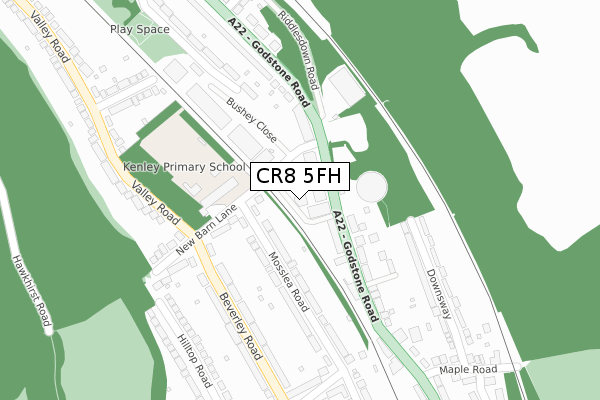
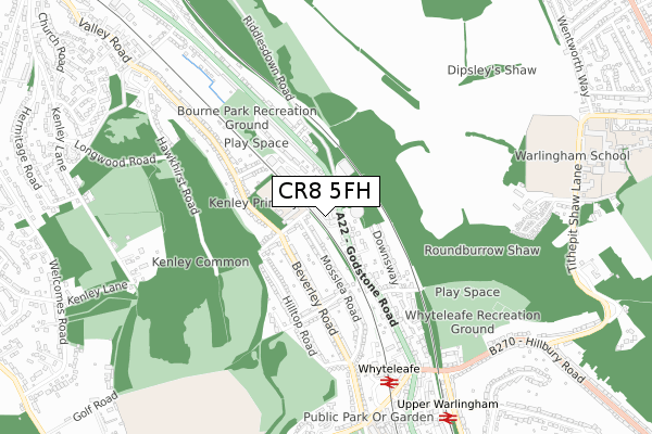
CR8 5FH is located in the Whyteleafe electoral ward, within the local authority district of Tandridge and the English Parliamentary constituency of East Surrey. The Sub Integrated Care Board (ICB) Location is NHS Surrey Heartlands ICB - 92A and the police force is Surrey. This postcode has been in use since July 2019.


GetTheData
Source: OS Open Zoomstack (Ordnance Survey)
Licence: Open Government Licence (requires attribution)
Attribution: Contains OS data © Crown copyright and database right 2024
Source: Open Postcode Geo
Licence: Open Government Licence (requires attribution)
Attribution: Contains OS data © Crown copyright and database right 2024; Contains Royal Mail data © Royal Mail copyright and database right 2024; Source: Office for National Statistics licensed under the Open Government Licence v.3.0
| Easting | 533609 |
| Northing | 159123 |
| Latitude | 51.315537 |
| Longitude | -0.084218 |
GetTheData
Source: Open Postcode Geo
Licence: Open Government Licence
| Country | England |
| Postcode District | CR8 |
| ➜ CR8 open data dashboard ➜ See where CR8 is on a map ➜ Where is London? | |
GetTheData
Source: Land Registry Price Paid Data
Licence: Open Government Licence
| Ward | Whyteleafe |
| Constituency | East Surrey |
GetTheData
Source: ONS Postcode Database
Licence: Open Government Licence
| June 2022 | Violence and sexual offences | On or near Old Barn Lane | 77m |
| June 2022 | Other theft | On or near Old Barn Lane | 77m |
| June 2022 | Anti-social behaviour | On or near Old Barn Lane | 77m |
| ➜ Get more crime data in our Crime section | |||
GetTheData
Source: data.police.uk
Licence: Open Government Licence
| Old Barn Lane (Godstone Road) | Whyteleafe | 52m |
| Old Barn Lane (Godstone Road) | Whyteleafe | 83m |
| New Barn Lane | Kenley | 205m |
| New Barn Lane | Kenley | 232m |
| Maple Road (Godstone Road) | Whyteleafe | 250m |
| Whyteleafe Station | 0.7km |
| Upper Warlingham Station | 0.9km |
| Whyteleafe South Station | 1.4km |
GetTheData
Source: NaPTAN
Licence: Open Government Licence
| Percentage of properties with Next Generation Access | 100.0% |
| Percentage of properties with Superfast Broadband | 100.0% |
| Percentage of properties with Ultrafast Broadband | 100.0% |
| Percentage of properties with Full Fibre Broadband | 100.0% |
Superfast Broadband is between 30Mbps and 300Mbps
Ultrafast Broadband is > 300Mbps
| Percentage of properties unable to receive 2Mbps | 0.0% |
| Percentage of properties unable to receive 5Mbps | 0.0% |
| Percentage of properties unable to receive 10Mbps | 0.0% |
| Percentage of properties unable to receive 30Mbps | 0.0% |
GetTheData
Source: Ofcom
Licence: Ofcom Terms of Use (requires attribution)
GetTheData
Source: ONS Postcode Database
Licence: Open Government Licence


➜ Get more ratings from the Food Standards Agency
GetTheData
Source: Food Standards Agency
Licence: FSA terms & conditions
| Last Collection | |||
|---|---|---|---|
| Location | Mon-Fri | Sat | Distance |
| Valley Road (120) | 16:45 | 12:00 | 404m |
| Godstone Road (79) | 16:15 | 12:00 | 747m |
| Upper Warlingham Station | 17:00 | 12:00 | 841m |
GetTheData
Source: Dracos
Licence: Creative Commons Attribution-ShareAlike
| Facility | Distance |
|---|---|
| Kenley Primary School New Barn Lane, Whyteleafe Grass Pitches | 134m |
| Whyteleafe Recreation Ground Hillbury Road, Warlingham Outdoor Tennis Courts, Grass Pitches | 735m |
| Warlingham School Tithepit Shaw Lane, Warlingham Sports Hall, Swimming Pool, Artificial Grass Pitch, Health and Fitness Gym, Grass Pitches, Outdoor Tennis Courts | 928m |
GetTheData
Source: Active Places
Licence: Open Government Licence
| School | Phase of Education | Distance |
|---|---|---|
| Kenley Primary School New Barn Lane, Whyteleafe, CR3 0EX | Primary | 134m |
| Whyteleafe Primary School Whyteleafe Hill, Whyteleafe, CR3 0AA | Primary | 888m |
| Warlingham School Tithepit Shaw Lane, Warlingham, CR6 9YB | Secondary | 1.1km |
GetTheData
Source: Edubase
Licence: Open Government Licence
The below table lists the International Territorial Level (ITL) codes (formerly Nomenclature of Territorial Units for Statistics (NUTS) codes) and Local Administrative Units (LAU) codes for CR8 5FH:
| ITL 1 Code | Name |
|---|---|
| TLJ | South East (England) |
| ITL 2 Code | Name |
| TLJ2 | Surrey, East and West Sussex |
| ITL 3 Code | Name |
| TLJ26 | East Surrey |
| LAU 1 Code | Name |
| E07000215 | Tandridge |
GetTheData
Source: ONS Postcode Directory
Licence: Open Government Licence
The below table lists the Census Output Area (OA), Lower Layer Super Output Area (LSOA), and Middle Layer Super Output Area (MSOA) for CR8 5FH:
| Code | Name | |
|---|---|---|
| OA | E00157354 | |
| LSOA | E01030860 | Tandridge 002D |
| MSOA | E02006429 | Tandridge 002 |
GetTheData
Source: ONS Postcode Directory
Licence: Open Government Licence
| CR3 0EA | Welcomes Terrace | 118m |
| CR8 5GX | Godstone Road | 120m |
| CR3 0DS | Mosslea Road | 146m |
| CR3 0EX | New Barn Lane | 155m |
| CR3 0DQ | Mosslea Road | 158m |
| CR3 0DU | Beverley Road | 209m |
| CR3 0EG | Godstone Road | 213m |
| CR8 5BH | Godstone Road | 216m |
| CR3 0DX | Beverley Road | 251m |
| CR3 0EW | Downsway | 252m |
GetTheData
Source: Open Postcode Geo; Land Registry Price Paid Data
Licence: Open Government Licence