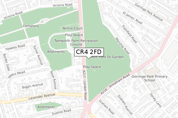
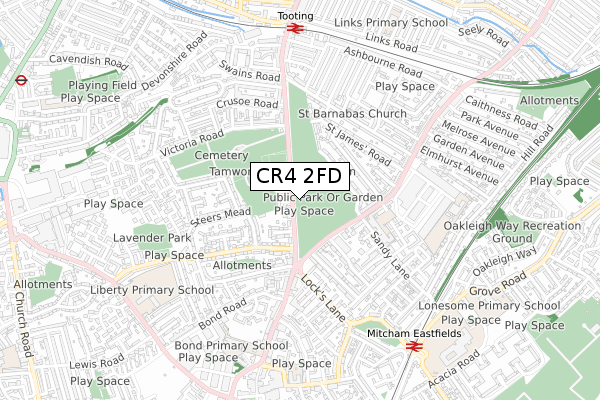
CR4 2FD is located in the Graveney electoral ward, within the London borough of Merton and the English Parliamentary constituency of Mitcham and Morden. The Sub Integrated Care Board (ICB) Location is NHS South West London ICB - 36L and the police force is Metropolitan Police. This postcode has been in use since April 2020.


GetTheData
Source: OS Open Zoomstack (Ordnance Survey)
Licence: Open Government Licence (requires attribution)
Attribution: Contains OS data © Crown copyright and database right 2024
Source: Open Postcode Geo
Licence: Open Government Licence (requires attribution)
Attribution: Contains OS data © Crown copyright and database right 2024; Contains Royal Mail data © Royal Mail copyright and database right 2024; Source: Office for National Statistics licensed under the Open Government Licence v.3.0
| Easting | 527982 |
| Northing | 170477 |
| Latitude | 51.418868 |
| Longitude | -0.160831 |
GetTheData
Source: Open Postcode Geo
Licence: Open Government Licence
| Country | England |
| Postcode District | CR4 |
| ➜ CR4 open data dashboard ➜ See where CR4 is on a map ➜ Where is London? | |
GetTheData
Source: Land Registry Price Paid Data
Licence: Open Government Licence
| Ward | Graveney |
| Constituency | Mitcham And Morden |
GetTheData
Source: ONS Postcode Database
Licence: Open Government Licence
| January 2024 | Vehicle crime | On or near Swains Road | 237m |
| December 2023 | Violence and sexual offences | On or near Swains Road | 237m |
| December 2023 | Violence and sexual offences | On or near Swains Road | 237m |
| ➜ Get more crime data in our Crime section | |||
GetTheData
Source: data.police.uk
Licence: Open Government Licence
| Tooting | Tooting | 98m |
| Tooting (Mitcham Road) | Tooting | 180m |
| Gorringe Park Avenue (London Road) | Collier's Wood | 189m |
| Gorringe Park Avenue (London Road) | Collier's Wood | 189m |
| Tooting (Mitcham Road) | Tooting | 241m |
| Tooting Broadway Underground Station | Tooting Broadway | 1,106m |
| Colliers Wood Underground Station | Collier's Wood | 1,201m |
| Tooting Station | 0.1km |
| Mitcham Eastfields Station | 1.3km |
| Streatham Common Station | 1.7km |
GetTheData
Source: NaPTAN
Licence: Open Government Licence
GetTheData
Source: ONS Postcode Database
Licence: Open Government Licence


➜ Get more ratings from the Food Standards Agency
GetTheData
Source: Food Standards Agency
Licence: FSA terms & conditions
| Last Collection | |||
|---|---|---|---|
| Location | Mon-Fri | Sat | Distance |
| Post Office | 17:30 | 12:00 | 75m |
| Links Road | 17:30 | 12:00 | 136m |
| Gorringe Park Avenue (57) | 16:45 | 12:00 | 295m |
GetTheData
Source: Dracos
Licence: Creative Commons Attribution-ShareAlike
| Facility | Distance |
|---|---|
| Snap Fitness (Tooting) Mitcham Road, Mitcham Road, London Health and Fitness Gym | 459m |
| Tamworth Recreation Ground London Road, Mitcham Outdoor Tennis Courts | 545m |
| Figges Marsh London Road, Mitcham Grass Pitches | 613m |
GetTheData
Source: Active Places
Licence: Open Government Licence
| School | Phase of Education | Distance |
|---|---|---|
| Links Primary School Frinton Road, London, SW17 9EH | Primary | 401m |
| Furzedown Primary School Beclands Road, Tooting, London, SW17 9TJ | Primary | 668m |
| Sellincourt Primary School Sellincourt Road, Tooting, London, SW17 9SA | Primary | 749m |
GetTheData
Source: Edubase
Licence: Open Government Licence
The below table lists the International Territorial Level (ITL) codes (formerly Nomenclature of Territorial Units for Statistics (NUTS) codes) and Local Administrative Units (LAU) codes for CR4 2FD:
| ITL 1 Code | Name |
|---|---|
| TLI | London |
| ITL 2 Code | Name |
| TLI6 | Outer London - South |
| ITL 3 Code | Name |
| TLI63 | Merton, Kingston upon Thames and Sutton |
| LAU 1 Code | Name |
| E09000024 | Merton |
GetTheData
Source: ONS Postcode Directory
Licence: Open Government Licence
The below table lists the Census Output Area (OA), Lower Layer Super Output Area (LSOA), and Middle Layer Super Output Area (MSOA) for CR4 2FD:
| Code | Name | |
|---|---|---|
| OA | E00017190 | |
| LSOA | E01003393 | Merton 008C |
| MSOA | E02000696 | Merton 008 |
GetTheData
Source: ONS Postcode Directory
Licence: Open Government Licence
| CR4 2BT | Inglemere Road | 28m |
| CR4 2BY | Grenfell Road | 30m |
| CR4 2BZ | Grenfell Road | 65m |
| CR4 2BJ | Bruce Road | 66m |
| SW17 9JT | London Road | 72m |
| SW17 9JR | London Road | 74m |
| CR4 2BX | Sirdar Road | 86m |
| SW17 9HP | London Road | 92m |
| CR4 2BG | Bruce Road | 92m |
| CR4 2FE | Grenfell Road | 94m |
GetTheData
Source: Open Postcode Geo; Land Registry Price Paid Data
Licence: Open Government Licence