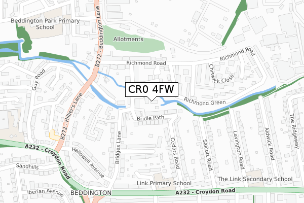
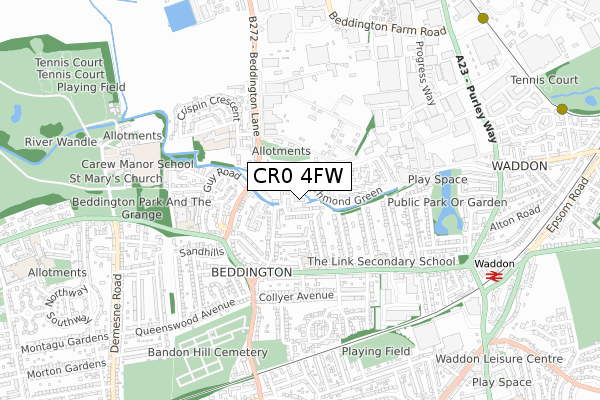
CR0 4FW is located in the Beddington electoral ward, within the London borough of Sutton and the English Parliamentary constituency of Carshalton and Wallington. The Sub Integrated Care Board (ICB) Location is NHS South West London ICB - 36L and the police force is Metropolitan Police. This postcode has been in use since July 2018.


GetTheData
Source: OS Open Zoomstack (Ordnance Survey)
Licence: Open Government Licence (requires attribution)
Attribution: Contains OS data © Crown copyright and database right 2024
Source: Open Postcode Geo
Licence: Open Government Licence (requires attribution)
Attribution: Contains OS data © Crown copyright and database right 2024; Contains Royal Mail data © Royal Mail copyright and database right 2024; Source: Office for National Statistics licensed under the Open Government Licence v.3.0
| Easting | 530322 |
| Northing | 165133 |
| Latitude | 51.370310 |
| Longitude | -0.129159 |
GetTheData
Source: Open Postcode Geo
Licence: Open Government Licence
| Country | England |
| Postcode District | CR0 |
| ➜ CR0 open data dashboard ➜ See where CR0 is on a map ➜ Where is London? | |
GetTheData
Source: Land Registry Price Paid Data
Licence: Open Government Licence
| Ward | Beddington |
| Constituency | Carshalton And Wallington |
GetTheData
Source: ONS Postcode Database
Licence: Open Government Licence
7, RIVER VIEW MEWS, BEDDINGTON, CROYDON, CR0 4FW 2018 26 SEP £525,000 |
GetTheData
Source: HM Land Registry Price Paid Data
Licence: Contains HM Land Registry data © Crown copyright and database right 2024. This data is licensed under the Open Government Licence v3.0.
| January 2024 | Violence and sexual offences | On or near Wandle Court Gardens | 160m |
| January 2024 | Anti-social behaviour | On or near Wandle Court Gardens | 160m |
| December 2023 | Other theft | On or near Wandle Court Gardens | 160m |
| ➜ Get more crime data in our Crime section | |||
GetTheData
Source: data.police.uk
Licence: Open Government Licence
| Hilliers Lane | Beddington | 245m |
| Richmond Road (Beddington Lane) | Beddington | 257m |
| Hilliers Lane | Beddington | 290m |
| Croydon Road Plough Lane (Croydon Road) | Beddington | 338m |
| Croydon Road Plough Lane | Beddington | 339m |
| Waddon Marsh Tram Stop (Off Gurney Crescent) | Waddon | 1,082m |
| Wandle Park Tram Stop (Vicarage Road) | Waddon | 1,159m |
| Ampere Way Tram Stop (Ampere Way) | Broad Green | 1,388m |
| Waddon Station | 0.9km |
| Wallington Station | 1.9km |
| Hackbridge Station | 1.9km |
GetTheData
Source: NaPTAN
Licence: Open Government Licence
➜ Broadband speed and availability dashboard for CR0 4FW
| Percentage of properties with Next Generation Access | 100.0% |
| Percentage of properties with Superfast Broadband | 100.0% |
| Percentage of properties with Ultrafast Broadband | 100.0% |
| Percentage of properties with Full Fibre Broadband | 0.0% |
Superfast Broadband is between 30Mbps and 300Mbps
Ultrafast Broadband is > 300Mbps
| Median download speed | 40.0Mbps |
| Average download speed | 102.8Mbps |
| Maximum download speed | 350.00Mbps |
| Median upload speed | 8.3Mbps |
| Average upload speed | 8.1Mbps |
| Maximum upload speed | 8.96Mbps |
| Percentage of properties unable to receive 2Mbps | 0.0% |
| Percentage of properties unable to receive 5Mbps | 0.0% |
| Percentage of properties unable to receive 10Mbps | 0.0% |
| Percentage of properties unable to receive 30Mbps | 0.0% |
➜ Broadband speed and availability dashboard for CR0 4FW
GetTheData
Source: Ofcom
Licence: Ofcom Terms of Use (requires attribution)
GetTheData
Source: ONS Postcode Database
Licence: Open Government Licence


➜ Get more ratings from the Food Standards Agency
GetTheData
Source: Food Standards Agency
Licence: FSA terms & conditions
| Last Collection | |||
|---|---|---|---|
| Location | Mon-Fri | Sat | Distance |
| Beddington Lane(2) | 19:00 | 12:00 | 242m |
| Croydon Road(104) | 18:45 | 12:00 | 354m |
| Aldwick Road (45) | 18:45 | 12:00 | 375m |
GetTheData
Source: Dracos
Licence: Creative Commons Attribution-ShareAlike
| Facility | Distance |
|---|---|
| Link Secondary School Croydon Road, Beddington, Croydon Sports Hall | 434m |
| The Change Foundation Plough Lane, Wallington Grass Pitches | 664m |
| Sheen Way Sports Ground (Closed) Sheen Way, Wallington Grass Pitches | 705m |
GetTheData
Source: Active Places
Licence: Open Government Licence
| School | Phase of Education | Distance |
|---|---|---|
| The Link School 138 Croydon Road, Beddington, Croydon, CR0 4PG | Not applicable | 267m |
| Beddington Park Academy Mallinson Road, Croydon, CR0 4UL | Primary | 405m |
| Sherwood Park School Streeters Lane, Wallington, SM6 7NP | Not applicable | 501m |
GetTheData
Source: Edubase
Licence: Open Government Licence
The below table lists the International Territorial Level (ITL) codes (formerly Nomenclature of Territorial Units for Statistics (NUTS) codes) and Local Administrative Units (LAU) codes for CR0 4FW:
| ITL 1 Code | Name |
|---|---|
| TLI | London |
| ITL 2 Code | Name |
| TLI6 | Outer London - South |
| ITL 3 Code | Name |
| TLI63 | Merton, Kingston upon Thames and Sutton |
| LAU 1 Code | Name |
| E09000029 | Sutton |
GetTheData
Source: ONS Postcode Directory
Licence: Open Government Licence
The below table lists the Census Output Area (OA), Lower Layer Super Output Area (LSOA), and Middle Layer Super Output Area (MSOA) for CR0 4FW:
| Code | Name | |
|---|---|---|
| OA | E00020543 | |
| LSOA | E01004078 | Sutton 011C |
| MSOA | E02000850 | Sutton 011 |
GetTheData
Source: ONS Postcode Directory
Licence: Open Government Licence
| CR0 4SP | Blandford Close | 27m |
| CR0 4SB | Bridle Path | 40m |
| CR0 4FL | Bridle Path | 43m |
| CR0 4TX | Kingston Gardens | 53m |
| CR0 4SD | Wandle Road | 63m |
| CR0 4TW | Windsor Gardens | 81m |
| CR0 4TY | Petersham Terrace | 82m |
| CR0 4AQ | Riverside Mews | 101m |
| CR0 4SF | Richmond Road | 117m |
| CR0 4SW | Mortlake Close | 141m |
GetTheData
Source: Open Postcode Geo; Land Registry Price Paid Data
Licence: Open Government Licence