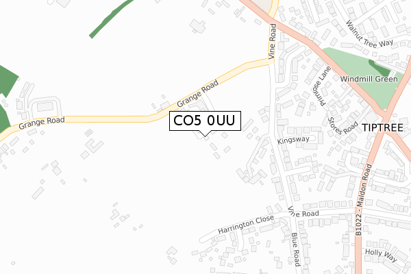
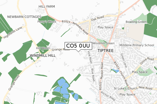
CO5 0UU is located in the Tiptree electoral ward, within the local authority district of Colchester and the English Parliamentary constituency of Witham. The Sub Integrated Care Board (ICB) Location is NHS Suffolk and North East Essex ICB - 06T and the police force is Essex. This postcode has been in use since September 2019.


GetTheData
Source: OS Open Zoomstack (Ordnance Survey)
Licence: Open Government Licence (requires attribution)
Attribution: Contains OS data © Crown copyright and database right 2024
Source: Open Postcode Geo
Licence: Open Government Licence (requires attribution)
Attribution: Contains OS data © Crown copyright and database right 2024; Contains Royal Mail data © Royal Mail copyright and database right 2024; Source: Office for National Statistics licensed under the Open Government Licence v.3.0
| Easting | 588861 |
| Northing | 216655 |
| Latitude | 51.816614 |
| Longitude | 0.738655 |
GetTheData
Source: Open Postcode Geo
Licence: Open Government Licence
| Country | England |
| Postcode District | CO5 |
| ➜ CO5 open data dashboard ➜ See where CO5 is on a map ➜ Where is Tiptree? | |
GetTheData
Source: Land Registry Price Paid Data
Licence: Open Government Licence
| Ward | Tiptree |
| Constituency | Witham |
GetTheData
Source: ONS Postcode Database
Licence: Open Government Licence
| June 2022 | Anti-social behaviour | On or near Windmill View | 352m |
| May 2022 | Vehicle crime | On or near Stores Road | 353m |
| May 2022 | Violence and sexual offences | On or near Pit Lane | 479m |
| ➜ Get more crime data in our Crime section | |||
GetTheData
Source: data.police.uk
Licence: Open Government Licence
| Baynards School (Kelvedon Road) | Tiptree | 329m |
| Baynards School (Kelvedon Road) | Tiptree | 338m |
| Windmill View (Maldon Road) | Tiptree | 386m |
| Windmill Green (Kelvedon Road) | Tiptree | 400m |
| Windmill Green (Kelvedon Road) | Tiptree | 407m |
| Kelvedon Station | 3.7km |
GetTheData
Source: NaPTAN
Licence: Open Government Licence
GetTheData
Source: ONS Postcode Database
Licence: Open Government Licence
➜ Get more ratings from the Food Standards Agency
GetTheData
Source: Food Standards Agency
Licence: FSA terms & conditions
| Last Collection | |||
|---|---|---|---|
| Location | Mon-Fri | Sat | Distance |
| Church Road Tiptree | 17:00 | 10:30 | 441m |
| Tiptree Delivery Office | 16:30 | 10:30 | 458m |
| Tiptree Post Office | 17:15 | 12:00 | 899m |
GetTheData
Source: Dracos
Licence: Creative Commons Attribution-ShareAlike
| Facility | Distance |
|---|---|
| Colchester United (Florence Park Training Ground) Grange Road, Tiptree, Colchester Grass Pitches, Health and Fitness Gym | 297m |
| Baynards Primary School Townsend Road, Tiptree, Colchester Grass Pitches | 420m |
| Leisure World Tiptree Maypole Road, Tiptree, Colchester Sports Hall, Health and Fitness Gym, Artificial Grass Pitch, Grass Pitches, Squash Courts, Studio | 723m |
GetTheData
Source: Active Places
Licence: Open Government Licence
| School | Phase of Education | Distance |
|---|---|---|
| Baynards Primary School Townsend Road, Tiptree, Colchester, CO5 0ND | Primary | 420m |
| Thurstable School Sports College and Sixth Form Centre Maypole Road, Tiptree, Colchester, CO5 0EW | Secondary | 740m |
| Milldene Primary School 65 Barbrook Lane, Tiptree, Colchester, CO5 0EF | Primary | 899m |
GetTheData
Source: Edubase
Licence: Open Government Licence
The below table lists the International Territorial Level (ITL) codes (formerly Nomenclature of Territorial Units for Statistics (NUTS) codes) and Local Administrative Units (LAU) codes for CO5 0UU:
| ITL 1 Code | Name |
|---|---|
| TLH | East |
| ITL 2 Code | Name |
| TLH3 | Essex |
| ITL 3 Code | Name |
| TLH34 | Essex Haven Gateway |
| LAU 1 Code | Name |
| E07000071 | Colchester |
GetTheData
Source: ONS Postcode Directory
Licence: Open Government Licence
The below table lists the Census Output Area (OA), Lower Layer Super Output Area (LSOA), and Middle Layer Super Output Area (MSOA) for CO5 0UU:
| Code | Name | |
|---|---|---|
| OA | E00110336 | |
| LSOA | E01021727 | Colchester 020E |
| MSOA | E02004525 | Colchester 020 |
GetTheData
Source: ONS Postcode Directory
Licence: Open Government Licence
| CO5 0LR | Vine Road | 176m |
| CO5 0LT | Vine Road | 176m |
| CO5 0JD | Harrington Close | 225m |
| CO5 0LS | Kingsway | 231m |
| CO5 0JT | Meadowview | 258m |
| CO5 0LP | Queensway | 259m |
| CO5 0UE | Pennsylvania Lane | 272m |
| CO5 0NT | Lansdowne Close | 273m |
| CO5 0LB | Primrose Lane | 280m |
| CO5 0UH | Grange Road | 297m |
GetTheData
Source: Open Postcode Geo; Land Registry Price Paid Data
Licence: Open Government Licence