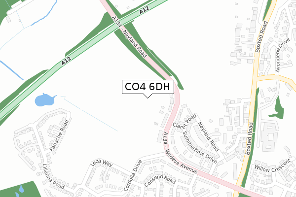
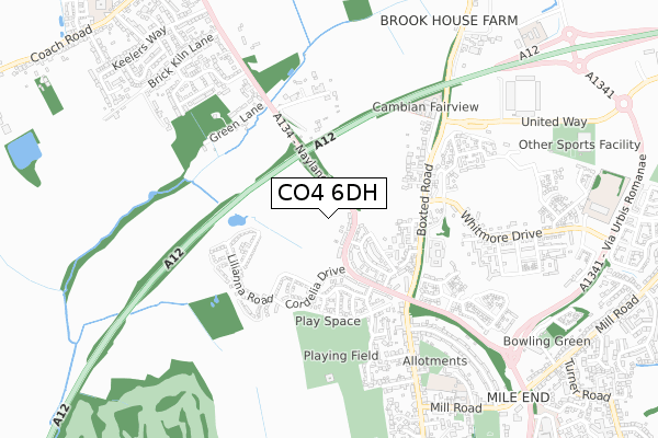
CO4 6DH is located in the Mile End electoral ward, within the local authority district of Colchester and the English Parliamentary constituency of Colchester. The Sub Integrated Care Board (ICB) Location is NHS Suffolk and North East Essex ICB - 06T and the police force is Essex. This postcode has been in use since February 2019.


GetTheData
Source: OS Open Zoomstack (Ordnance Survey)
Licence: Open Government Licence (requires attribution)
Attribution: Contains OS data © Crown copyright and database right 2024
Source: Open Postcode Geo
Licence: Open Government Licence (requires attribution)
Attribution: Contains OS data © Crown copyright and database right 2024; Contains Royal Mail data © Royal Mail copyright and database right 2024; Source: Office for National Statistics licensed under the Open Government Licence v.3.0
| Easting | 599327 |
| Northing | 228722 |
| Latitude | 51.921340 |
| Longitude | 0.897257 |
GetTheData
Source: Open Postcode Geo
Licence: Open Government Licence
| Country | England |
| Postcode District | CO4 |
| ➜ CO4 open data dashboard ➜ See where CO4 is on a map ➜ Where is Colchester? | |
GetTheData
Source: Land Registry Price Paid Data
Licence: Open Government Licence
| Ward | Mile End |
| Constituency | Colchester |
GetTheData
Source: ONS Postcode Database
Licence: Open Government Licence
4, WOODLAND WALK, COLCHESTER, CO4 6DH 2021 22 DEC £373,000 |
GetTheData
Source: HM Land Registry Price Paid Data
Licence: Contains HM Land Registry data © Crown copyright and database right 2024. This data is licensed under the Open Government Licence v3.0.
| June 2022 | Violence and sexual offences | On or near Boxted Road | 302m |
| June 2022 | Violence and sexual offences | On or near Boxted Road | 302m |
| June 2022 | Violence and sexual offences | On or near Boxted Road | 302m |
| ➜ Get more crime data in our Crime section | |||
GetTheData
Source: data.police.uk
Licence: Open Government Licence
| Colchester United Fc (United Way) | Mile End | 168m |
| Colchester United Fc (United Way) | Mile End | 176m |
| Colchester United Fc (United Way) | Mile End | 184m |
| Colchester United Fc (United Way) | Mile End | 190m |
| Colchester United Fc (United Way) | Mile End | 193m |
| Colchester Station | 2.3km |
| Colchester Town Station | 3.9km |
| Hythe (Essex) Station | 4.5km |
GetTheData
Source: NaPTAN
Licence: Open Government Licence
GetTheData
Source: ONS Postcode Database
Licence: Open Government Licence


➜ Get more ratings from the Food Standards Agency
GetTheData
Source: Food Standards Agency
Licence: FSA terms & conditions
| Last Collection | |||
|---|---|---|---|
| Location | Mon-Fri | Sat | Distance |
| Defoe Crescent | 17:30 | 11:30 | 786m |
| Nayland Road | 17:30 | 11:30 | 1,010m |
| Highwoods Square Post Office | 17:30 | 12:10 | 1,906m |
GetTheData
Source: Dracos
Licence: Creative Commons Attribution-ShareAlike
| Facility | Distance |
|---|---|
| Colchester United (Jobserve Community Stadium) United Way, Mile End, Colchester Grass Pitches, Artificial Grass Pitch | 228m |
| David Lloyd (Colchester) United Way, Colchester Swimming Pool, Outdoor Tennis Courts, Health and Fitness Gym | 293m |
| Camulos Academy Whitmore Drive, Whitmore Drive, Colchester Grass Pitches | 376m |
GetTheData
Source: Active Places
Licence: Open Government Licence
| School | Phase of Education | Distance |
|---|---|---|
| The St Aubyn Centre Education Department St Aubyn Centre, 2 Boxted Road, Colchester, CO4 5HG | Not applicable | 58m |
| Camulos Academy Whitmore Drive, Via Urbis Romanea, Colchester, CO4 6AL | Primary | 376m |
| North East Essex Co-operative Academy Walnut Tree Way, Colchester, CO2 9BS | Not applicable | 891m |
GetTheData
Source: Edubase
Licence: Open Government Licence
The below table lists the International Territorial Level (ITL) codes (formerly Nomenclature of Territorial Units for Statistics (NUTS) codes) and Local Administrative Units (LAU) codes for CO4 6DH:
| ITL 1 Code | Name |
|---|---|
| TLH | East |
| ITL 2 Code | Name |
| TLH3 | Essex |
| ITL 3 Code | Name |
| TLH34 | Essex Haven Gateway |
| LAU 1 Code | Name |
| E07000071 | Colchester |
GetTheData
Source: ONS Postcode Directory
Licence: Open Government Licence
The below table lists the Census Output Area (OA), Lower Layer Super Output Area (LSOA), and Middle Layer Super Output Area (MSOA) for CO4 6DH:
| Code | Name | |
|---|---|---|
| OA | E00110120 | |
| LSOA | E01021680 | Colchester 004B |
| MSOA | E02004509 | Colchester 004 |
GetTheData
Source: ONS Postcode Directory
Licence: Open Government Licence
| CO4 5HF | Boxted Road | 358m |
| CO4 5HE | Boxted Road | 400m |
| CO4 5FX | Chesterwell Mews | 417m |
| CO4 5FB | Pleasant Plains Mews | 433m |
| CO4 5YW | Venture Chase | 485m |
| CO4 5ES | Walnut Drive | 501m |
| CO4 5JH | Chestnut Close | 525m |
| CO4 5XZ | Courage Drive | 571m |
| CO4 5HB | Whitebeam Close | 572m |
| CO4 5WU | Flame Way | 583m |
GetTheData
Source: Open Postcode Geo; Land Registry Price Paid Data
Licence: Open Government Licence