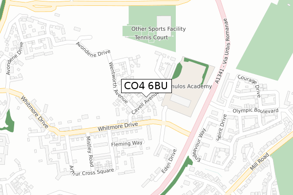
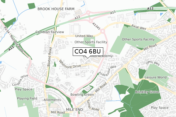
CO4 6BU is located in the Mile End electoral ward, within the local authority district of Colchester and the English Parliamentary constituency of Colchester. The Sub Integrated Care Board (ICB) Location is NHS Suffolk and North East Essex ICB - 06T and the police force is Essex. This postcode has been in use since May 2019.


GetTheData
Source: OS Open Zoomstack (Ordnance Survey)
Licence: Open Government Licence (requires attribution)
Attribution: Contains OS data © Crown copyright and database right 2024
Source: Open Postcode Geo
Licence: Open Government Licence (requires attribution)
Attribution: Contains OS data © Crown copyright and database right 2024; Contains Royal Mail data © Royal Mail copyright and database right 2024; Source: Office for National Statistics licensed under the Open Government Licence v.3.0
| Easting | 599589 |
| Northing | 228596 |
| Latitude | 51.920114 |
| Longitude | 0.900989 |
GetTheData
Source: Open Postcode Geo
Licence: Open Government Licence
| Country | England |
| Postcode District | CO4 |
| ➜ CO4 open data dashboard ➜ See where CO4 is on a map ➜ Where is Colchester? | |
GetTheData
Source: Land Registry Price Paid Data
Licence: Open Government Licence
| Ward | Mile End |
| Constituency | Colchester |
GetTheData
Source: ONS Postcode Database
Licence: Open Government Licence
1, CAVELL AVENUE, COLCHESTER, CO4 6BU 2023 9 JUN £480,000 |
2023 28 APR £591,000 |
2023 6 APR £510,000 |
34, CAVELL AVENUE, COLCHESTER, CO4 6BU 2020 28 FEB £334,995 |
30, CAVELL AVENUE, COLCHESTER, CO4 6BU 2020 20 FEB £414,995 |
28, CAVELL AVENUE, COLCHESTER, CO4 6BU 2020 31 JAN £399,995 |
15, CAVELL AVENUE, COLCHESTER, CO4 6BU 2019 12 JUL £469,995 |
13, CAVELL AVENUE, COLCHESTER, CO4 6BU 2019 28 JUN £449,995 |
11, CAVELL AVENUE, COLCHESTER, CO4 6BU 2019 27 JUN £460,000 |
2019 31 MAY £529,995 |
GetTheData
Source: HM Land Registry Price Paid Data
Licence: Contains HM Land Registry data © Crown copyright and database right 2024. This data is licensed under the Open Government Licence v3.0.
| December 2023 | Anti-social behaviour | On or near Thomas Wakley Close | 399m |
| December 2023 | Vehicle crime | On or near Thomas Wakley Close | 399m |
| March 2023 | Violence and sexual offences | On or near Thomas Wakley Close | 399m |
| ➜ Get more crime data in our Crime section | |||
GetTheData
Source: data.police.uk
Licence: Open Government Licence
| Bedford Road (Mill Road) | Mile End | 439m |
| Colchester United Fc (United Way) | Mile End | 457m |
| Bedford Road (Mill Road) | Mile End | 462m |
| Colchester United Fc (United Way) | Mile End | 465m |
| Colchester United Fc (United Way) | Mile End | 474m |
| Colchester Station | 2.2km |
| Colchester Town Station | 3.8km |
| Hythe (Essex) Station | 4.2km |
GetTheData
Source: NaPTAN
Licence: Open Government Licence
| Percentage of properties with Next Generation Access | 100.0% |
| Percentage of properties with Superfast Broadband | 100.0% |
| Percentage of properties with Ultrafast Broadband | 100.0% |
| Percentage of properties with Full Fibre Broadband | 100.0% |
Superfast Broadband is between 30Mbps and 300Mbps
Ultrafast Broadband is > 300Mbps
| Percentage of properties unable to receive 2Mbps | 0.0% |
| Percentage of properties unable to receive 5Mbps | 0.0% |
| Percentage of properties unable to receive 10Mbps | 0.0% |
| Percentage of properties unable to receive 30Mbps | 0.0% |
GetTheData
Source: Ofcom
Licence: Ofcom Terms of Use (requires attribution)
GetTheData
Source: ONS Postcode Database
Licence: Open Government Licence


➜ Get more ratings from the Food Standards Agency
GetTheData
Source: Food Standards Agency
Licence: FSA terms & conditions
| Last Collection | |||
|---|---|---|---|
| Location | Mon-Fri | Sat | Distance |
| Defoe Crescent | 17:30 | 11:30 | 856m |
| Nayland Road | 17:30 | 11:30 | 1,035m |
| Highwoods Square Post Office | 17:30 | 12:10 | 1,621m |
GetTheData
Source: Dracos
Licence: Creative Commons Attribution-ShareAlike
| Facility | Distance |
|---|---|
| Camulos Academy Whitmore Drive, Whitmore Drive, Colchester Grass Pitches | 97m |
| David Lloyd (Colchester) United Way, Colchester Swimming Pool, Outdoor Tennis Courts, Health and Fitness Gym | 202m |
| Colchester United (Jobserve Community Stadium) United Way, Mile End, Colchester Grass Pitches, Artificial Grass Pitch | 418m |
GetTheData
Source: Active Places
Licence: Open Government Licence
| School | Phase of Education | Distance |
|---|---|---|
| Camulos Academy Whitmore Drive, Via Urbis Romanea, Colchester, CO4 6AL | Primary | 97m |
| The St Aubyn Centre Education Department St Aubyn Centre, 2 Boxted Road, Colchester, CO4 5HG | Not applicable | 348m |
| North East Essex Co-operative Academy Walnut Tree Way, Colchester, CO2 9BS | Not applicable | 747m |
GetTheData
Source: Edubase
Licence: Open Government Licence
The below table lists the International Territorial Level (ITL) codes (formerly Nomenclature of Territorial Units for Statistics (NUTS) codes) and Local Administrative Units (LAU) codes for CO4 6BU:
| ITL 1 Code | Name |
|---|---|
| TLH | East |
| ITL 2 Code | Name |
| TLH3 | Essex |
| ITL 3 Code | Name |
| TLH34 | Essex Haven Gateway |
| LAU 1 Code | Name |
| E07000071 | Colchester |
GetTheData
Source: ONS Postcode Directory
Licence: Open Government Licence
The below table lists the Census Output Area (OA), Lower Layer Super Output Area (LSOA), and Middle Layer Super Output Area (MSOA) for CO4 6BU:
| Code | Name | |
|---|---|---|
| OA | E00110125 | |
| LSOA | E01021682 | Colchester 004D |
| MSOA | E02004509 | Colchester 004 |
GetTheData
Source: ONS Postcode Directory
Licence: Open Government Licence
| CO4 5YW | Venture Chase | 197m |
| CO4 5XZ | Courage Drive | 291m |
| CO4 5WU | Flame Way | 299m |
| CO4 5WT | Altius Chase | 301m |
| CO4 5XN | Endeavour Way | 305m |
| CO4 5XA | Flame Way | 315m |
| CO4 5ZP | Olympic Boulevard | 328m |
| CO4 5PL | Endeavour Way | 338m |
| CO4 5YU | Fortius Mews | 345m |
| CO4 5LN | Romulus Close | 361m |
GetTheData
Source: Open Postcode Geo; Land Registry Price Paid Data
Licence: Open Government Licence