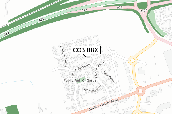
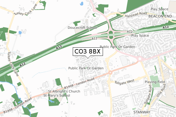
CO3 8BX is located in the Marks Tey and Layer electoral ward, within the local authority district of Colchester and the English Parliamentary constituency of Witham. The Sub Integrated Care Board (ICB) Location is NHS Suffolk and North East Essex ICB - 06T and the police force is Essex. This postcode has been in use since December 2017.


GetTheData
Source: OS Open Zoomstack (Ordnance Survey)
Licence: Open Government Licence (requires attribution)
Attribution: Contains OS data © Crown copyright and database right 2025
Source: Open Postcode Geo
Licence: Open Government Licence (requires attribution)
Attribution: Contains OS data © Crown copyright and database right 2025; Contains Royal Mail data © Royal Mail copyright and database right 2025; Source: Office for National Statistics licensed under the Open Government Licence v.3.0
| Easting | 594366 |
| Northing | 224764 |
| Latitude | 51.887550 |
| Longitude | 0.822976 |
GetTheData
Source: Open Postcode Geo
Licence: Open Government Licence
| Country | England |
| Postcode District | CO3 |
➜ See where CO3 is on a map ➜ Where is Colchester? | |
GetTheData
Source: Land Registry Price Paid Data
Licence: Open Government Licence
| Ward | Marks Tey And Layer |
| Constituency | Witham |
GetTheData
Source: ONS Postcode Database
Licence: Open Government Licence
2022 11 MAR £385,000 |
2019 5 JUL £308,500 |
13, FLAMINGO CRESCENT, STANWAY, COLCHESTER, CO3 8BX 2019 28 JUN £325,000 |
4, FLAMINGO CRESCENT, STANWAY, COLCHESTER, CO3 8BX 2018 29 MAR £350,000 |
2017 21 DEC £312,000 |
2017 30 NOV £305,000 |
GetTheData
Source: HM Land Registry Price Paid Data
Licence: Contains HM Land Registry data © Crown copyright and database right 2025. This data is licensed under the Open Government Licence v3.0.
| Wyvern Farm (Stane Street) | Stanway | 328m |
| Church Lane (London Road) | Stanway | 332m |
| Wyvern Farm (Stane Street) | Stanway | 337m |
| Church Lane (London Road) | Stanway | 338m |
| Sainsburys Store (Stane Street) | Stanway | 505m |
| Marks Tey Station | 2.8km |
| Colchester Station | 5km |
| Chappel & Wakes Colne Station | 6.2km |
GetTheData
Source: NaPTAN
Licence: Open Government Licence
| Percentage of properties with Next Generation Access | 100.0% |
| Percentage of properties with Superfast Broadband | 100.0% |
| Percentage of properties with Ultrafast Broadband | 100.0% |
| Percentage of properties with Full Fibre Broadband | 100.0% |
Superfast Broadband is between 30Mbps and 300Mbps
Ultrafast Broadband is > 300Mbps
| Median download speed | 360.0Mbps |
| Average download speed | 360.0Mbps |
| Maximum download speed | 360.00Mbps |
| Median upload speed | 360.0Mbps |
| Average upload speed | 360.0Mbps |
| Maximum upload speed | 360.00Mbps |
| Percentage of properties unable to receive 2Mbps | 0.0% |
| Percentage of properties unable to receive 5Mbps | 0.0% |
| Percentage of properties unable to receive 10Mbps | 0.0% |
| Percentage of properties unable to receive 30Mbps | 0.0% |
GetTheData
Source: Ofcom
Licence: Ofcom Terms of Use (requires attribution)
GetTheData
Source: ONS Postcode Database
Licence: Open Government Licence


➜ Get more ratings from the Food Standards Agency
GetTheData
Source: Food Standards Agency
Licence: FSA terms & conditions
| Last Collection | |||
|---|---|---|---|
| Location | Mon-Fri | Sat | Distance |
| Stanway Church | 17:30 | 11:30 | 573m |
| Tollgate Drive Stanway | 17:30 | 11:30 | 714m |
| Dale Close Stanway | 17:30 | 11:30 | 749m |
GetTheData
Source: Dracos
Licence: Creative Commons Attribution-ShareAlike
The below table lists the International Territorial Level (ITL) codes (formerly Nomenclature of Territorial Units for Statistics (NUTS) codes) and Local Administrative Units (LAU) codes for CO3 8BX:
| ITL 1 Code | Name |
|---|---|
| TLH | East |
| ITL 2 Code | Name |
| TLH3 | Essex |
| ITL 3 Code | Name |
| TLH34 | Essex Haven Gateway |
| LAU 1 Code | Name |
| E07000071 | Colchester |
GetTheData
Source: ONS Postcode Directory
Licence: Open Government Licence
The below table lists the Census Output Area (OA), Lower Layer Super Output Area (LSOA), and Middle Layer Super Output Area (MSOA) for CO3 8BX:
| Code | Name | |
|---|---|---|
| OA | E00109996 | |
| LSOA | E01021654 | Colchester 010A |
| MSOA | E02004515 | Colchester 010 |
GetTheData
Source: ONS Postcode Directory
Licence: Open Government Licence
| CO3 8PB | London Road | 275m |
| CO3 8NZ | London Road | 475m |
| CO3 0PR | Tollgate Drive | 542m |
| CO3 0PL | Meadow Grass Close | 545m |
| CO3 0PW | Woodrush End | 566m |
| CO3 0FT | Dale Close | 595m |
| CO3 0PE | Tollgate Drive | 605m |
| CO3 0FL | Darina Court | 610m |
| CO3 0PN | Darnel Way | 622m |
| CO6 3QL | Abbotts Lane | 628m |
GetTheData
Source: Open Postcode Geo; Land Registry Price Paid Data
Licence: Open Government Licence