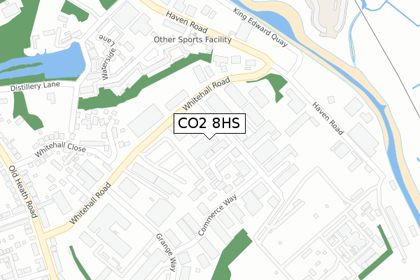
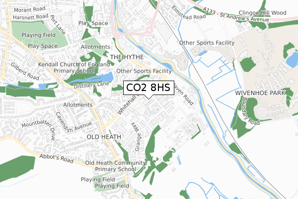
CO2 8HS is located in the Old Heath and The Hythe electoral ward, within the local authority district of Colchester and the English Parliamentary constituency of Colchester. The Sub Integrated Care Board (ICB) Location is NHS Suffolk and North East Essex ICB - 06T and the police force is Essex. This postcode has been in use since October 2017.


GetTheData
Source: OS Open Zoomstack (Ordnance Survey)
Licence: Open Government Licence (requires attribution)
Attribution: Contains OS data © Crown copyright and database right 2025
Source: Open Postcode Geo
Licence: Open Government Licence (requires attribution)
Attribution: Contains OS data © Crown copyright and database right 2025; Contains Royal Mail data © Royal Mail copyright and database right 2025; Source: Office for National Statistics licensed under the Open Government Licence v.3.0
| Easting | 601814 |
| Northing | 223701 |
| Latitude | 51.875360 |
| Longitude | 0.930434 |
GetTheData
Source: Open Postcode Geo
Licence: Open Government Licence
| Country | England |
| Postcode District | CO2 |
➜ See where CO2 is on a map ➜ Where is Colchester? | |
GetTheData
Source: Land Registry Price Paid Data
Licence: Open Government Licence
| Ward | Old Heath And The Hythe |
| Constituency | Colchester |
GetTheData
Source: ONS Postcode Database
Licence: Open Government Licence
| Commerce Way (Whitehall Road) | Old Heath | 126m |
| Commerce Way (Whitehall Road) | Old Heath | 133m |
| Grange Way (Whitehall Road) | Old Heath | 234m |
| Grange Way (Whitehall Road) | Old Heath | 309m |
| Albany Gardens (Haven Road) | Colchester | 325m |
| Hythe (Essex) Station | 1.2km |
| Colchester Town Station | 2.2km |
| Wivenhoe Station | 2.7km |
GetTheData
Source: NaPTAN
Licence: Open Government Licence
GetTheData
Source: ONS Postcode Database
Licence: Open Government Licence


➜ Get more ratings from the Food Standards Agency
GetTheData
Source: Food Standards Agency
Licence: FSA terms & conditions
| Last Collection | |||
|---|---|---|---|
| Location | Mon-Fri | Sat | Distance |
| Whitehall Road | 18:15 | 11:30 | 113m |
| Whitehall Road | 119m | ||
| Old Heath Post Office | 17:30 | 12:00 | 448m |
GetTheData
Source: Dracos
Licence: Creative Commons Attribution-ShareAlike
The below table lists the International Territorial Level (ITL) codes (formerly Nomenclature of Territorial Units for Statistics (NUTS) codes) and Local Administrative Units (LAU) codes for CO2 8HS:
| ITL 1 Code | Name |
|---|---|
| TLH | East |
| ITL 2 Code | Name |
| TLH3 | Essex |
| ITL 3 Code | Name |
| TLH34 | Essex Haven Gateway |
| LAU 1 Code | Name |
| E07000071 | Colchester |
GetTheData
Source: ONS Postcode Directory
Licence: Open Government Licence
The below table lists the Census Output Area (OA), Lower Layer Super Output Area (LSOA), and Middle Layer Super Output Area (MSOA) for CO2 8HS:
| Code | Name | |
|---|---|---|
| OA | E00176447 | |
| LSOA | E01021664 | Colchester 016C |
| MSOA | E02004521 | Colchester 016 |
GetTheData
Source: ONS Postcode Directory
Licence: Open Government Licence
| CO2 8HR | Commerce Way | 70m |
| CO2 8HH | Commerce Way | 126m |
| CO2 8JW | Grange Farm Road | 163m |
| CO2 8HA | Whitehall Road | 165m |
| CO2 8AP | Whitehall Road | 200m |
| CO2 8HQ | Albany Gardens | 244m |
| CO2 8FA | Hilltop Close | 257m |
| CO2 8HU | Albany Gardens | 276m |
| CO2 8HZ | Waterside Lane | 306m |
| CO2 8AJ | Whitehall Close | 307m |
GetTheData
Source: Open Postcode Geo; Land Registry Price Paid Data
Licence: Open Government Licence