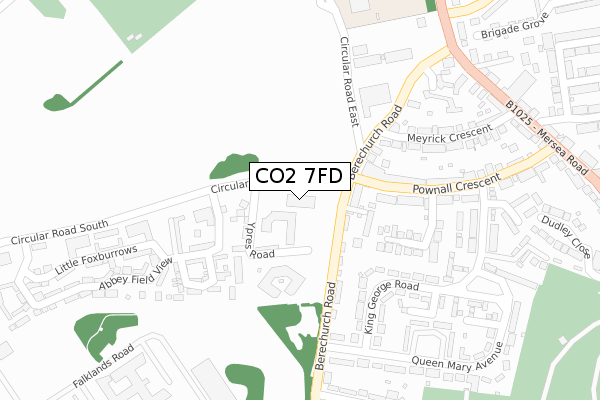
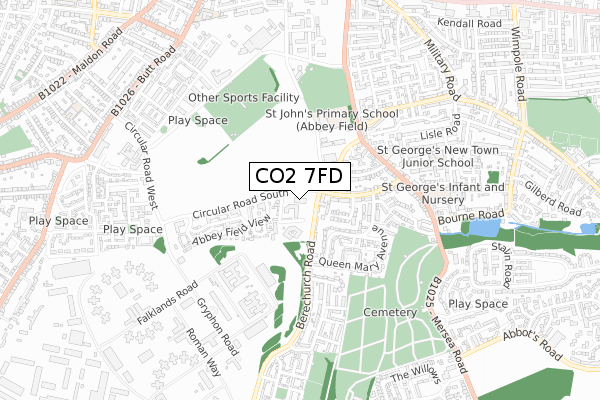
CO2 7FD is located in the Shrub End electoral ward, within the local authority district of Colchester and the English Parliamentary constituency of Colchester. The Sub Integrated Care Board (ICB) Location is NHS Suffolk and North East Essex ICB - 06T and the police force is Essex. This postcode has been in use since March 2018.


GetTheData
Source: OS Open Zoomstack (Ordnance Survey)
Licence: Open Government Licence (requires attribution)
Attribution: Contains OS data © Crown copyright and database right 2024
Source: Open Postcode Geo
Licence: Open Government Licence (requires attribution)
Attribution: Contains OS data © Crown copyright and database right 2024; Contains Royal Mail data © Royal Mail copyright and database right 2024; Source: Office for National Statistics licensed under the Open Government Licence v.3.0
| Easting | 599717 |
| Northing | 223932 |
| Latitude | 51.878189 |
| Longitude | 0.900146 |
GetTheData
Source: Open Postcode Geo
Licence: Open Government Licence
| Country | England |
| Postcode District | CO2 |
| ➜ CO2 open data dashboard ➜ See where CO2 is on a map ➜ Where is Colchester? | |
GetTheData
Source: Land Registry Price Paid Data
Licence: Open Government Licence
| Ward | Shrub End |
| Constituency | Colchester |
GetTheData
Source: ONS Postcode Database
Licence: Open Government Licence
| December 2023 | Violence and sexual offences | On or near Dudley Close | 491m |
| December 2023 | Violence and sexual offences | On or near Dudley Close | 491m |
| November 2023 | Violence and sexual offences | On or near Dudley Close | 491m |
| ➜ Get more crime data in our Crime section | |||
GetTheData
Source: data.police.uk
Licence: Open Government Licence
| Ypres Road (Circular Road South) | Colchester | 52m |
| Ypres Road (Circular Road South) | Colchester | 55m |
| The Britannia (Berechurch Road) | Colchester | 185m |
| The Britannia (Berechurch Road) | Colchester | 198m |
| Queen Mary Avenue (Berechurch Road) | Colchester | 251m |
| Colchester Town Station | 1km |
| Hythe (Essex) Station | 2.1km |
| Colchester Station | 2.6km |
GetTheData
Source: NaPTAN
Licence: Open Government Licence
GetTheData
Source: ONS Postcode Database
Licence: Open Government Licence


➜ Get more ratings from the Food Standards Agency
GetTheData
Source: Food Standards Agency
Licence: FSA terms & conditions
| Last Collection | |||
|---|---|---|---|
| Location | Mon-Fri | Sat | Distance |
| Pownall Crescent Post Office | 17:30 | 12:00 | 90m |
| Hyderabad Barracks | 17:30 | 11:30 | 366m |
| Broom Hill Mersea Road | 17:30 | 11:30 | 461m |
GetTheData
Source: Dracos
Licence: Creative Commons Attribution-ShareAlike
| Facility | Distance |
|---|---|
| Arena Sports & Leisure Club (Closed) Circular Road East, Colchester Health and Fitness Gym, Sports Hall, Studio | 470m |
| Colchester Garrison Circular Road North, Colchester Athletics, Artificial Grass Pitch, Grass Pitches | 513m |
| Garrison A Cricket Ground Circular Road East, Colchester Grass Pitches | 550m |
GetTheData
Source: Active Places
Licence: Open Government Licence
| School | Phase of Education | Distance |
|---|---|---|
| St. George's School Canterbury Road, Colchester, CO2 7RU | Primary | 610m |
| St John's Green Primary School St John's Green, Colchester, CO2 7HE | Primary | 916m |
| Hamilton Primary School Constantine Road, Colchester, CO3 3GB | Primary | 1km |
GetTheData
Source: Edubase
Licence: Open Government Licence
The below table lists the International Territorial Level (ITL) codes (formerly Nomenclature of Territorial Units for Statistics (NUTS) codes) and Local Administrative Units (LAU) codes for CO2 7FD:
| ITL 1 Code | Name |
|---|---|
| TLH | East |
| ITL 2 Code | Name |
| TLH3 | Essex |
| ITL 3 Code | Name |
| TLH34 | Essex Haven Gateway |
| LAU 1 Code | Name |
| E07000071 | Colchester |
GetTheData
Source: ONS Postcode Directory
Licence: Open Government Licence
The below table lists the Census Output Area (OA), Lower Layer Super Output Area (LSOA), and Middle Layer Super Output Area (MSOA) for CO2 7FD:
| Code | Name | |
|---|---|---|
| OA | E00109930 | |
| LSOA | E01021642 | Colchester 018F |
| MSOA | E02004523 | Colchester 018 |
GetTheData
Source: ONS Postcode Directory
Licence: Open Government Licence
| CO2 7QB | Berechurch Road | 87m |
| CO2 7TJ | Britannia Mews | 120m |
| CO2 7UW | Ypres Road | 131m |
| CO2 7UP | Circular Road South | 160m |
| CO2 7RF | Pownall Crescent | 166m |
| CO2 7RS | Midland Close | 202m |
| CO2 7WA | Dapifer Close | 208m |
| CO2 7UN | Baynard Green | 214m |
| CO2 7PG | King George Road | 218m |
| CO2 7QY | Meyrick Crescent | 237m |
GetTheData
Source: Open Postcode Geo; Land Registry Price Paid Data
Licence: Open Government Licence