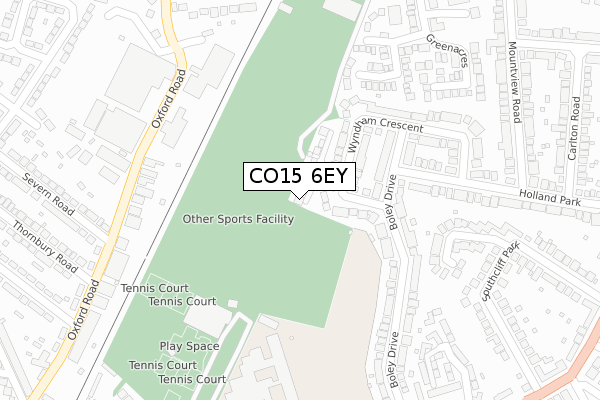
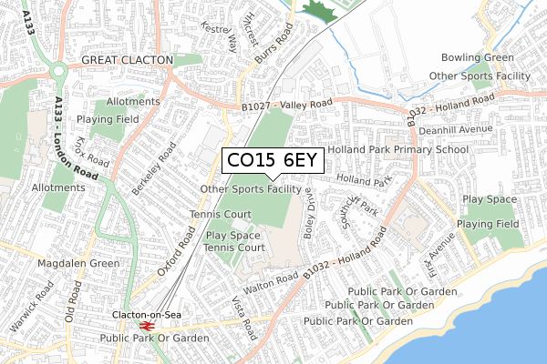
CO15 6EY is located in the St Paul's electoral ward, within the local authority district of Tendring and the English Parliamentary constituency of Clacton. The Sub Integrated Care Board (ICB) Location is NHS Suffolk and North East Essex ICB - 06T and the police force is Essex. This postcode has been in use since November 2019.


GetTheData
Source: OS Open Zoomstack (Ordnance Survey)
Licence: Open Government Licence (requires attribution)
Attribution: Contains OS data © Crown copyright and database right 2024
Source: Open Postcode Geo
Licence: Open Government Licence (requires attribution)
Attribution: Contains OS data © Crown copyright and database right 2024; Contains Royal Mail data © Royal Mail copyright and database right 2024; Source: Office for National Statistics licensed under the Open Government Licence v.3.0
| Easting | 618149 |
| Northing | 215995 |
| Latitude | 51.800038 |
| Longitude | 1.162509 |
GetTheData
Source: Open Postcode Geo
Licence: Open Government Licence
| Country | England |
| Postcode District | CO15 |
| ➜ CO15 open data dashboard ➜ See where CO15 is on a map ➜ Where is Clacton-on-Sea? | |
GetTheData
Source: Land Registry Price Paid Data
Licence: Open Government Licence
| Ward | St Paul's |
| Constituency | Clacton |
GetTheData
Source: ONS Postcode Database
Licence: Open Government Licence
| January 2024 | Violence and sexual offences | On or near Ramsden Close | 347m |
| December 2023 | Public order | On or near Ramsden Close | 347m |
| October 2023 | Anti-social behaviour | On or near Ramsden Close | 347m |
| ➜ Get more crime data in our Crime section | |||
GetTheData
Source: data.police.uk
Licence: Open Government Licence
| Valleybridge (Valley Road) | Clacton | 308m |
| Asda (Oxford Road) | Clacton | 315m |
| Thornbury Road (Oxford Road) | Clacton | 326m |
| Asda (Oxford Road) | Clacton | 329m |
| Thornbury Road (Oxford Road) | Clacton | 333m |
| Clacton-on-Sea Station | 0.9km |
| Kirby Cross Station | 5.9km |
GetTheData
Source: NaPTAN
Licence: Open Government Licence
| Percentage of properties with Next Generation Access | 100.0% |
| Percentage of properties with Superfast Broadband | 100.0% |
| Percentage of properties with Ultrafast Broadband | 0.0% |
| Percentage of properties with Full Fibre Broadband | 0.0% |
Superfast Broadband is between 30Mbps and 300Mbps
Ultrafast Broadband is > 300Mbps
| Percentage of properties unable to receive 2Mbps | 0.0% |
| Percentage of properties unable to receive 5Mbps | 0.0% |
| Percentage of properties unable to receive 10Mbps | 0.0% |
| Percentage of properties unable to receive 30Mbps | 0.0% |
GetTheData
Source: Ofcom
Licence: Ofcom Terms of Use (requires attribution)
GetTheData
Source: ONS Postcode Database
Licence: Open Government Licence


➜ Get more ratings from the Food Standards Agency
GetTheData
Source: Food Standards Agency
Licence: FSA terms & conditions
| Last Collection | |||
|---|---|---|---|
| Location | Mon-Fri | Sat | Distance |
| Boley Drive | 16:45 | 11:00 | 130m |
| Clacton Delivery Office | 18:15 | 12:30 | 283m |
| Ramsden Close | 16:45 | 11:00 | 335m |
GetTheData
Source: Dracos
Licence: Creative Commons Attribution-ShareAlike
| Facility | Distance |
|---|---|
| Vista Road Recreation Ground Vista Road, Clacton-on-sea Grass Pitches | 87m |
| Clacton & District Indoor Bowls Club Ltd Valley Road, Clacton-on-sea Indoor Bowls | 280m |
| Clacton Leisure Centre Vista Road, Clacton-on-sea Sports Hall, Swimming Pool, Health and Fitness Gym, Artificial Grass Pitch, Studio, Outdoor Tennis Courts | 300m |
GetTheData
Source: Active Places
Licence: Open Government Licence
| School | Phase of Education | Distance |
|---|---|---|
| Clacton County High School Walton Road, Clacton-on-Sea, CO15 6DZ | Secondary | 374m |
| Shorefields School Ogilvie House, 114 Holland Road, Clacton-on-Sea, CO15 6HF | Not applicable | 610m |
| Holland Park Primary School Holland Road, Clacton-on-Sea, CO15 6NG | Primary | 611m |
GetTheData
Source: Edubase
Licence: Open Government Licence
The below table lists the International Territorial Level (ITL) codes (formerly Nomenclature of Territorial Units for Statistics (NUTS) codes) and Local Administrative Units (LAU) codes for CO15 6EY:
| ITL 1 Code | Name |
|---|---|
| TLH | East |
| ITL 2 Code | Name |
| TLH3 | Essex |
| ITL 3 Code | Name |
| TLH34 | Essex Haven Gateway |
| LAU 1 Code | Name |
| E07000076 | Tendring |
GetTheData
Source: ONS Postcode Directory
Licence: Open Government Licence
The below table lists the Census Output Area (OA), Lower Layer Super Output Area (LSOA), and Middle Layer Super Output Area (MSOA) for CO15 6EY:
| Code | Name | |
|---|---|---|
| OA | E00112030 | |
| LSOA | E01022049 | Tendring 014D |
| MSOA | E02004586 | Tendring 014 |
GetTheData
Source: ONS Postcode Directory
Licence: Open Government Licence
| CO15 6LG | Wyndham Crescent | 79m |
| CO15 6LD | Boley Drive | 116m |
| CO15 6LQ | Wyndham Crescent | 120m |
| CO15 6LE | Boley Drive | 130m |
| CO15 6LJ | Holland Park | 195m |
| CO15 6RB | Archery Fields | 205m |
| CO15 6LH | Wyndham Crescent | 237m |
| CO15 6LB | Boley Drive | 243m |
| CO15 6RA | Clay Hall Road | 261m |
| CO15 3TH | Oxford Road | 263m |
GetTheData
Source: Open Postcode Geo; Land Registry Price Paid Data
Licence: Open Government Licence