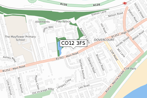
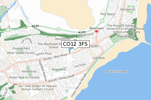
CO12 3FS is located in the Dovercourt Bay electoral ward, within the local authority district of Tendring and the English Parliamentary constituency of Harwich and North Essex. The Sub Integrated Care Board (ICB) Location is NHS Suffolk and North East Essex ICB - 06T and the police force is Essex. This postcode has been in use since August 2019.


GetTheData
Source: OS Open Zoomstack (Ordnance Survey)
Licence: Open Government Licence (requires attribution)
Attribution: Contains OS data © Crown copyright and database right 2024
Source: Open Postcode Geo
Licence: Open Government Licence (requires attribution)
Attribution: Contains OS data © Crown copyright and database right 2024; Contains Royal Mail data © Royal Mail copyright and database right 2024; Source: Office for National Statistics licensed under the Open Government Licence v.3.0
| Easting | 625235 |
| Northing | 231480 |
| Latitude | 51.936231 |
| Longitude | 1.275190 |
GetTheData
Source: Open Postcode Geo
Licence: Open Government Licence
| Country | England |
| Postcode District | CO12 |
| ➜ CO12 open data dashboard ➜ See where CO12 is on a map ➜ Where is Harwich? | |
GetTheData
Source: Land Registry Price Paid Data
Licence: Open Government Licence
| Ward | Dovercourt Bay |
| Constituency | Harwich And North Essex |
GetTheData
Source: ONS Postcode Database
Licence: Open Government Licence
| June 2022 | Violence and sexual offences | On or near Supermarket | 148m |
| June 2022 | Anti-social behaviour | On or near Mill Close | 160m |
| June 2022 | Violence and sexual offences | On or near Oakland Road | 161m |
| ➜ Get more crime data in our Crime section | |||
GetTheData
Source: data.police.uk
Licence: Open Government Licence
| Brooklyn Road (Main Road) | Dovercourt | 54m |
| Brooklyn Road (Main Road) | Dovercourt | 66m |
| Dart Dovercourt (Manor Road) | Dovercourt | 180m |
| Mayflower School (Main Road) | Dovercourt | 204m |
| Mayflower School (Main Road) | Dovercourt | 235m |
| Dovercourt Station | 0.5km |
| Harwich Town Station | 1.2km |
| Harwich International Station | 1.8km |
GetTheData
Source: NaPTAN
Licence: Open Government Licence
GetTheData
Source: ONS Postcode Database
Licence: Open Government Licence


➜ Get more ratings from the Food Standards Agency
GetTheData
Source: Food Standards Agency
Licence: FSA terms & conditions
| Last Collection | |||
|---|---|---|---|
| Location | Mon-Fri | Sat | Distance |
| Brooklyn Road | 17:30 | 11:00 | 140m |
| Lee Road | 17:00 | 11:30 | 261m |
| Westcliff Marine Parade | 17:00 | 11:30 | 366m |
GetTheData
Source: Dracos
Licence: Creative Commons Attribution-ShareAlike
| Facility | Distance |
|---|---|
| The Royal Oak Ground Main Road, Harwich Grass Pitches | 200m |
| Fitness Found (Harwich) (Closed) St. Augustines Court, Hill Road, Harwich Health and Fitness Gym | 204m |
| Mayflower School Main Road, Harwich Grass Pitches | 315m |
GetTheData
Source: Active Places
Licence: Open Government Licence
| School | Phase of Education | Distance |
|---|---|---|
| The Mayflower Primary School Main Road, Dovercourt, Harwich, CO12 4AJ | Primary | 315m |
| St Joseph's Catholic Primary School The Drive, Dovercourt, CO12 3SU | Primary | 832m |
| Harwich Community Primary School and Nursery Barrack Lane, Harwich, CO12 3NP | Primary | 1km |
GetTheData
Source: Edubase
Licence: Open Government Licence
The below table lists the International Territorial Level (ITL) codes (formerly Nomenclature of Territorial Units for Statistics (NUTS) codes) and Local Administrative Units (LAU) codes for CO12 3FS:
| ITL 1 Code | Name |
|---|---|
| TLH | East |
| ITL 2 Code | Name |
| TLH3 | Essex |
| ITL 3 Code | Name |
| TLH34 | Essex Haven Gateway |
| LAU 1 Code | Name |
| E07000076 | Tendring |
GetTheData
Source: ONS Postcode Directory
Licence: Open Government Licence
The below table lists the Census Output Area (OA), Lower Layer Super Output Area (LSOA), and Middle Layer Super Output Area (MSOA) for CO12 3FS:
| Code | Name | |
|---|---|---|
| OA | E00111755 | |
| LSOA | E01022001 | Tendring 001D |
| MSOA | E02004573 | Tendring 001 |
GetTheData
Source: ONS Postcode Directory
Licence: Open Government Licence
| CO12 3PL | Main Road | 55m |
| CO12 3PF | High Street | 97m |
| CO12 3PJ | Main Road | 97m |
| CO12 3QH | Portland Crescent | 105m |
| CO12 3QW | Portland Avenue | 107m |
| CO12 3FF | Heron Way | 113m |
| CO12 3QJ | Pattricks Lane | 141m |
| CO12 3FD | Heron Way | 145m |
| CO12 3PQ | Mill Close | 159m |
| CO12 3PH | Main Road | 164m |
GetTheData
Source: Open Postcode Geo; Land Registry Price Paid Data
Licence: Open Government Licence