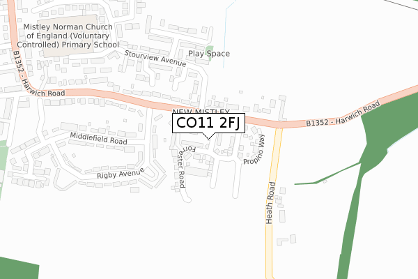
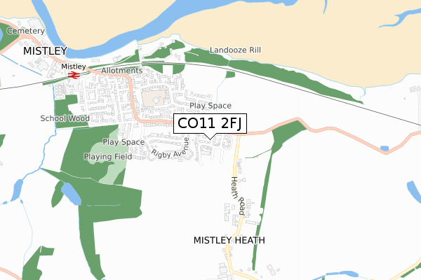
CO11 2FJ is located in the Lawford, Manningtree & Mistley electoral ward, within the local authority district of Tendring and the English Parliamentary constituency of Harwich and North Essex. The Sub Integrated Care Board (ICB) Location is NHS Suffolk and North East Essex ICB - 06T and the police force is Essex. This postcode has been in use since March 2019.


GetTheData
Source: OS Open Zoomstack (Ordnance Survey)
Licence: Open Government Licence (requires attribution)
Attribution: Contains OS data © Crown copyright and database right 2024
Source: Open Postcode Geo
Licence: Open Government Licence (requires attribution)
Attribution: Contains OS data © Crown copyright and database right 2024; Contains Royal Mail data © Royal Mail copyright and database right 2024; Source: Office for National Statistics licensed under the Open Government Licence v.3.0
| Easting | 612615 |
| Northing | 231255 |
| Latitude | 51.939170 |
| Longitude | 1.091761 |
GetTheData
Source: Open Postcode Geo
Licence: Open Government Licence
| Country | England |
| Postcode District | CO11 |
| ➜ CO11 open data dashboard ➜ See where CO11 is on a map ➜ Where is Mistley? | |
GetTheData
Source: Land Registry Price Paid Data
Licence: Open Government Licence
| Ward | Lawford, Manningtree & Mistley |
| Constituency | Harwich And North Essex |
GetTheData
Source: ONS Postcode Database
Licence: Open Government Licence
2023 22 FEB £450,000 |
140, FORRESTER ROAD, MISTLEY, MANNINGTREE, CO11 2FJ 2022 30 NOV £370,000 |
130, FORRESTER ROAD, MISTLEY, MANNINGTREE, CO11 2FJ 2022 25 NOV £570,000 |
128, FORRESTER ROAD, MISTLEY, MANNINGTREE, CO11 2FJ 2022 9 NOV £565,000 |
2022 2 NOV £375,000 |
124, FORRESTER ROAD, MISTLEY, MANNINGTREE, CO11 2FJ 2022 28 OCT £640,000 |
120, FORRESTER ROAD, MISTLEY, MANNINGTREE, CO11 2FJ 2022 26 AUG £460,000 |
114, FORRESTER ROAD, MISTLEY, MANNINGTREE, CO11 2FJ 2022 19 AUG £645,000 |
116, FORRESTER ROAD, MISTLEY, MANNINGTREE, CO11 2FJ 2022 19 AUG £460,000 |
112, FORRESTER ROAD, MISTLEY, MANNINGTREE, CO11 2FJ 2022 22 JUL £440,000 |
GetTheData
Source: HM Land Registry Price Paid Data
Licence: Contains HM Land Registry data © Crown copyright and database right 2024. This data is licensed under the Open Government Licence v3.0.
| November 2023 | Violence and sexual offences | On or near Swan Court | 424m |
| May 2023 | Criminal damage and arson | On or near Swan Court | 424m |
| June 2022 | Violence and sexual offences | On or near Harwich Road | 152m |
| ➜ Get more crime data in our Crime section | |||
GetTheData
Source: data.police.uk
Licence: Open Government Licence
| Rigby Avenue (Harwich Road) | Mistley | 170m |
| Rigby Avenue (Harwich Road) | Mistley | 179m |
| Harwich Road | Mistley | 191m |
| Harwich Road | Mistley | 199m |
| Heath Road (Harwich Road (B1352)) | Mistley | 249m |
| Mistley Station | 0.9km |
| Manningtree Station | 3.4km |
GetTheData
Source: NaPTAN
Licence: Open Government Licence
| Percentage of properties with Next Generation Access | 100.0% |
| Percentage of properties with Superfast Broadband | 100.0% |
| Percentage of properties with Ultrafast Broadband | 100.0% |
| Percentage of properties with Full Fibre Broadband | 100.0% |
Superfast Broadband is between 30Mbps and 300Mbps
Ultrafast Broadband is > 300Mbps
| Percentage of properties unable to receive 2Mbps | 0.0% |
| Percentage of properties unable to receive 5Mbps | 0.0% |
| Percentage of properties unable to receive 10Mbps | 0.0% |
| Percentage of properties unable to receive 30Mbps | 0.0% |
GetTheData
Source: Ofcom
Licence: Ofcom Terms of Use (requires attribution)
GetTheData
Source: ONS Postcode Database
Licence: Open Government Licence


➜ Get more ratings from the Food Standards Agency
GetTheData
Source: Food Standards Agency
Licence: FSA terms & conditions
| Last Collection | |||
|---|---|---|---|
| Location | Mon-Fri | Sat | Distance |
| Rigby Avenue Mistley | 17:00 | 09:00 | 183m |
| Harwich Road Mistley | 17:00 | 09:00 | 516m |
| Mistley Heath | 17:00 | 09:15 | 556m |
GetTheData
Source: Dracos
Licence: Creative Commons Attribution-ShareAlike
| Facility | Distance |
|---|---|
| Furze Hill Recreation Ground Shrubland Road, Mistley Grass Pitches | 460m |
| Mistley Cricket Club New Road, Mistley Grass Pitches | 1.4km |
| Bradfield Playing Field The Street, Bradfield, Manningtree Grass Pitches | 1.9km |
GetTheData
Source: Active Places
Licence: Open Government Licence
| School | Phase of Education | Distance |
|---|---|---|
| Mistley Norman Church of England Primary School Remercie Road, Mistley, Manningtree, CO11 1LS | Primary | 392m |
| Bradfield Primary School Heath Road, Bradfield, Manningtree, CO11 2UZ | Primary | 1.9km |
| Highfields Primary School Colchester Road, Lawford, Manningtree, CO11 2BN | Primary | 2.5km |
GetTheData
Source: Edubase
Licence: Open Government Licence
The below table lists the International Territorial Level (ITL) codes (formerly Nomenclature of Territorial Units for Statistics (NUTS) codes) and Local Administrative Units (LAU) codes for CO11 2FJ:
| ITL 1 Code | Name |
|---|---|
| TLH | East |
| ITL 2 Code | Name |
| TLH3 | Essex |
| ITL 3 Code | Name |
| TLH34 | Essex Haven Gateway |
| LAU 1 Code | Name |
| E07000076 | Tendring |
GetTheData
Source: ONS Postcode Directory
Licence: Open Government Licence
The below table lists the Census Output Area (OA), Lower Layer Super Output Area (LSOA), and Middle Layer Super Output Area (MSOA) for CO11 2FJ:
| Code | Name | |
|---|---|---|
| OA | E00111871 | |
| LSOA | E01022021 | Tendring 003G |
| MSOA | E02004575 | Tendring 003 |
GetTheData
Source: ONS Postcode Directory
Licence: Open Government Licence
| CO11 2DH | Rigby Avenue | 89m |
| CO11 2DG | Harwich Road | 172m |
| CO11 1NA | Harwich Road | 174m |
| CO11 2DL | Middlefield Road | 208m |
| CO11 2DJ | Rigby Avenue | 230m |
| CO11 2DN | Harwich Road | 236m |
| CO11 1LY | Westmorland Close | 253m |
| CO11 2DF | Harwich Road | 260m |
| CO11 1NQ | Stour View Avenue | 277m |
| CO11 1LT | Stour View Avenue | 278m |
GetTheData
Source: Open Postcode Geo; Land Registry Price Paid Data
Licence: Open Government Licence