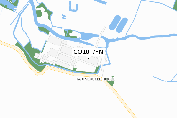
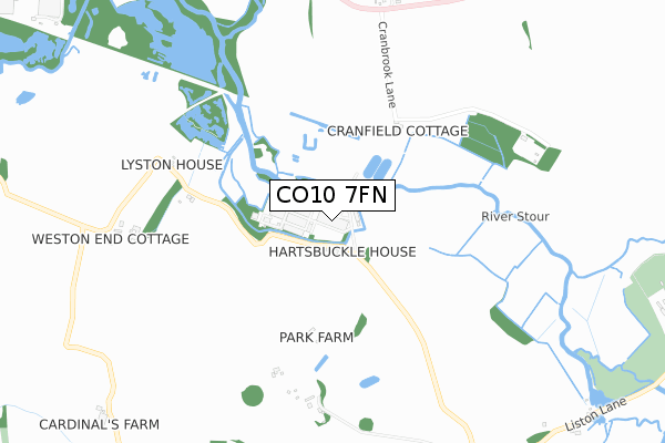
CO10 7FN is located in the Stour Valley North electoral ward, within the local authority district of Braintree and the English Parliamentary constituency of Braintree. The Sub Integrated Care Board (ICB) Location is NHS Mid and South Essex ICB - 06Q and the police force is Essex. This postcode has been in use since March 2018.


GetTheData
Source: OS Open Zoomstack (Ordnance Survey)
Licence: Open Government Licence (requires attribution)
Attribution: Contains OS data © Crown copyright and database right 2025
Source: Open Postcode Geo
Licence: Open Government Licence (requires attribution)
Attribution: Contains OS data © Crown copyright and database right 2025; Contains Royal Mail data © Royal Mail copyright and database right 2025; Source: Office for National Statistics licensed under the Open Government Licence v.3.0
| Easting | 584701 |
| Northing | 245658 |
| Latitude | 52.078481 |
| Longitude | 0.693947 |
GetTheData
Source: Open Postcode Geo
Licence: Open Government Licence
| Country | England |
| Postcode District | CO10 |
➜ See where CO10 is on a map | |
GetTheData
Source: Land Registry Price Paid Data
Licence: Open Government Licence
| Ward | Stour Valley North |
| Constituency | Braintree |
GetTheData
Source: ONS Postcode Database
Licence: Open Government Licence
| Martins Nest (A1092) | Glemsford | 1,002m |
| Martins Nest (A1092) | Glemsford | 1,011m |
| Hobbs Lane (Lower Road) | Glemsford | 1,246m |
| Hobbs Lane (Lower Road) | Glemsford | 1,256m |
| Windmill Hill | Long Melford | 1,312m |
| Sudbury (Suffolk) Station | 5.5km |
GetTheData
Source: NaPTAN
Licence: Open Government Licence
GetTheData
Source: ONS Postcode Database
Licence: Open Government Licence


➜ Get more ratings from the Food Standards Agency
GetTheData
Source: Food Standards Agency
Licence: FSA terms & conditions
| Last Collection | |||
|---|---|---|---|
| Location | Mon-Fri | Sat | Distance |
| Liston | 16:45 | 10:30 | 1,049m |
| Windmill Hill Long Melford | 16:30 | 10:30 | 1,361m |
| Long Melford Post Office | 17:00 | 11:00 | 1,557m |
GetTheData
Source: Dracos
Licence: Creative Commons Attribution-ShareAlike
| Risk of CO10 7FN flooding from rivers and sea | Medium |
| ➜ CO10 7FN flood map | |
GetTheData
Source: Open Flood Risk by Postcode
Licence: Open Government Licence
The below table lists the International Territorial Level (ITL) codes (formerly Nomenclature of Territorial Units for Statistics (NUTS) codes) and Local Administrative Units (LAU) codes for CO10 7FN:
| ITL 1 Code | Name |
|---|---|
| TLH | East |
| ITL 2 Code | Name |
| TLH3 | Essex |
| ITL 3 Code | Name |
| TLH34 | Essex Haven Gateway |
| LAU 1 Code | Name |
| E07000067 | Braintree |
GetTheData
Source: ONS Postcode Directory
Licence: Open Government Licence
The below table lists the Census Output Area (OA), Lower Layer Super Output Area (LSOA), and Middle Layer Super Output Area (MSOA) for CO10 7FN:
| Code | Name | |
|---|---|---|
| OA | E00108741 | |
| LSOA | E01021406 | Braintree 002B |
| MSOA | E02004447 | Braintree 002 |
GetTheData
Source: ONS Postcode Directory
Licence: Open Government Licence
| CO10 7HY | Liston Gardens | 549m |
| CO10 7HT | 712m | |
| CO10 7HZ | 838m | |
| CO10 9AE | Clare Road | 872m |
| CO10 7HS | 1105m | |
| CO10 9AD | Windmill Hill | 1312m |
| CO10 9JY | New Road | 1323m |
| CO10 9RF | Dyehouse Meadow | 1388m |
| CO10 9JX | St Catherines Road | 1400m |
| CO10 7JB | Glebeside | 1413m |
GetTheData
Source: Open Postcode Geo; Land Registry Price Paid Data
Licence: Open Government Licence