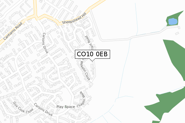
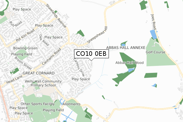
CO10 0EB is located in the Great Cornard electoral ward, within the local authority district of Babergh and the English Parliamentary constituency of South Suffolk. The Sub Integrated Care Board (ICB) Location is NHS Suffolk and North East Essex ICB - 07K and the police force is Suffolk. This postcode has been in use since June 2019.


GetTheData
Source: OS Open Zoomstack (Ordnance Survey)
Licence: Open Government Licence (requires attribution)
Attribution: Contains OS data © Crown copyright and database right 2024
Source: Open Postcode Geo
Licence: Open Government Licence (requires attribution)
Attribution: Contains OS data © Crown copyright and database right 2024; Contains Royal Mail data © Royal Mail copyright and database right 2024; Source: Office for National Statistics licensed under the Open Government Licence v.3.0
| Easting | 589640 |
| Northing | 240255 |
| Latitude | 52.028292 |
| Longitude | 0.762936 |
GetTheData
Source: Open Postcode Geo
Licence: Open Government Licence
| Country | England |
| Postcode District | CO10 |
| ➜ CO10 open data dashboard ➜ See where CO10 is on a map ➜ Where is Sudbury? | |
GetTheData
Source: Land Registry Price Paid Data
Licence: Open Government Licence
| Ward | Great Cornard |
| Constituency | South Suffolk |
GetTheData
Source: ONS Postcode Database
Licence: Open Government Licence
3, JAMIE ALLEN CLOSE, GREAT CORNARD, SUDBURY, CO10 0EB 2023 21 SEP £380,000 |
1, JAMIE ALLEN CLOSE, GREAT CORNARD, SUDBURY, CO10 0EB 2019 28 NOV £319,995 |
8, JAMIE ALLEN CLOSE, GREAT CORNARD, SUDBURY, CO10 0EB 2019 30 AUG £321,995 |
6, JAMIE ALLEN CLOSE, GREAT CORNARD, SUDBURY, CO10 0EB 2019 30 AUG £444,995 |
3, JAMIE ALLEN CLOSE, GREAT CORNARD, SUDBURY, CO10 0EB 2019 8 AUG £344,995 |
4, JAMIE ALLEN CLOSE, GREAT CORNARD, SUDBURY, CO10 0EB 2019 5 AUG £389,995 |
GetTheData
Source: HM Land Registry Price Paid Data
Licence: Contains HM Land Registry data © Crown copyright and database right 2024. This data is licensed under the Open Government Licence v3.0.
| July 2023 | Violence and sexual offences | On or near Guy Cook Close | 467m |
| April 2023 | Violence and sexual offences | On or near Chaplin Walk | 189m |
| October 2022 | Anti-social behaviour | On or near Guy Cook Close | 467m |
| ➜ Get more crime data in our Crime section | |||
GetTheData
Source: data.police.uk
Licence: Open Government Licence
| Turkentine Close (Carsons Drive) | Great Cornard | 191m |
| Walsingham Close (Carson Drive) | Great Cornard | 229m |
| Kempson Drive (Carsons Drive) | Great Cornard | 295m |
| Kempson Drive | Great Cornard | 353m |
| Eldred Drive (Carsons Drive) | Great Cornard | 368m |
| Sudbury (Suffolk) Station | 2.1km |
GetTheData
Source: NaPTAN
Licence: Open Government Licence
| Percentage of properties with Next Generation Access | 100.0% |
| Percentage of properties with Superfast Broadband | 100.0% |
| Percentage of properties with Ultrafast Broadband | 100.0% |
| Percentage of properties with Full Fibre Broadband | 100.0% |
Superfast Broadband is between 30Mbps and 300Mbps
Ultrafast Broadband is > 300Mbps
| Percentage of properties unable to receive 2Mbps | 0.0% |
| Percentage of properties unable to receive 5Mbps | 0.0% |
| Percentage of properties unable to receive 10Mbps | 0.0% |
| Percentage of properties unable to receive 30Mbps | 0.0% |
GetTheData
Source: Ofcom
Licence: Ofcom Terms of Use (requires attribution)
GetTheData
Source: ONS Postcode Database
Licence: Open Government Licence


➜ Get more ratings from the Food Standards Agency
GetTheData
Source: Food Standards Agency
Licence: FSA terms & conditions
| Last Collection | |||
|---|---|---|---|
| Location | Mon-Fri | Sat | Distance |
| Carsons Drive Great Cornard | 16:00 | 10:30 | 322m |
| Kempson Drive | 16:15 | 10:30 | 398m |
| Mede Way Great Cornard | 16:15 | 11:30 | 659m |
GetTheData
Source: Dracos
Licence: Creative Commons Attribution-ShareAlike
| Facility | Distance |
|---|---|
| Blackhouse Lane Recreation Ground Blackhouse Lane, Great Cornard Grass Pitches | 827m |
| Great Cornard Sports Centre Head Lane, Great Cornard, Sudbury Sports Hall, Swimming Pool, Health and Fitness Gym, Artificial Grass Pitch, Grass Pitches, Studio, Outdoor Tennis Courts | 868m |
| Old Joe's Golf & Leisure Joes Road, Cornard Tye, Great Cornard, Sudbury Golf | 883m |
GetTheData
Source: Active Places
Licence: Open Government Licence
| School | Phase of Education | Distance |
|---|---|---|
| Thomas Gainsborough School Wells Hall Road, Great Cornard, Sudbury, CO10 0NH | Secondary | 686m |
| Wells Hall Primary School Wells Hall Road, Great Cornard, Sudbury, CO10 0NH | Primary | 700m |
| Pot Kiln Primary School Butt Road, Great Cornard, Sudbury, CO10 0DS | Primary | 1.3km |
GetTheData
Source: Edubase
Licence: Open Government Licence
The below table lists the International Territorial Level (ITL) codes (formerly Nomenclature of Territorial Units for Statistics (NUTS) codes) and Local Administrative Units (LAU) codes for CO10 0EB:
| ITL 1 Code | Name |
|---|---|
| TLH | East |
| ITL 2 Code | Name |
| TLH1 | East Anglia |
| ITL 3 Code | Name |
| TLH14 | Suffolk CC |
| LAU 1 Code | Name |
| E07000200 | Babergh |
GetTheData
Source: ONS Postcode Directory
Licence: Open Government Licence
The below table lists the Census Output Area (OA), Lower Layer Super Output Area (LSOA), and Middle Layer Super Output Area (MSOA) for CO10 0EB:
| Code | Name | |
|---|---|---|
| OA | E00152308 | |
| LSOA | E01029890 | Babergh 008E |
| MSOA | E02006234 | Babergh 008 |
GetTheData
Source: ONS Postcode Directory
Licence: Open Government Licence
| CO10 0YR | Turkentine Close | 143m |
| CO10 0YP | Brands Close | 154m |
| CO10 0NA | Walsingham Close | 201m |
| CO10 0YT | Chaplin Walk | 210m |
| CO10 0NG | Carsons Drive | 213m |
| CO10 0YS | Parmenter Drive | 242m |
| CO10 0NB | De Greys Close | 250m |
| CO10 0NQ | Pecockes Close | 262m |
| CO10 0YH | Caustons Close | 279m |
| CO10 0YN | Abbas Walk | 288m |
GetTheData
Source: Open Postcode Geo; Land Registry Price Paid Data
Licence: Open Government Licence