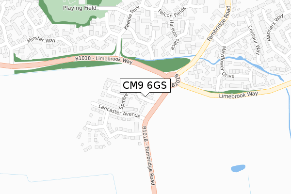
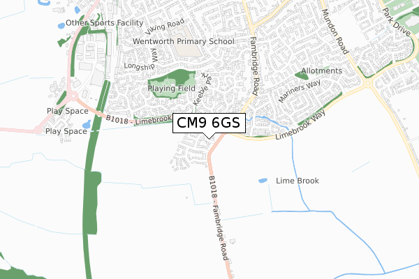
CM9 6GS is located in the Maldon West electoral ward, within the local authority district of Maldon and the English Parliamentary constituency of Maldon. The Sub Integrated Care Board (ICB) Location is NHS Mid and South Essex ICB - 06Q and the police force is Essex. This postcode has been in use since January 2020.


GetTheData
Source: OS Open Zoomstack (Ordnance Survey)
Licence: Open Government Licence (requires attribution)
Attribution: Contains OS data © Crown copyright and database right 2024
Source: Open Postcode Geo
Licence: Open Government Licence (requires attribution)
Attribution: Contains OS data © Crown copyright and database right 2024; Contains Royal Mail data © Royal Mail copyright and database right 2024; Source: Office for National Statistics licensed under the Open Government Licence v.3.0
| Easting | 584791 |
| Northing | 205388 |
| Latitude | 51.716779 |
| Longitude | 0.673690 |
GetTheData
Source: Open Postcode Geo
Licence: Open Government Licence
| Country | England |
| Postcode District | CM9 |
| ➜ CM9 open data dashboard ➜ See where CM9 is on a map ➜ Where is Maldon? | |
GetTheData
Source: Land Registry Price Paid Data
Licence: Open Government Licence
| Ward | Maldon West |
| Constituency | Maldon |
GetTheData
Source: ONS Postcode Database
Licence: Open Government Licence
2021 16 FEB £400,000 |
7, STIRLING CLOSE, MALDON, CM9 6GS 2020 9 NOV £489,536 |
1, STIRLING CLOSE, MALDON, CM9 6GS 2020 29 SEP £490,000 |
3, STIRLING CLOSE, MALDON, CM9 6GS 2020 29 SEP £380,500 |
14, STIRLING CLOSE, MALDON, CM9 6GS 2020 26 JUN £450,000 |
2019 20 DEC £389,995 |
9, STIRLING CLOSE, MALDON, CM9 6GS 2019 19 DEC £639,995 |
GetTheData
Source: HM Land Registry Price Paid Data
Licence: Contains HM Land Registry data © Crown copyright and database right 2024. This data is licensed under the Open Government Licence v3.0.
| September 2022 | Violence and sexual offences | On or near Courtland Mews | 424m |
| August 2022 | Violence and sexual offences | On or near Courtland Mews | 424m |
| June 2022 | Violence and sexual offences | On or near B1018 | 134m |
| ➜ Get more crime data in our Crime section | |||
GetTheData
Source: data.police.uk
Licence: Open Government Licence
| Randolph Close (Fambridge Road) | Maldon | 236m |
| Randolph Close (Fambridge Road) | Maldon | 260m |
| Dorset Road | Maldon | 457m |
| Dorset Road | Maldon | 464m |
| Lambourne Grove (Fambridge Road) | Maldon | 525m |
GetTheData
Source: NaPTAN
Licence: Open Government Licence
GetTheData
Source: ONS Postcode Database
Licence: Open Government Licence


➜ Get more ratings from the Food Standards Agency
GetTheData
Source: Food Standards Agency
Licence: FSA terms & conditions
| Last Collection | |||
|---|---|---|---|
| Location | Mon-Fri | Sat | Distance |
| Keeble Park | 17:30 | 11:00 | 201m |
| Roundbush | 16:30 | 08:00 | 694m |
| Washington Road P.o. | 18:00 | 11:30 | 828m |
GetTheData
Source: Dracos
Licence: Creative Commons Attribution-ShareAlike
| Facility | Distance |
|---|---|
| West Maldon Community Centre Sunbury Way, Maldon Sports Hall | 386m |
| Primrose Meadow Mundon Road, Maldon Grass Pitches | 1.1km |
| Krozier Field (Closed) A414, Maldon Grass Pitches | 1.2km |
GetTheData
Source: Active Places
Licence: Open Government Licence
| School | Phase of Education | Distance |
|---|---|---|
| Wentworth Primary School Viking Road, Maldon, CM9 6JN | Primary | 676m |
| Maldon Primary School Wantz Chase, Maldon, CM9 5DQ | Primary | 1.4km |
| Plume School Fambridge Road, Maldon, CM9 6AB | Secondary | 1.4km |
GetTheData
Source: Edubase
Licence: Open Government Licence
The below table lists the International Territorial Level (ITL) codes (formerly Nomenclature of Territorial Units for Statistics (NUTS) codes) and Local Administrative Units (LAU) codes for CM9 6GS:
| ITL 1 Code | Name |
|---|---|
| TLH | East |
| ITL 2 Code | Name |
| TLH3 | Essex |
| ITL 3 Code | Name |
| TLH36 | Heart of Essex |
| LAU 1 Code | Name |
| E07000074 | Maldon |
GetTheData
Source: ONS Postcode Directory
Licence: Open Government Licence
The below table lists the Census Output Area (OA), Lower Layer Super Output Area (LSOA), and Middle Layer Super Output Area (MSOA) for CM9 6GS:
| Code | Name | |
|---|---|---|
| OA | E00111230 | |
| LSOA | E01021896 | Maldon 005D |
| MSOA | E02004559 | Maldon 005 |
GetTheData
Source: ONS Postcode Directory
Licence: Open Government Licence
| CM9 6YJ | Belvedere Place | 198m |
| CM9 6XW | Halston Place | 225m |
| CM9 6XP | Randolph Close | 238m |
| CM9 6FJ | Belvedere Court | 242m |
| CM9 6XT | Memory Close | 250m |
| CM9 6YQ | Aveley Way | 265m |
| CM9 6XN | Conyer Close | 282m |
| CM9 6YA | Falcon Fields | 287m |
| CM9 6YH | Sunbury Way | 304m |
| CM9 6XX | Mayflower Drive | 336m |
GetTheData
Source: Open Postcode Geo; Land Registry Price Paid Data
Licence: Open Government Licence