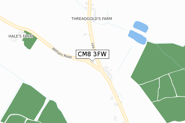
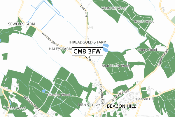
CM8 3FW is located in the Wickham Bishops and Woodham electoral ward, within the local authority district of Maldon and the English Parliamentary constituency of Witham. The Sub Integrated Care Board (ICB) Location is NHS Mid and South Essex ICB - 06Q and the police force is Essex. This postcode has been in use since August 2017.


GetTheData
Source: OS Open Zoomstack (Ordnance Survey)
Licence: Open Government Licence (requires attribution)
Attribution: Contains OS data © Crown copyright and database right 2024
Source: Open Postcode Geo
Licence: Open Government Licence (requires attribution)
Attribution: Contains OS data © Crown copyright and database right 2024; Contains Royal Mail data © Royal Mail copyright and database right 2024; Source: Office for National Statistics licensed under the Open Government Licence v.3.0
| Easting | 584783 |
| Northing | 213437 |
| Latitude | 51.789074 |
| Longitude | 0.677847 |
GetTheData
Source: Open Postcode Geo
Licence: Open Government Licence
| Country | England |
| Postcode District | CM8 |
| ➜ CM8 open data dashboard ➜ See where CM8 is on a map | |
GetTheData
Source: Land Registry Price Paid Data
Licence: Open Government Licence
| Ward | Wickham Bishops And Woodham |
| Constituency | Witham |
GetTheData
Source: ONS Postcode Database
Licence: Open Government Licence
| October 2021 | Violence and sexual offences | On or near Lea Lane | 82m |
| September 2021 | Anti-social behaviour | On or near Green Man Lane | 398m |
| June 2021 | Criminal damage and arson | On or near Lea Lane | 82m |
| ➜ Get more crime data in our Crime section | |||
GetTheData
Source: data.police.uk
Licence: Open Government Licence
| Finch's (Kelvedon Road) | Wickham Bishops | 855m |
| Finch's (Kelvedon Road) | Wickham Bishops | 859m |
| Snows Corner (Witham Road) | Wickham Bishops | 1,022m |
| Snows Corner (Tiptree Road) | Wickham Bishops | 1,050m |
| Snows Corner (The Street) | Wickham Bishops | 1,095m |
| Witham (Essex) Station | 3.3km |
GetTheData
Source: NaPTAN
Licence: Open Government Licence
| Percentage of properties with Next Generation Access | 100.0% |
| Percentage of properties with Superfast Broadband | 0.0% |
| Percentage of properties with Ultrafast Broadband | 0.0% |
| Percentage of properties with Full Fibre Broadband | 0.0% |
Superfast Broadband is between 30Mbps and 300Mbps
Ultrafast Broadband is > 300Mbps
| Percentage of properties unable to receive 2Mbps | 0.0% |
| Percentage of properties unable to receive 5Mbps | 0.0% |
| Percentage of properties unable to receive 10Mbps | 0.0% |
| Percentage of properties unable to receive 30Mbps | 100.0% |
GetTheData
Source: Ofcom
Licence: Ofcom Terms of Use (requires attribution)
GetTheData
Source: ONS Postcode Database
Licence: Open Government Licence


➜ Get more ratings from the Food Standards Agency
GetTheData
Source: Food Standards Agency
Licence: FSA terms & conditions
| Last Collection | |||
|---|---|---|---|
| Location | Mon-Fri | Sat | Distance |
| Great Braxted P.o. | 16:15 | 07:30 | 1,638m |
| Hall Estate | 17:00 | 08:30 | 2,378m |
| Pelly Avenue | 17:30 | 11:30 | 2,759m |
GetTheData
Source: Dracos
Licence: Creative Commons Attribution-ShareAlike
| Facility | Distance |
|---|---|
| Wickham Bishops Village Hall Church Road, Wickham Bishops, Witham Sports Hall | 1.1km |
| Wickham Bishops Playing Field Great Totham Road, Wickham Bishops Grass Pitches, Outdoor Tennis Courts | 1.2km |
| Great Braxted And Tiptree Cricket Club Tiptree Road, Great Braxted Grass Pitches | 1.4km |
GetTheData
Source: Active Places
Licence: Open Government Licence
| School | Phase of Education | Distance |
|---|---|---|
| Great Totham Primary School Walden House Road, Great Totham, Maldon, CM9 8PN | Primary | 1.5km |
| Howbridge Church of England Junior School Howbridge Road, Witham, CM8 1BZ | Primary | 2.9km |
| Howbridge Infant School Dengie Close, Witham, CM8 1DJ | Primary | 2.9km |
GetTheData
Source: Edubase
Licence: Open Government Licence
The below table lists the International Territorial Level (ITL) codes (formerly Nomenclature of Territorial Units for Statistics (NUTS) codes) and Local Administrative Units (LAU) codes for CM8 3FW:
| ITL 1 Code | Name |
|---|---|
| TLH | East |
| ITL 2 Code | Name |
| TLH3 | Essex |
| ITL 3 Code | Name |
| TLH36 | Heart of Essex |
| LAU 1 Code | Name |
| E07000074 | Maldon |
GetTheData
Source: ONS Postcode Directory
Licence: Open Government Licence
The below table lists the Census Output Area (OA), Lower Layer Super Output Area (LSOA), and Middle Layer Super Output Area (MSOA) for CM8 3FW:
| Code | Name | |
|---|---|---|
| OA | E00111299 | |
| LSOA | E01021912 | Maldon 002C |
| MSOA | E02004556 | Maldon 002 |
GetTheData
Source: ONS Postcode Directory
Licence: Open Government Licence
| CM8 3ES | Kelvedon Road | 137m |
| CM8 3XA | 153m | |
| CM8 3ER | Lea Lane | 318m |
| CM8 3LB | Green Man Lane | 399m |
| CM8 3LD | Kelvedon Road | 463m |
| CM8 3LL | 581m | |
| CM8 3LE | Kelvedon Road | 669m |
| CM8 3LF | Carters Lane | 676m |
| CM8 3JY | Braxted Road | 680m |
| CM8 3HW | Braxted Road | 752m |
GetTheData
Source: Open Postcode Geo; Land Registry Price Paid Data
Licence: Open Government Licence