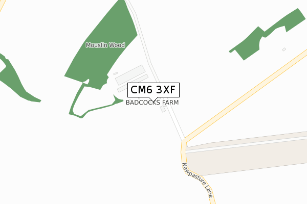
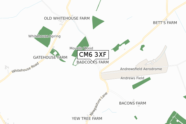
CM6 3XF is located in the Felsted & Stebbing electoral ward, within the local authority district of Uttlesford and the English Parliamentary constituency of Saffron Walden. The Sub Integrated Care Board (ICB) Location is NHS Hertfordshire and West Essex ICB - 07H and the police force is Essex. This postcode has been in use since November 2018.


GetTheData
Source: OS Open Zoomstack (Ordnance Survey)
Licence: Open Government Licence (requires attribution)
Attribution: Contains OS data © Crown copyright and database right 2024
Source: Open Postcode Geo
Licence: Open Government Licence (requires attribution)
Attribution: Contains OS data © Crown copyright and database right 2024; Contains Royal Mail data © Royal Mail copyright and database right 2024; Source: Office for National Statistics licensed under the Open Government Licence v.3.0
| Easting | 568077 |
| Northing | 224811 |
| Latitude | 51.896509 |
| Longitude | 0.441394 |
GetTheData
Source: Open Postcode Geo
Licence: Open Government Licence
| Country | England |
| Postcode District | CM6 |
| ➜ CM6 open data dashboard ➜ See where CM6 is on a map | |
GetTheData
Source: Land Registry Price Paid Data
Licence: Open Government Licence
| Ward | Felsted & Stebbing |
| Constituency | Saffron Walden |
GetTheData
Source: ONS Postcode Database
Licence: Open Government Licence
| Newpasture Lane (Stebbing Road) | Stebbing | 1,130m |
| Newpasture Lane (Stebbing Green) | Stebbing | 1,148m |
| Warehouse Villas (Stebbing Road) | Stebbing | 1,388m |
| Warehouse Villas (Stebbing Road) | Stebbing | 1,420m |
| Woolpits Road (Crows Green Road) | Great Saling | 1,495m |
GetTheData
Source: NaPTAN
Licence: Open Government Licence
GetTheData
Source: ONS Postcode Database
Licence: Open Government Licence


➜ Get more ratings from the Food Standards Agency
GetTheData
Source: Food Standards Agency
Licence: FSA terms & conditions
| Last Collection | |||
|---|---|---|---|
| Location | Mon-Fri | Sat | Distance |
| Felsted P.o. | 17:30 | 09:00 | 4,476m |
| Easton Lodge | 16:00 | 09:45 | 6,124m |
GetTheData
Source: Dracos
Licence: Creative Commons Attribution-ShareAlike
| Facility | Distance |
|---|---|
| Alcott Playing Field Stebbing Road, Stebbing Grass Pitches | 1.4km |
| Stebbing Primary School High Street, High Street, Stebbing, Dunmow Grass Pitches | 2km |
| Stebbing Cricket Club Mill Lane, Stebbing Grass Pitches | 2.1km |
GetTheData
Source: Active Places
Licence: Open Government Licence
| School | Phase of Education | Distance |
|---|---|---|
| Stebbing Primary School High Street, Stebbing, Dunmow, CM6 3SH | Primary | 2.1km |
| Felsted Primary School Watch House Green, Felsted, Dunmow, CM6 3EB | Primary | 3.8km |
| Felsted School Stebbing Road, Felsted, CM6 3LL | Not applicable | 4.1km |
GetTheData
Source: Edubase
Licence: Open Government Licence
The below table lists the International Territorial Level (ITL) codes (formerly Nomenclature of Territorial Units for Statistics (NUTS) codes) and Local Administrative Units (LAU) codes for CM6 3XF:
| ITL 1 Code | Name |
|---|---|
| TLH | East |
| ITL 2 Code | Name |
| TLH3 | Essex |
| ITL 3 Code | Name |
| TLH35 | West Essex |
| LAU 1 Code | Name |
| E07000077 | Uttlesford |
GetTheData
Source: ONS Postcode Directory
Licence: Open Government Licence
The below table lists the Census Output Area (OA), Lower Layer Super Output Area (LSOA), and Middle Layer Super Output Area (MSOA) for CM6 3XF:
| Code | Name | |
|---|---|---|
| OA | E00112231 | |
| LSOA | E01022088 | Uttlesford 008E |
| MSOA | E02004598 | Uttlesford 008 |
GetTheData
Source: ONS Postcode Directory
Licence: Open Government Licence
| CM6 3BZ | Gatehouse Cottages | 572m |
| CM6 3TD | Saling Road | 684m |
| CM6 3BY | Whitehouse Road | 691m |
| CM6 3DA | Whitehouse Road | 1175m |
| CM6 3SY | Collops Villas | 1335m |
| CM6 3SU | Warehouse Villas | 1375m |
| CM6 3SX | Oakfield | 1426m |
| CM6 3SS | Watchouse Road | 1431m |
| CM6 3ST | Warehouse Road | 1436m |
| CM7 5EB | Crows Green | 1452m |
GetTheData
Source: Open Postcode Geo; Land Registry Price Paid Data
Licence: Open Government Licence