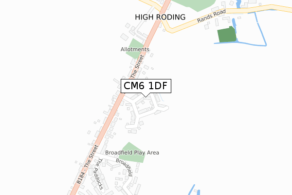
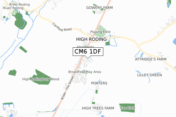
CM6 1DF is located in the High Easter & the Rodings electoral ward, within the local authority district of Uttlesford and the English Parliamentary constituency of Saffron Walden. The Sub Integrated Care Board (ICB) Location is NHS Hertfordshire and West Essex ICB - 07H and the police force is Essex. This postcode has been in use since August 2017.


GetTheData
Source: OS Open Zoomstack (Ordnance Survey)
Licence: Open Government Licence (requires attribution)
Attribution: Contains OS data © Crown copyright and database right 2024
Source: Open Postcode Geo
Licence: Open Government Licence (requires attribution)
Attribution: Contains OS data © Crown copyright and database right 2024; Contains Royal Mail data © Royal Mail copyright and database right 2024; Source: Office for National Statistics licensed under the Open Government Licence v.3.0
| Easting | 560447 |
| Northing | 217360 |
| Latitude | 51.831819 |
| Longitude | 0.327145 |
GetTheData
Source: Open Postcode Geo
Licence: Open Government Licence
| Country | England |
| Postcode District | CM6 |
| ➜ CM6 open data dashboard ➜ See where CM6 is on a map ➜ Where is High Roding? | |
GetTheData
Source: Land Registry Price Paid Data
Licence: Open Government Licence
| Ward | High Easter & The Rodings |
| Constituency | Saffron Walden |
GetTheData
Source: ONS Postcode Database
Licence: Open Government Licence
2023 18 AUG £730,000 |
45, OWERS PLACE, HIGH RODING, DUNMOW, CM6 1DF 2018 11 DEC £600,000 |
4, OWERS PLACE, HIGH RODING, DUNMOW, CM6 1DF 2018 3 DEC £475,000 |
2018 11 SEP £622,500 |
1, OWERS PLACE, HIGH RODING, DUNMOW, CM6 1DF 2018 12 JUN £435,000 |
3, OWERS PLACE, HIGH RODING, DUNMOW, CM6 1DF 2018 29 MAY £490,000 |
49, OWERS PLACE, HIGH RODING, DUNMOW, CM6 1DF 2018 25 MAY £605,000 |
5, OWERS PLACE, HIGH RODING, DUNMOW, CM6 1DF 2018 18 MAY £390,000 |
14, OWERS PLACE, HIGH RODING, DUNMOW, CM6 1DF 2018 28 MAR £415,000 |
12, OWERS PLACE, HIGH RODING, DUNMOW, CM6 1DF 2018 19 MAR £475,000 |
GetTheData
Source: HM Land Registry Price Paid Data
Licence: Contains HM Land Registry data © Crown copyright and database right 2024. This data is licensed under the Open Government Licence v3.0.
| January 2024 | Vehicle crime | On or near Broadfield | 310m |
| December 2023 | Violence and sexual offences | On or near Broadfield | 310m |
| December 2023 | Violence and sexual offences | On or near Broadfield | 310m |
| ➜ Get more crime data in our Crime section | |||
GetTheData
Source: data.police.uk
Licence: Open Government Licence
| High Roding (The Street (B184)) | High Roding | 174m |
| High Roding (The Street (B184)) | High Roding | 178m |
| Rands Road (Dunmow Road) | High Roding | 236m |
| Rands Road (The Street) | High Roding | 250m |
| The Black Lion (The Street (B184)) | High Roding | 360m |
GetTheData
Source: NaPTAN
Licence: Open Government Licence
➜ Broadband speed and availability dashboard for CM6 1DF
| Percentage of properties with Next Generation Access | 100.0% |
| Percentage of properties with Superfast Broadband | 100.0% |
| Percentage of properties with Ultrafast Broadband | 0.0% |
| Percentage of properties with Full Fibre Broadband | 0.0% |
Superfast Broadband is between 30Mbps and 300Mbps
Ultrafast Broadband is > 300Mbps
| Median download speed | 42.2Mbps |
| Average download speed | 49.3Mbps |
| Maximum download speed | 76.07Mbps |
| Median upload speed | 10.0Mbps |
| Average upload speed | 11.6Mbps |
| Maximum upload speed | 20.00Mbps |
| Percentage of properties unable to receive 2Mbps | 0.0% |
| Percentage of properties unable to receive 5Mbps | 0.0% |
| Percentage of properties unable to receive 10Mbps | 0.0% |
| Percentage of properties unable to receive 30Mbps | 0.0% |
➜ Broadband speed and availability dashboard for CM6 1DF
GetTheData
Source: Ofcom
Licence: Ofcom Terms of Use (requires attribution)
GetTheData
Source: ONS Postcode Database
Licence: Open Government Licence


➜ Get more ratings from the Food Standards Agency
GetTheData
Source: Food Standards Agency
Licence: FSA terms & conditions
| Last Collection | |||
|---|---|---|---|
| Location | Mon-Fri | Sat | Distance |
| Windmill | 16:45 | 10:00 | 2,485m |
| Godfrey Way | 17:15 | 11:45 | 2,550m |
| Aythorpe Roding | 16:45 | 10:00 | 3,276m |
GetTheData
Source: Dracos
Licence: Creative Commons Attribution-ShareAlike
| Facility | Distance |
|---|---|
| High Roding Cricket Club Rands Road, High Roding, Dunmow Grass Pitches | 411m |
| Roundbush Green Dunmow Road, Aythorpe Roding Grass Pitches | 2.8km |
| High Easter Cricket Club The Street, High Easter Grass Pitches | 3.1km |
GetTheData
Source: Active Places
Licence: Open Government Licence
| School | Phase of Education | Distance |
|---|---|---|
| Rodings Primary School Dunmow Road, Leaden Roding, Dunmow, CM6 1PZ | Primary | 3.9km |
| Cambian Great Dunmow School Unit 13, Flitch Industrial Estate, Chelmsford Road, Great Dunmow, Essex, CM6 1XJ | Not applicable | 4.8km |
| Great Dunmow Primary School Walnut Walk, Woodlands Park Drive, Great Dunmow, CM6 1ZR | Primary | 4.9km |
GetTheData
Source: Edubase
Licence: Open Government Licence
The below table lists the International Territorial Level (ITL) codes (formerly Nomenclature of Territorial Units for Statistics (NUTS) codes) and Local Administrative Units (LAU) codes for CM6 1DF:
| ITL 1 Code | Name |
|---|---|
| TLH | East |
| ITL 2 Code | Name |
| TLH3 | Essex |
| ITL 3 Code | Name |
| TLH35 | West Essex |
| LAU 1 Code | Name |
| E07000077 | Uttlesford |
GetTheData
Source: ONS Postcode Directory
Licence: Open Government Licence
The below table lists the Census Output Area (OA), Lower Layer Super Output Area (LSOA), and Middle Layer Super Output Area (MSOA) for CM6 1DF:
| Code | Name | |
|---|---|---|
| OA | E00112274 | |
| LSOA | E01022096 | Uttlesford 009D |
| MSOA | E02004599 | Uttlesford 009 |
GetTheData
Source: ONS Postcode Directory
Licence: Open Government Licence
| CM6 1NP | The Street | 88m |
| CM6 1NW | The Street | 98m |
| CM6 1NR | School Villas | 173m |
| CM6 1NN | The Street | 209m |
| CM6 1YH | Dove Crofts | 223m |
| CM6 1NY | Broadfield | 302m |
| CM6 1NZ | The Paddocks | 324m |
| CM6 1NS | The Street | 326m |
| CM6 1NJ | Canfield Road | 357m |
| CM6 1NH | Rands Road | 384m |
GetTheData
Source: Open Postcode Geo; Land Registry Price Paid Data
Licence: Open Government Licence