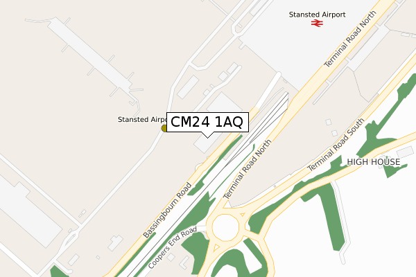
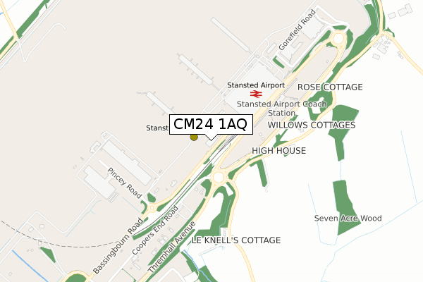
CM24 1AQ is located in the Takeley electoral ward, within the local authority district of Uttlesford and the English Parliamentary constituency of Saffron Walden. The Sub Integrated Care Board (ICB) Location is NHS Hertfordshire and West Essex ICB - 07H and the police force is Essex. This postcode has been in use since November 2017.


GetTheData
Source: OS Open Zoomstack (Ordnance Survey)
Licence: Open Government Licence (requires attribution)
Attribution: Contains OS data © Crown copyright and database right 2025
Source: Open Postcode Geo
Licence: Open Government Licence (requires attribution)
Attribution: Contains OS data © Crown copyright and database right 2025; Contains Royal Mail data © Royal Mail copyright and database right 2025; Source: Office for National Statistics licensed under the Open Government Licence v.3.0
| Easting | 555479 |
| Northing | 223404 |
| Latitude | 51.887522 |
| Longitude | 0.257825 |
GetTheData
Source: Open Postcode Geo
Licence: Open Government Licence
| Country | England |
| Postcode District | CM24 |
➜ See where CM24 is on a map | |
GetTheData
Source: Land Registry Price Paid Data
Licence: Open Government Licence
| Ward | Takeley |
| Constituency | Saffron Walden |
GetTheData
Source: ONS Postcode Database
Licence: Open Government Licence
| Terminal (Terminal Road North) | Stansted Airport | 466m |
| High House (Parsonage Road) | Takeley | 486m |
| High House (Parsonage Road) | Takeley | 487m |
| Airport Drt (Terminal Road North) | Stansted Airport | 505m |
| Coopers Villas (Parsonage Road) | Takeley | 526m |
| Stansted Airport Station | 0.2km |
| Elsenham Station | 4.2km |
| Stansted Mountfitchet Station | 4.3km |
GetTheData
Source: NaPTAN
Licence: Open Government Licence
GetTheData
Source: ONS Postcode Database
Licence: Open Government Licence


➜ Get more ratings from the Food Standards Agency
GetTheData
Source: Food Standards Agency
Licence: FSA terms & conditions
| Last Collection | |||
|---|---|---|---|
| Location | Mon-Fri | Sat | Distance |
| Stanstead Airport - Concourse | 17:00 | 10:30 | 267m |
| Standstead Airport - Arrivals | 17:30 | 10:30 | 453m |
| Harrod's Aviation | 16:15 | 09:00 | 1,629m |
GetTheData
Source: Dracos
Licence: Creative Commons Attribution-ShareAlike
The below table lists the International Territorial Level (ITL) codes (formerly Nomenclature of Territorial Units for Statistics (NUTS) codes) and Local Administrative Units (LAU) codes for CM24 1AQ:
| ITL 1 Code | Name |
|---|---|
| TLH | East |
| ITL 2 Code | Name |
| TLH3 | Essex |
| ITL 3 Code | Name |
| TLH35 | West Essex |
| LAU 1 Code | Name |
| E07000077 | Uttlesford |
GetTheData
Source: ONS Postcode Directory
Licence: Open Government Licence
The below table lists the Census Output Area (OA), Lower Layer Super Output Area (LSOA), and Middle Layer Super Output Area (MSOA) for CM24 1AQ:
| Code | Name | |
|---|---|---|
| OA | E00112244 | |
| LSOA | E01022090 | Uttlesford 006B |
| MSOA | E02004596 | Uttlesford 006 |
GetTheData
Source: ONS Postcode Directory
Licence: Open Government Licence
| CM22 6PL | Mill End | 542m |
| CM22 6PT | Coopers Villas | 563m |
| CM22 6PF | Bambers Green | 1226m |
| CM22 6PU | Parsonage Road | 1351m |
| CM22 6PG | Mole Hill Green Cottages | 1523m |
| CM22 6PQ | Mole Hill Green | 1571m |
| CM24 8UL | 1624m | |
| CM22 6DZ | Tye Green | 1675m |
| CM22 6PH | Mole Hill Green | 1734m |
| CM22 6DY | Tye Green | 1741m |
GetTheData
Source: Open Postcode Geo; Land Registry Price Paid Data
Licence: Open Government Licence