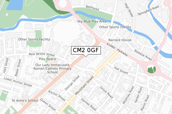
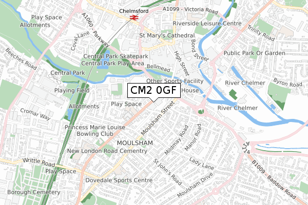
CM2 0GF is located in the Moulsham and Central electoral ward, within the local authority district of Chelmsford and the English Parliamentary constituency of Chelmsford. The Sub Integrated Care Board (ICB) Location is NHS Mid and South Essex ICB - 06Q and the police force is Essex. This postcode has been in use since October 2019.


GetTheData
Source: OS Open Zoomstack (Ordnance Survey)
Licence: Open Government Licence (requires attribution)
Attribution: Contains OS data © Crown copyright and database right 2024
Source: Open Postcode Geo
Licence: Open Government Licence (requires attribution)
Attribution: Contains OS data © Crown copyright and database right 2024; Contains Royal Mail data © Royal Mail copyright and database right 2024; Source: Office for National Statistics licensed under the Open Government Licence v.3.0
| Easting | 570720 |
| Northing | 206392 |
| Latitude | 51.730254 |
| Longitude | 0.470697 |
GetTheData
Source: Open Postcode Geo
Licence: Open Government Licence
| Country | England |
| Postcode District | CM2 |
| ➜ CM2 open data dashboard ➜ See where CM2 is on a map ➜ Where is Chelmsford? | |
GetTheData
Source: Land Registry Price Paid Data
Licence: Open Government Licence
| Ward | Moulsham And Central |
| Constituency | Chelmsford |
GetTheData
Source: ONS Postcode Database
Licence: Open Government Licence
| January 2024 | Criminal damage and arson | On or near Rochford Road | 399m |
| January 2024 | Public order | On or near Parking Area | 460m |
| December 2023 | Criminal damage and arson | On or near Parking Area | 460m |
| ➜ Get more crime data in our Crime section | |||
GetTheData
Source: data.police.uk
Licence: Open Government Licence
| C & E Hospital (New London Road) | Chelmsford | 35m |
| Rc Church (New London Road) | Chelmsford | 159m |
| Job Centre (New London Road) | Chelmsford City Centre | 202m |
| Rc Church (B1007) | Chelmsford | 214m |
| Mildmay Car Park (Parkway) | Chelmsford City Centre | 244m |
| Chelmsford Station | 0.7km |
GetTheData
Source: NaPTAN
Licence: Open Government Licence
GetTheData
Source: ONS Postcode Database
Licence: Open Government Licence


➜ Get more ratings from the Food Standards Agency
GetTheData
Source: Food Standards Agency
Licence: FSA terms & conditions
| Last Collection | |||
|---|---|---|---|
| Location | Mon-Fri | Sat | Distance |
| Moulsham Street P.o. | 17:30 | 12:15 | 137m |
| Red Lion | 18:15 | 12:45 | 311m |
| Red Lion | 18:15 | 12:45 | 311m |
GetTheData
Source: Dracos
Licence: Creative Commons Attribution-ShareAlike
| Facility | Distance |
|---|---|
| Our Lady Immaculate Catholic Primary School New London Road, Chelmsford Sports Hall, Grass Pitches | 221m |
| The Gym Group (Chelmsford) New London Road, Chelmsford Health and Fitness Gym | 245m |
| Devon House Health & Leisure (Closed) Anchor Street, Chelmsford Studio, Health and Fitness Gym | 285m |
GetTheData
Source: Active Places
Licence: Open Government Licence
| School | Phase of Education | Distance |
|---|---|---|
| Our Lady Immaculate Catholic Primary School New London Road, Chelmsford, CM2 0RG | Primary | 270m |
| St Anne's School 154 London Road, Chelmsford, CM2 0AW | Not applicable | 418m |
| St Cedd's School 178a New London Road, Chelmsford, CM2 0AR | Not applicable | 500m |
GetTheData
Source: Edubase
Licence: Open Government Licence
The below table lists the International Territorial Level (ITL) codes (formerly Nomenclature of Territorial Units for Statistics (NUTS) codes) and Local Administrative Units (LAU) codes for CM2 0GF:
| ITL 1 Code | Name |
|---|---|
| TLH | East |
| ITL 2 Code | Name |
| TLH3 | Essex |
| ITL 3 Code | Name |
| TLH36 | Heart of Essex |
| LAU 1 Code | Name |
| E07000070 | Chelmsford |
GetTheData
Source: ONS Postcode Directory
Licence: Open Government Licence
The below table lists the Census Output Area (OA), Lower Layer Super Output Area (LSOA), and Middle Layer Super Output Area (MSOA) for CM2 0GF:
| Code | Name | |
|---|---|---|
| OA | E00109630 | |
| LSOA | E01033140 | Chelmsford 010F |
| MSOA | E02004494 | Chelmsford 010 |
GetTheData
Source: ONS Postcode Directory
Licence: Open Government Licence
| CM2 0LF | New Writtle Street | 69m |
| CM2 0PP | New London Road | 69m |
| CM2 0LG | Moulsham Street | 109m |
| CM2 0RF | County Place | 122m |
| CM2 0FS | New Writtle Street | 130m |
| CM2 0RG | New London Road | 144m |
| CM2 0HX | Moulsham Street | 153m |
| CM2 0JU | George Street | 160m |
| CM2 0RN | Hayes Close | 166m |
| CM2 0PD | New London Road | 168m |
GetTheData
Source: Open Postcode Geo; Land Registry Price Paid Data
Licence: Open Government Licence