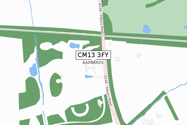
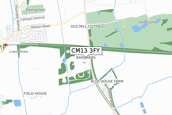
CM13 3FY is located in the Orsett electoral ward, within the unitary authority of Thurrock and the English Parliamentary constituency of South Basildon and East Thurrock. The Sub Integrated Care Board (ICB) Location is NHS Mid and South Essex ICB - 07G and the police force is Essex. This postcode has been in use since April 2020.


GetTheData
Source: OS Open Zoomstack (Ordnance Survey)
Licence: Open Government Licence (requires attribution)
Attribution: Contains OS data © Crown copyright and database right 2024
Source: Open Postcode Geo
Licence: Open Government Licence (requires attribution)
Attribution: Contains OS data © Crown copyright and database right 2024; Contains Royal Mail data © Royal Mail copyright and database right 2024; Source: Office for National Statistics licensed under the Open Government Licence v.3.0
| Easting | 563493 |
| Northing | 187853 |
| Latitude | 51.565855 |
| Longitude | 0.357491 |
GetTheData
Source: Open Postcode Geo
Licence: Open Government Licence
| Country | England |
| Postcode District | CM13 |
| ➜ CM13 open data dashboard ➜ See where CM13 is on a map | |
GetTheData
Source: Land Registry Price Paid Data
Licence: Open Government Licence
| Ward | Orsett |
| Constituency | South Basildon And East Thurrock |
GetTheData
Source: ONS Postcode Database
Licence: Open Government Licence
| April 2022 | Drugs | On or near Tilbury Road | 135m |
| February 2022 | Criminal damage and arson | On or near Tilbury Road | 135m |
| February 2022 | Vehicle crime | On or near Tilbury Road | 135m |
| ➜ Get more crime data in our Crime section | |||
GetTheData
Source: data.police.uk
Licence: Open Government Licence
| Dunton Hills Farm (Tilbury Road) | West Horndon | 769m |
| Clavering Gardens (Station Road) | West Horndon | 830m |
| Dunton Hills Farm (Tilbury Road) | West Horndon | 851m |
| Clavering Gardens (Station Road) | West Horndon | 905m |
| Railway Station (Station Road) | West Horndon | 1,224m |
| West Horndon Station | 1.2km |
| Laindon Station | 4.6km |
GetTheData
Source: NaPTAN
Licence: Open Government Licence
GetTheData
Source: ONS Postcode Database
Licence: Open Government Licence


➜ Get more ratings from the Food Standards Agency
GetTheData
Source: Food Standards Agency
Licence: FSA terms & conditions
| Last Collection | |||
|---|---|---|---|
| Location | Mon-Fri | Sat | Distance |
| West Horndon P.o. | 16:45 | 11:00 | 999m |
| Childerditch Lane | 16:00 | 08:00 | 2,775m |
| Billericay Road | 17:00 | 09:15 | 3,246m |
GetTheData
Source: Dracos
Licence: Creative Commons Attribution-ShareAlike
| Facility | Distance |
|---|---|
| Dunton Hills Golf Course Tilbury Road, West Horndon, Brentwood Golf | 716m |
| West Horndon Park Cadogan Avenue, West Horndon, Brentwood Grass Pitches | 1.1km |
| West Horndon Primary School Thorndon Avenue, West Horndon, Brentwood Grass Pitches | 1.2km |
GetTheData
Source: Active Places
Licence: Open Government Licence
| School | Phase of Education | Distance |
|---|---|---|
| West Horndon Primary School Thorndon Avenue, West Horndon, Brentwood, CM13 3TR | Primary | 1.2km |
| Bulphan Church of England Academy Fen Lane, Bulphan, RM14 3RL | Primary | 1.9km |
| Great Berry Primary School Great Berry Primary School, Forest Glade, Langdon Hills, Basildon, SS16 6SG | Primary | 3.5km |
GetTheData
Source: Edubase
Licence: Open Government Licence
The below table lists the International Territorial Level (ITL) codes (formerly Nomenclature of Territorial Units for Statistics (NUTS) codes) and Local Administrative Units (LAU) codes for CM13 3FY:
| ITL 1 Code | Name |
|---|---|
| TLH | East |
| ITL 2 Code | Name |
| TLH3 | Essex |
| ITL 3 Code | Name |
| TLH32 | Thurrock |
| LAU 1 Code | Name |
| E06000034 | Thurrock |
GetTheData
Source: ONS Postcode Directory
Licence: Open Government Licence
The below table lists the Census Output Area (OA), Lower Layer Super Output Area (LSOA), and Middle Layer Super Output Area (MSOA) for CM13 3FY:
| Code | Name | |
|---|---|---|
| OA | E00080797 | |
| LSOA | E01015978 | Thurrock 004B |
| MSOA | E02003299 | Thurrock 004 |
GetTheData
Source: ONS Postcode Directory
Licence: Open Government Licence
| CM13 3LU | Old Mill Cottages | 456m |
| CM13 3ND | Clavering Gardens | 667m |
| CM13 3NE | Freshwell Gardens | 671m |
| CM13 3NF | Saffron Close | 755m |
| CM13 3NN | Burntwood Close | 799m |
| CM13 3NG | Freshwell Gardens | 807m |
| CM13 3NL | Dunmow Gardens | 812m |
| CM13 3LZ | Station Road | 858m |
| CM13 3NH | Witham Gardens | 871m |
| CM13 3NB | Station Road | 879m |
GetTheData
Source: Open Postcode Geo; Land Registry Price Paid Data
Licence: Open Government Licence