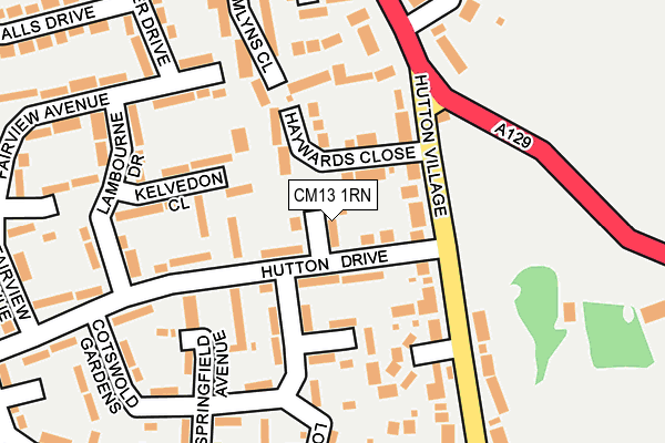
CM13 1RN is located in the Hutton East electoral ward, within the local authority district of Brentwood and the English Parliamentary constituency of Brentwood and Ongar. The Sub Integrated Care Board (ICB) Location is NHS Mid and South Essex ICB - 99E and the police force is Essex. This postcode has been in use since July 2017.


GetTheData
Source: OS OpenMap – Local (Ordnance Survey)
Source: OS VectorMap District (Ordnance Survey)
Licence: Open Government Licence (requires attribution)
| Easting | 563332 |
| Northing | 195024 |
| Latitude | 51.630325 |
| Longitude | 0.358505 |
GetTheData
Source: Open Postcode Geo
Licence: Open Government Licence
| Country | England |
| Postcode District | CM13 |
| ➜ CM13 open data dashboard ➜ See where CM13 is on a map ➜ Where is Brentwood? | |
GetTheData
Source: Land Registry Price Paid Data
Licence: Open Government Licence
| Ward | Hutton East |
| Constituency | Brentwood And Ongar |
GetTheData
Source: ONS Postcode Database
Licence: Open Government Licence
| January 2024 | Other theft | On or near Chelmer Drive | 312m |
| January 2024 | Public order | On or near Chelmer Drive | 312m |
| September 2023 | Anti-social behaviour | On or near Chelmer Drive | 312m |
| ➜ Get more crime data in our Crime section | |||
GetTheData
Source: data.police.uk
Licence: Open Government Licence
| Hutton Drive Shops (Hutton Drive) | Hutton | 82m |
| Hutton Drive Shops (Hutton Drive) | Hutton | 108m |
| Haywards Close (Hutton Village) | Hutton | 142m |
| Hutton Village (Rayleigh Road) | Hutton | 173m |
| Hutton Village (Rayleigh Road) | Hutton | 214m |
| Shenfield Station | 2km |
| Billericay Station | 4.2km |
| Ingatestone Station | 4.5km |
GetTheData
Source: NaPTAN
Licence: Open Government Licence
| Percentage of properties with Next Generation Access | 100.0% |
| Percentage of properties with Superfast Broadband | 100.0% |
| Percentage of properties with Ultrafast Broadband | 0.0% |
| Percentage of properties with Full Fibre Broadband | 0.0% |
Superfast Broadband is between 30Mbps and 300Mbps
Ultrafast Broadband is > 300Mbps
| Percentage of properties unable to receive 2Mbps | 0.0% |
| Percentage of properties unable to receive 5Mbps | 0.0% |
| Percentage of properties unable to receive 10Mbps | 0.0% |
| Percentage of properties unable to receive 30Mbps | 0.0% |
GetTheData
Source: Ofcom
Licence: Ofcom Terms of Use (requires attribution)
GetTheData
Source: ONS Postcode Database
Licence: Open Government Licence


➜ Get more ratings from the Food Standards Agency
GetTheData
Source: Food Standards Agency
Licence: FSA terms & conditions
| Last Collection | |||
|---|---|---|---|
| Location | Mon-Fri | Sat | Distance |
| Springfield Avenue | 17:30 | 09:10 | 135m |
| Hutton P.o. | 17:15 | 11:30 | 374m |
| Cedar Road | 17:30 | 11:30 | 573m |
GetTheData
Source: Dracos
Licence: Creative Commons Attribution-ShareAlike
| Facility | Distance |
|---|---|
| Hutton Cricket Club Hall Green Lane, Hutton, Brentwood Grass Pitches | 497m |
| Polo Fields Hall Green Lane, Hall Green Lane, Hutton Grass Pitches | 509m |
| Wash Road Playing Fields Harrison Close, Hutton, Brentwood Grass Pitches | 640m |
GetTheData
Source: Active Places
Licence: Open Government Licence
| School | Phase of Education | Distance |
|---|---|---|
| Willowbrook Primary School Rosen Crescent, Hutton, Brentwood, CM13 2TU | Primary | 691m |
| Hutton All Saints' Church of England Primary School Claughton Way, Hutton, Brentwood, CM13 1JW | Primary | 754m |
| Woodlands School Hutton Manor 428 Rayleigh Road, Brentwood, Essex, Brentwood, CM13 1SD | Not applicable | 776m |
GetTheData
Source: Edubase
Licence: Open Government Licence
The below table lists the International Territorial Level (ITL) codes (formerly Nomenclature of Territorial Units for Statistics (NUTS) codes) and Local Administrative Units (LAU) codes for CM13 1RN:
| ITL 1 Code | Name |
|---|---|
| TLH | East |
| ITL 2 Code | Name |
| TLH3 | Essex |
| ITL 3 Code | Name |
| TLH36 | Heart of Essex |
| LAU 1 Code | Name |
| E07000068 | Brentwood |
GetTheData
Source: ONS Postcode Directory
Licence: Open Government Licence
The below table lists the Census Output Area (OA), Lower Layer Super Output Area (LSOA), and Middle Layer Super Output Area (MSOA) for CM13 1RN:
| Code | Name | |
|---|---|---|
| OA | E00108978 | |
| LSOA | E01021449 | Brentwood 003B |
| MSOA | E02004466 | Brentwood 003 |
GetTheData
Source: ONS Postcode Directory
Licence: Open Government Licence
| CM13 1RL | Magdalen Gardens | 58m |
| CM13 1QT | Mandeville Walk | 69m |
| CM13 1RS | Haywards Close | 70m |
| CM13 1QZ | Hutton Drive | 87m |
| CM13 1QS | Kelvedon Close | 91m |
| CM13 1QX | Hutton Drive | 95m |
| CM13 1NZ | Fairview Avenue | 117m |
| CM13 1QP | Lambourne Drive | 121m |
| CM13 1RT | Hutton Village | 125m |
| CM13 1RD | Greenstead Close | 127m |
GetTheData
Source: Open Postcode Geo; Land Registry Price Paid Data
Licence: Open Government Licence