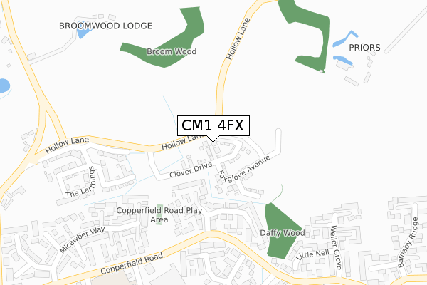
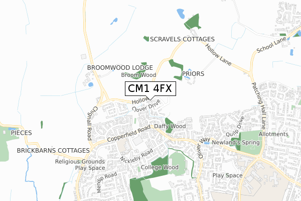
CM1 4FX is located in the Broomfield and The Walthams electoral ward, within the local authority district of Chelmsford and the English Parliamentary constituency of Saffron Walden. The Sub Integrated Care Board (ICB) Location is NHS Mid and South Essex ICB - 06Q and the police force is Essex. This postcode has been in use since January 2020.


GetTheData
Source: OS Open Zoomstack (Ordnance Survey)
Licence: Open Government Licence (requires attribution)
Attribution: Contains OS data © Crown copyright and database right 2024
Source: Open Postcode Geo
Licence: Open Government Licence (requires attribution)
Attribution: Contains OS data © Crown copyright and database right 2024; Contains Royal Mail data © Royal Mail copyright and database right 2024; Source: Office for National Statistics licensed under the Open Government Licence v.3.0
| Easting | 569211 |
| Northing | 209410 |
| Latitude | 51.757822 |
| Longitude | 0.450336 |
GetTheData
Source: Open Postcode Geo
Licence: Open Government Licence
| Country | England |
| Postcode District | CM1 |
| ➜ CM1 open data dashboard ➜ See where CM1 is on a map ➜ Where is Chelmsford? | |
GetTheData
Source: Land Registry Price Paid Data
Licence: Open Government Licence
| Ward | Broomfield And The Walthams |
| Constituency | Saffron Walden |
GetTheData
Source: ONS Postcode Database
Licence: Open Government Licence
2023 14 SEP £628,500 |
45, FOXGLOVE AVENUE, CHELMSFORD, CM1 4FX 2023 24 MAR £650,000 |
47, FOXGLOVE AVENUE, CHELMSFORD, CM1 4FX 2022 25 NOV £700,000 |
43, FOXGLOVE AVENUE, CHELMSFORD, CM1 4FX 2022 30 SEP £630,000 |
41, FOXGLOVE AVENUE, CHELMSFORD, CM1 4FX 2022 31 AUG £625,000 |
49, FOXGLOVE AVENUE, CHELMSFORD, CM1 4FX 2022 30 JUN £460,000 |
69, FOXGLOVE AVENUE, CHELMSFORD, CM1 4FX 2022 31 MAR £682,500 |
67, FOXGLOVE AVENUE, CHELMSFORD, CM1 4FX 2021 23 DEC £345,000 |
71, FOXGLOVE AVENUE, CHELMSFORD, CM1 4FX 2021 23 DEC £621,000 |
59, FOXGLOVE AVENUE, CHELMSFORD, CM1 4FX 2021 20 DEC £616,000 |
GetTheData
Source: HM Land Registry Price Paid Data
Licence: Contains HM Land Registry data © Crown copyright and database right 2024. This data is licensed under the Open Government Licence v3.0.
| July 2022 | Violence and sexual offences | On or near Little Nell | 264m |
| July 2022 | Anti-social behaviour | On or near Little Nell | 264m |
| June 2022 | Violence and sexual offences | On or near Trotwood Close | 175m |
| ➜ Get more crime data in our Crime section | |||
GetTheData
Source: data.police.uk
Licence: Open Government Licence
| Havisham Way (Copperfield Road) | North Melbourne | 227m |
| Weller Grove (Copperfield Road) | North Melbourne | 322m |
| North Melbourne Shops (Copperfield Road) | North Melbourne | 351m |
| North Melbourne Shops (Copperfield Road) | North Melbourne | 359m |
| Weller Grove (Copperfield Road) | North Melbourne | 383m |
| Chelmsford Station | 2.7km |
GetTheData
Source: NaPTAN
Licence: Open Government Licence
GetTheData
Source: ONS Postcode Database
Licence: Open Government Licence


➜ Get more ratings from the Food Standards Agency
GetTheData
Source: Food Standards Agency
Licence: FSA terms & conditions
| Last Collection | |||
|---|---|---|---|
| Location | Mon-Fri | Sat | Distance |
| Pines Road | 17:45 | 12:00 | 1,150m |
| Woodhall Road | 17:45 | 13:00 | 1,335m |
| Goulton Road | 17:10 | 13:00 | 1,338m |
GetTheData
Source: Dracos
Licence: Creative Commons Attribution-ShareAlike
| Facility | Distance |
|---|---|
| Newlands Spring Primary School Dickens Place, Chelmsford Grass Pitches, Sports Hall | 494m |
| Chelmsford Sports And Athletics Centre Salerno Way, Chelmsford Sports Hall, Athletics, Health and Fitness Gym, Studio | 556m |
| Melbourne Park Salerno Way, Chelmsford Grass Pitches, Artificial Grass Pitch | 669m |
GetTheData
Source: Active Places
Licence: Open Government Licence
| School | Phase of Education | Distance |
|---|---|---|
| Newlands Spring Primary and Nursery School Dickens Place, Copperfield Road, Chelmsford, CM1 4UU | Primary | 494m |
| Columbus School and College Oliver Way, Chelmsford, CM1 4ZB | Not applicable | 823m |
| Tanglewood Nursery School Melbourne Avenue, Chelmsford, CM1 2DX | Nursery | 972m |
GetTheData
Source: Edubase
Licence: Open Government Licence
The below table lists the International Territorial Level (ITL) codes (formerly Nomenclature of Territorial Units for Statistics (NUTS) codes) and Local Administrative Units (LAU) codes for CM1 4FX:
| ITL 1 Code | Name |
|---|---|
| TLH | East |
| ITL 2 Code | Name |
| TLH3 | Essex |
| ITL 3 Code | Name |
| TLH36 | Heart of Essex |
| LAU 1 Code | Name |
| E07000070 | Chelmsford |
GetTheData
Source: ONS Postcode Directory
Licence: Open Government Licence
The below table lists the Census Output Area (OA), Lower Layer Super Output Area (LSOA), and Middle Layer Super Output Area (MSOA) for CM1 4FX:
| Code | Name | |
|---|---|---|
| OA | E00109429 | |
| LSOA | E01021542 | Chelmsford 002A |
| MSOA | E02004486 | Chelmsford 002 |
GetTheData
Source: ONS Postcode Directory
Licence: Open Government Licence
| CM1 4UZ | Trotwood Close | 186m |
| CM1 4UY | Havisham Way | 226m |
| CM1 4YJ | Weller Grove | 267m |
| CM1 4YL | Little Nell | 275m |
| CM1 4XQ | Chuzzlewit Drive | 303m |
| CM1 4XH | Estella Mead | 317m |
| CM1 4YQ | Little Dorrit | 348m |
| CM1 4YP | Flintwich Manor | 352m |
| CM1 4UF | Nickleby Road | 381m |
| CM1 4UE | Micawber Way | 388m |
GetTheData
Source: Open Postcode Geo; Land Registry Price Paid Data
Licence: Open Government Licence