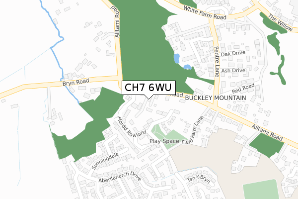
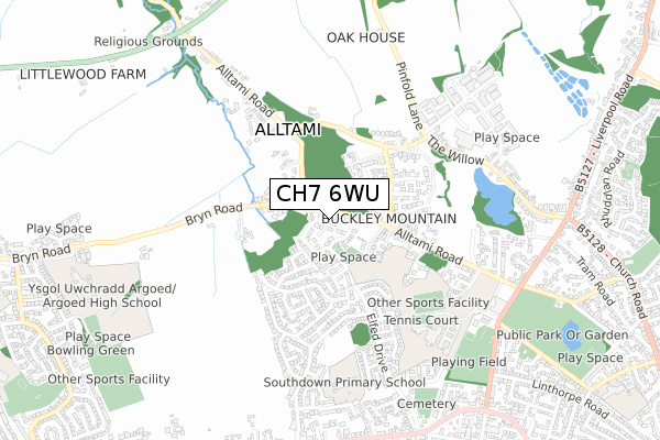
CH7 6WU is located in the Buckley: Mountain electoral ward, within the unitary authority of Flintshire and the Welsh Parliamentary constituency of Alyn and Deeside. The Local Health Board is Betsi Cadwaladr University and the police force is North Wales. This postcode has been in use since November 2019.


GetTheData
Source: OS Open Zoomstack (Ordnance Survey)
Licence: Open Government Licence (requires attribution)
Attribution: Contains OS data © Crown copyright and database right 2024
Source: Open Postcode Geo
Licence: Open Government Licence (requires attribution)
Attribution: Contains OS data © Crown copyright and database right 2024; Contains Royal Mail data © Royal Mail copyright and database right 2024; Source: Office for National Statistics licensed under the Open Government Licence v.3.0
| Easting | 327264 |
| Northing | 364854 |
| Latitude | 53.175816 |
| Longitude | -3.089694 |
GetTheData
Source: Open Postcode Geo
Licence: Open Government Licence
| Country | Wales |
| Postcode District | CH7 |
| ➜ CH7 open data dashboard ➜ See where CH7 is on a map ➜ Where is Buckley? | |
GetTheData
Source: Land Registry Price Paid Data
Licence: Open Government Licence
| Ward | Buckley: Mountain |
| Constituency | Alyn And Deeside |
GetTheData
Source: ONS Postcode Database
Licence: Open Government Licence
2020 23 OCT £485,000 |
3, DERW NEWYDD, ALLTAMI, MOLD, CH7 6WU 2020 19 MAR £450,000 |
1, DERW NEWYDD, ALLTAMI, MOLD, CH7 6WU 2019 13 DEC £485,000 |
2017 28 JUL £360,000 |
GetTheData
Source: HM Land Registry Price Paid Data
Licence: Contains HM Land Registry data © Crown copyright and database right 2024. This data is licensed under the Open Government Licence v3.0.
| January 2024 | Anti-social behaviour | On or near Ochr Y Waen | 389m |
| January 2024 | Violence and sexual offences | On or near Ochr Y Waen | 389m |
| January 2024 | Violence and sexual offences | On or near Ochr Y Waen | 389m |
| ➜ Get more crime data in our Crime section | |||
GetTheData
Source: data.police.uk
Licence: Open Government Licence
| Field Farm Road (St Mellor`s Road) | Buckley | 314m |
| Sunningdale (Aberllanerch Drive) | Buckley | 333m |
| St Andrew`s Drive | Buckley | 594m |
| Buckly Medical Centre (Liverpool Road) | Buckley | 740m |
| Hawkesbury Road (Liverpool Road) | Buckley | 743m |
| Buckley Station | 2.7km |
| Hawarden Station | 4km |
| Penyffordd Station | 4.3km |
GetTheData
Source: NaPTAN
Licence: Open Government Licence
GetTheData
Source: ONS Postcode Database
Licence: Open Government Licence


➜ Get more ratings from the Food Standards Agency
GetTheData
Source: Food Standards Agency
Licence: FSA terms & conditions
| Last Collection | |||
|---|---|---|---|
| Location | Mon-Fri | Sat | Distance |
| Lower Common | 16:00 | 11:00 | 265m |
| Liverpool Road Post Office | 16:00 | 11:00 | 855m |
| The Square Post Office | 17:04 | 11:30 | 907m |
GetTheData
Source: Dracos
Licence: Creative Commons Attribution-ShareAlike
| School | Phase of Education | Distance |
|---|---|---|
| Elfed High School Mill Lane, Buckley, CH7 3HQ | Not applicable | 619m |
| Buckley Southdown C.P. Linderick Avenue, Buckley, Flintshire, CH7 2NP | Not applicable | 732m |
| Argoed High School Bryn Road, Bryn Y Baal, Nr Mold, Flintshire, CH7 6RY | Not applicable | 993m |
GetTheData
Source: Edubase
Licence: Open Government Licence
The below table lists the International Territorial Level (ITL) codes (formerly Nomenclature of Territorial Units for Statistics (NUTS) codes) and Local Administrative Units (LAU) codes for CH7 6WU:
| ITL 1 Code | Name |
|---|---|
| TLL | Wales |
| ITL 2 Code | Name |
| TLL2 | East Wales |
| ITL 3 Code | Name |
| TLL23 | Flintshire and Wrexham |
| LAU 1 Code | Name |
| W06000005 | Flintshire |
GetTheData
Source: ONS Postcode Directory
Licence: Open Government Licence
The below table lists the Census Output Area (OA), Lower Layer Super Output Area (LSOA), and Middle Layer Super Output Area (MSOA) for CH7 6WU:
| Code | Name | |
|---|---|---|
| OA | W00001429 | |
| LSOA | W01000264 | Flintshire 012A |
| MSOA | W02000069 | Flintshire 012 |
GetTheData
Source: ONS Postcode Directory
Licence: Open Government Licence
| CH7 6RT | Alltami Road | 32m |
| CH7 3DE | Ffordd Brannan | 93m |
| CH7 3DD | Ffordd Rowlands | 117m |
| CH7 3DJ | Lon Pritchard | 142m |
| CH7 3DG | Cwrt Nuttall | 179m |
| CH7 3PD | Field Farm Lane | 191m |
| CH7 2QX | Wentworth Close | 198m |
| CH7 3GG | Old Field Farm Lane | 226m |
| CH7 3PX | Tryfan Court | 236m |
| CH7 2QU | Sunningdale | 246m |
GetTheData
Source: Open Postcode Geo; Land Registry Price Paid Data
Licence: Open Government Licence