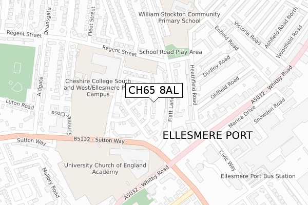
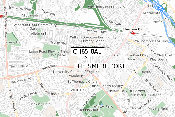
CH65 8AL is located in the Central & Grange electoral ward, within the unitary authority of Cheshire West and Chester and the English Parliamentary constituency of Ellesmere Port and Neston. The Sub Integrated Care Board (ICB) Location is NHS Cheshire and Merseyside ICB - 27D and the police force is Cheshire. This postcode has been in use since December 2018.


GetTheData
Source: OS Open Zoomstack (Ordnance Survey)
Licence: Open Government Licence (requires attribution)
Attribution: Contains OS data © Crown copyright and database right 2024
Source: Open Postcode Geo
Licence: Open Government Licence (requires attribution)
Attribution: Contains OS data © Crown copyright and database right 2024; Contains Royal Mail data © Royal Mail copyright and database right 2024; Source: Office for National Statistics licensed under the Open Government Licence v.3.0
| Easting | 339683 |
| Northing | 376137 |
| Latitude | 53.278780 |
| Longitude | -2.906054 |
GetTheData
Source: Open Postcode Geo
Licence: Open Government Licence
| Country | England |
| Postcode District | CH65 |
| ➜ CH65 open data dashboard ➜ See where CH65 is on a map ➜ Where is Ellesmere Port? | |
GetTheData
Source: Land Registry Price Paid Data
Licence: Open Government Licence
| Ward | Central & Grange |
| Constituency | Ellesmere Port And Neston |
GetTheData
Source: ONS Postcode Database
Licence: Open Government Licence
2021 13 AUG £225,000 |
19, COLUMBIA ROAD, ELLESMERE PORT, CH65 8AL 2019 27 SEP £252,995 |
15, COLUMBIA ROAD, ELLESMERE PORT, CH65 8AL 2019 28 JUN £182,995 |
12, COLUMBIA ROAD, ELLESMERE PORT, CH65 8AL 2019 17 MAY £211,995 |
2019 29 MAR £211,995 |
GetTheData
Source: HM Land Registry Price Paid Data
Licence: Contains HM Land Registry data © Crown copyright and database right 2024. This data is licensed under the Open Government Licence v3.0.
| October 2023 | Anti-social behaviour | On or near Dawn Gardens | 487m |
| October 2023 | Anti-social behaviour | On or near Dawn Gardens | 487m |
| June 2023 | Possession of weapons | On or near Dawn Gardens | 487m |
| ➜ Get more crime data in our Crime section | |||
GetTheData
Source: data.police.uk
Licence: Open Government Licence
| Oldfield Road (Heathfield Road) | Ellesmere Port | 128m |
| The Grange Centre (Regent Street) | Whitby | 134m |
| Oldfield Road (Heathfield Road) | Ellesmere Port | 143m |
| The Grange Centre (Regent Street) | Whitby | 194m |
| Ucea School (Whitby Road) | Whitby | 230m |
| Ellesmere Port Station | 0.7km |
| Overpool Station | 1.3km |
| Little Sutton Station | 2.6km |
GetTheData
Source: NaPTAN
Licence: Open Government Licence
| Percentage of properties with Next Generation Access | 100.0% |
| Percentage of properties with Superfast Broadband | 100.0% |
| Percentage of properties with Ultrafast Broadband | 100.0% |
| Percentage of properties with Full Fibre Broadband | 100.0% |
Superfast Broadband is between 30Mbps and 300Mbps
Ultrafast Broadband is > 300Mbps
| Percentage of properties unable to receive 2Mbps | 0.0% |
| Percentage of properties unable to receive 5Mbps | 0.0% |
| Percentage of properties unable to receive 10Mbps | 0.0% |
| Percentage of properties unable to receive 30Mbps | 0.0% |
GetTheData
Source: Ofcom
Licence: Ofcom Terms of Use (requires attribution)
GetTheData
Source: ONS Postcode Database
Licence: Open Government Licence


➜ Get more ratings from the Food Standards Agency
GetTheData
Source: Food Standards Agency
Licence: FSA terms & conditions
| Last Collection | |||
|---|---|---|---|
| Location | Mon-Fri | Sat | Distance |
| Ellesmere Port Post Office | 18:45 | 12:00 | 313m |
| Rivington Road | 18:15 | 314m | |
| Rivington Road | 18:15 | 12:00 | 317m |
GetTheData
Source: Dracos
Licence: Creative Commons Attribution-ShareAlike
| Facility | Distance |
|---|---|
| The Ellesmere Port C Of E College Whitby Road, Whitby, Ellesmere Port Sports Hall, Health and Fitness Gym, Artificial Grass Pitch, Studio, Grass Pitches | 177m |
| West Cheshire College (Ellesmere Port Campus) Regent Street, Ellesmere Port Health and Fitness Gym, Sports Hall, Grass Pitches, Outdoor Tennis Courts | 181m |
| Ellesmere Port Hub (Closed) Whitby Road, Whitby, Ellesmere Port Grass Pitches, Sports Hall | 300m |
GetTheData
Source: Active Places
Licence: Open Government Licence
| School | Phase of Education | Distance |
|---|---|---|
| Ellesmere Port Church of England College 164 Whitby Road, Ellesmere Port, CH65 6EA | Secondary | 177m |
| William Stockton Community Primary School Heathfield Road, Ellesmere Port, CH65 8DH | Primary | 204m |
| Cambridge Road Community Primary and Nursery School Cambridge Road, Ellesmere Port, CH65 4AQ | Primary | 645m |
GetTheData
Source: Edubase
Licence: Open Government Licence
The below table lists the International Territorial Level (ITL) codes (formerly Nomenclature of Territorial Units for Statistics (NUTS) codes) and Local Administrative Units (LAU) codes for CH65 8AL:
| ITL 1 Code | Name |
|---|---|
| TLD | North West (England) |
| ITL 2 Code | Name |
| TLD6 | Cheshire |
| ITL 3 Code | Name |
| TLD63 | Cheshire West and Chester |
| LAU 1 Code | Name |
| E06000050 | Cheshire West and Chester |
GetTheData
Source: ONS Postcode Directory
Licence: Open Government Licence
The below table lists the Census Output Area (OA), Lower Layer Super Output Area (LSOA), and Middle Layer Super Output Area (MSOA) for CH65 8AL:
| Code | Name | |
|---|---|---|
| OA | E00093478 | |
| LSOA | E01018525 | Cheshire West and Chester 007C |
| MSOA | E02003845 | Cheshire West and Chester 007 |
GetTheData
Source: ONS Postcode Directory
Licence: Open Government Licence
| CH65 8DN | Flatt Lane | 43m |
| CH65 8DP | Flatt Lane | 85m |
| CH65 8DH | Heathfield Road | 122m |
| CH65 8EJ | Regent Street | 164m |
| CH65 8DJ | Heathfield Road | 164m |
| CH65 8EQ | Regent Street | 178m |
| CH65 0AB | Whitby Road | 208m |
| CH65 8DF | Oldfield Road | 227m |
| CH65 8DQ | Dudley Road | 229m |
| CH65 8DL | Penn Gardens | 231m |
GetTheData
Source: Open Postcode Geo; Land Registry Price Paid Data
Licence: Open Government Licence