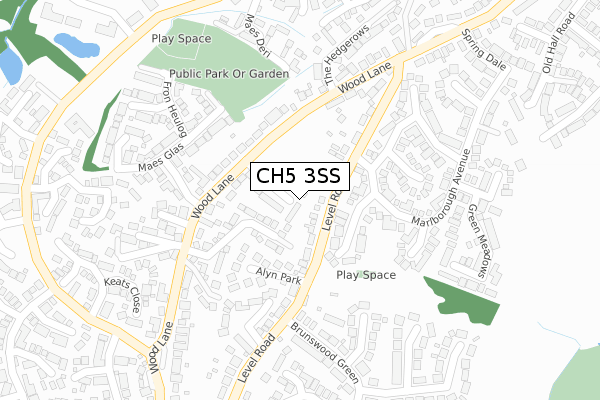
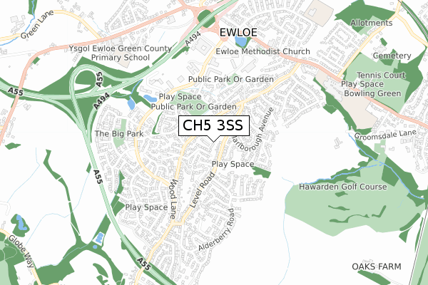
CH5 3SS is located in the Hawarden: Ewloe electoral ward, within the unitary authority of Flintshire and the Welsh Parliamentary constituency of Alyn and Deeside. The Local Health Board is Betsi Cadwaladr University and the police force is North Wales. This postcode has been in use since February 2020.


GetTheData
Source: OS Open Zoomstack (Ordnance Survey)
Licence: Open Government Licence (requires attribution)
Attribution: Contains OS data © Crown copyright and database right 2024
Source: Open Postcode Geo
Licence: Open Government Licence (requires attribution)
Attribution: Contains OS data © Crown copyright and database right 2024; Contains Royal Mail data © Royal Mail copyright and database right 2024; Source: Office for National Statistics licensed under the Open Government Licence v.3.0
| Easting | 329763 |
| Northing | 365858 |
| Latitude | 53.185176 |
| Longitude | -3.052533 |
GetTheData
Source: Open Postcode Geo
Licence: Open Government Licence
| Country | Wales |
| Postcode District | CH5 |
| ➜ CH5 open data dashboard ➜ See where CH5 is on a map ➜ Where is Hawarden? | |
GetTheData
Source: Land Registry Price Paid Data
Licence: Open Government Licence
| Ward | Hawarden: Ewloe |
| Constituency | Alyn And Deeside |
GetTheData
Source: ONS Postcode Database
Licence: Open Government Licence
6, HAMILTON COURT, HAWARDEN, DEESIDE, CH5 3SS 2021 12 JAN £220,000 |
1, HAMILTON COURT, HAWARDEN, DEESIDE, CH5 3SS 2020 30 OCT £342,000 |
5, HAMILTON COURT, HAWARDEN, DEESIDE, CH5 3SS 2020 30 SEP £300,000 |
19, HAMILTON COURT, HAWARDEN, DEESIDE, CH5 3SS 2020 28 AUG £224,995 |
14, HAMILTON COURT, HAWARDEN, DEESIDE, CH5 3SS 2020 28 AUG £224,995 |
3, HAMILTON COURT, HAWARDEN, DEESIDE, CH5 3SS 2020 3 AUG £239,995 |
8, HAMILTON COURT, HAWARDEN, DEESIDE, CH5 3SS 2020 6 JUL £300,000 |
4, HAMILTON COURT, HAWARDEN, DEESIDE, CH5 3SS 2020 3 JUL £315,000 |
20, HAMILTON COURT, HAWARDEN, DEESIDE, CH5 3SS 2020 22 MAY £238,000 |
15, HAMILTON COURT, HAWARDEN, DEESIDE, CH5 3SS 2020 31 MAR £240,995 |
GetTheData
Source: HM Land Registry Price Paid Data
Licence: Contains HM Land Registry data © Crown copyright and database right 2024. This data is licensed under the Open Government Licence v3.0.
| August 2023 | Burglary | On or near Cromwell Close | 287m |
| July 2023 | Violence and sexual offences | On or near Dryden Close | 467m |
| August 2022 | Anti-social behaviour | On or near Dryden Close | 467m |
| ➜ Get more crime data in our Crime section | |||
GetTheData
Source: data.police.uk
Licence: Open Government Licence
| Sycamore Lodge (Wood Lane) | Hawarden | 85m |
| Sycamore Lodge (Wood Lane) | Hawarden | 96m |
| Paradise Place (Wood Lane) | Hawarden | 368m |
| Paradise Place (Wood Lane) | Hawarden | 373m |
| Level Road (Wood Lane) | Hawarden | 375m |
| Hawarden Station | 1.4km |
| Buckley Station | 2.5km |
| Shotton Station | 3.2km |
GetTheData
Source: NaPTAN
Licence: Open Government Licence
GetTheData
Source: ONS Postcode Database
Licence: Open Government Licence


➜ Get more ratings from the Food Standards Agency
GetTheData
Source: Food Standards Agency
Licence: FSA terms & conditions
| Last Collection | |||
|---|---|---|---|
| Location | Mon-Fri | Sat | Distance |
| Wood Lane | 17:40 | 07:00 | 177m |
| Level Road. | 17:30 | 07:00 | 515m |
| Ewloe Post Office. | 16:00 | 11:30 | 660m |
GetTheData
Source: Dracos
Licence: Creative Commons Attribution-ShareAlike
| School | Phase of Education | Distance |
|---|---|---|
| Ewloe Green C.P. School Old Mold Road, Ewloe, Deeside, Flintshire, CH5 3AU | Not applicable | 809m |
| Hawarden High School The Highway, Hawarden, Deeside, Flintshire, CH5 3DJ | Not applicable | 815m |
| Penarlag C.P. School Carlines Avenue, Carlines Park, Ewloe, Flintshire, CH5 3RQ | Not applicable | 992m |
GetTheData
Source: Edubase
Licence: Open Government Licence
The below table lists the International Territorial Level (ITL) codes (formerly Nomenclature of Territorial Units for Statistics (NUTS) codes) and Local Administrative Units (LAU) codes for CH5 3SS:
| ITL 1 Code | Name |
|---|---|
| TLL | Wales |
| ITL 2 Code | Name |
| TLL2 | East Wales |
| ITL 3 Code | Name |
| TLL23 | Flintshire and Wrexham |
| LAU 1 Code | Name |
| W06000005 | Flintshire |
GetTheData
Source: ONS Postcode Directory
Licence: Open Government Licence
The below table lists the Census Output Area (OA), Lower Layer Super Output Area (LSOA), and Middle Layer Super Output Area (MSOA) for CH5 3SS:
| Code | Name | |
|---|---|---|
| OA | W00001526 | |
| LSOA | W01000284 | Flintshire 013C |
| MSOA | W02000070 | Flintshire 013 |
GetTheData
Source: ONS Postcode Directory
Licence: Open Government Licence
| CH5 3GR | Sorrel Court | 59m |
| CH5 3GA | Alyn Park | 102m |
| CH5 3SF | Palmerston Crescent | 116m |
| CH5 3JE | Wood Lane | 165m |
| CH5 3LG | Bramley Way | 171m |
| CH5 3DP | Greenvale Park | 180m |
| CH5 3GD | Lon Cae Del | 186m |
| CH5 3JG | Wood Lane | 189m |
| CH5 3GE | Maes Glas | 197m |
| CH5 3JR | Level Road | 198m |
GetTheData
Source: Open Postcode Geo; Land Registry Price Paid Data
Licence: Open Government Licence