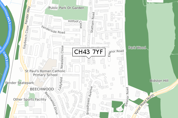
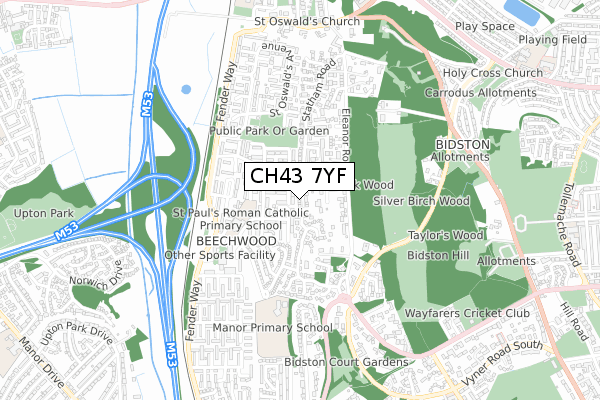
CH43 7YF is located in the Bidston and St James electoral ward, within the metropolitan district of Wirral and the English Parliamentary constituency of Birkenhead. The Sub Integrated Care Board (ICB) Location is NHS Cheshire and Merseyside ICB - 12F and the police force is Merseyside. This postcode has been in use since August 2019.


GetTheData
Source: OS Open Zoomstack (Ordnance Survey)
Licence: Open Government Licence (requires attribution)
Attribution: Contains OS data © Crown copyright and database right 2024
Source: Open Postcode Geo
Licence: Open Government Licence (requires attribution)
Attribution: Contains OS data © Crown copyright and database right 2024; Contains Royal Mail data © Royal Mail copyright and database right 2024; Source: Office for National Statistics licensed under the Open Government Licence v.3.0
| Easting | 328136 |
| Northing | 390235 |
| Latitude | 53.404039 |
| Longitude | -3.082401 |
GetTheData
Source: Open Postcode Geo
Licence: Open Government Licence
| Country | England |
| Postcode District | CH43 |
| ➜ CH43 open data dashboard ➜ See where CH43 is on a map ➜ Where is Birkenhead? | |
GetTheData
Source: Land Registry Price Paid Data
Licence: Open Government Licence
| Ward | Bidston And St James |
| Constituency | Birkenhead |
GetTheData
Source: ONS Postcode Database
Licence: Open Government Licence
| January 2024 | Violence and sexual offences | On or near St Oswald'S Avenue | 202m |
| November 2023 | Violence and sexual offences | On or near St Oswald'S Avenue | 202m |
| October 2023 | Violence and sexual offences | On or near St Oswald'S Avenue | 202m |
| ➜ Get more crime data in our Crime section | |||
GetTheData
Source: data.police.uk
Licence: Open Government Licence
| Bidston Village Road (Fender Way) | Beechwood | 19m |
| Bidston Village Road (Fender Way) | Beechwood | 43m |
| St Oswalds Ave (Fender Way) | Beechwood | 186m |
| School Lane (Bidston Village Road) | Bidston | 217m |
| St Oswalds Ave (Fender Way) | Beechwood | 249m |
| Bidston Station | 0.6km |
| Leasowe Station | 1.2km |
| Birkenhead North Station | 1.7km |
GetTheData
Source: NaPTAN
Licence: Open Government Licence
GetTheData
Source: ONS Postcode Database
Licence: Open Government Licence


➜ Get more ratings from the Food Standards Agency
GetTheData
Source: Food Standards Agency
Licence: FSA terms & conditions
| Last Collection | |||
|---|---|---|---|
| Location | Mon-Fri | Sat | Distance |
| Leasowe Post Office | 17:11 | 12:00 | 1,579m |
| Sandbrook Lane | 17:30 | 12:00 | 1,585m |
| Saughall Bridge Road | 17:15 | 12:00 | 1,675m |
GetTheData
Source: Dracos
Licence: Creative Commons Attribution-ShareAlike
| Facility | Distance |
|---|---|
| Bidston Sports And Activity Centre Valley Road, Birkenhead Sports Hall, Health and Fitness Gym, Indoor Tennis Centre, Artificial Grass Pitch, Grass Pitches, Studio, Outdoor Tennis Courts | 864m |
| Bidston Golf Club Bidston Link Road, Wallasey Golf | 878m |
| Puregym (Wirral Bidston Moss) Bidston Moss, Wallasey Health and Fitness Gym | 944m |
GetTheData
Source: Active Places
Licence: Open Government Licence
| School | Phase of Education | Distance |
|---|---|---|
| Bidston Village CofE (Controlled) Primary School Ballantyne Drive, Bidston, Prenton, CH43 7XG | Primary | 118m |
| The Observatory School Bidston Village Road, Bidston, Prenton, CH43 7QT | Not applicable | 245m |
| St Paul's Catholic Primary School Farmfield Drive, Beechwood, Prenton, CH43 7TE | Primary | 842m |
GetTheData
Source: Edubase
Licence: Open Government Licence
The below table lists the International Territorial Level (ITL) codes (formerly Nomenclature of Territorial Units for Statistics (NUTS) codes) and Local Administrative Units (LAU) codes for CH43 7YF:
| ITL 1 Code | Name |
|---|---|
| TLD | North West (England) |
| ITL 2 Code | Name |
| TLD7 | Merseyside |
| ITL 3 Code | Name |
| TLD74 | Wirral |
| LAU 1 Code | Name |
| E08000015 | Wirral |
GetTheData
Source: ONS Postcode Directory
Licence: Open Government Licence
The below table lists the Census Output Area (OA), Lower Layer Super Output Area (LSOA), and Middle Layer Super Output Area (MSOA) for CH43 7YF:
| Code | Name | |
|---|---|---|
| OA | E00036088 | |
| LSOA | E01007124 | Wirral 011E |
| MSOA | E02001477 | Wirral 011 |
GetTheData
Source: ONS Postcode Directory
Licence: Open Government Licence
| CH43 7YN | Bidston View | 54m |
| CH43 7YW | St Oswalds Mews | 103m |
| CH43 7UQ | Harthill Mews | 140m |
| CH43 7XQ | Ballantyne Walk | 161m |
| CH43 7LN | St Oswalds Avenue | 177m |
| CH43 7YU | Firbrook Court | 179m |
| CH43 7YL | St Oswalds Avenue | 183m |
| CH43 7RD | School Lane | 200m |
| CH43 7XG | Ballantyne Drive | 218m |
| CH43 7RG | School Lane | 226m |
GetTheData
Source: Open Postcode Geo; Land Registry Price Paid Data
Licence: Open Government Licence