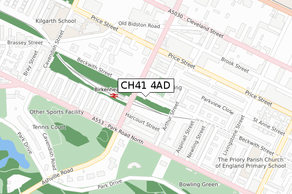
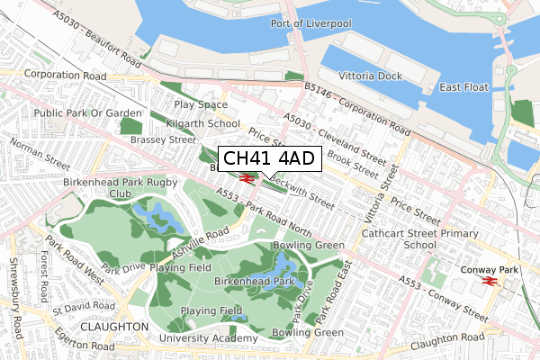
CH41 4AD is located in the Bidston and St James electoral ward, within the metropolitan district of Wirral and the English Parliamentary constituency of Birkenhead. The Sub Integrated Care Board (ICB) Location is NHS Cheshire and Merseyside ICB - 12F and the police force is Merseyside. This postcode has been in use since October 2017.


GetTheData
Source: OS Open Zoomstack (Ordnance Survey)
Licence: Open Government Licence (requires attribution)
Attribution: Contains OS data © Crown copyright and database right 2024
Source: Open Postcode Geo
Licence: Open Government Licence (requires attribution)
Attribution: Contains OS data © Crown copyright and database right 2024; Contains Royal Mail data © Royal Mail copyright and database right 2024; Source: Office for National Statistics licensed under the Open Government Licence v.3.0
| Easting | 331073 |
| Northing | 389462 |
| Latitude | 53.397484 |
| Longitude | -3.038064 |
GetTheData
Source: Open Postcode Geo
Licence: Open Government Licence
| Country | England |
| Postcode District | CH41 |
| ➜ CH41 open data dashboard ➜ See where CH41 is on a map ➜ Where is Birkenhead? | |
GetTheData
Source: Land Registry Price Paid Data
Licence: Open Government Licence
| Ward | Bidston And St James |
| Constituency | Birkenhead |
GetTheData
Source: ONS Postcode Database
Licence: Open Government Licence
| June 2022 | Drugs | On or near Harcourt Street | 88m |
| June 2022 | Violence and sexual offences | On or near Harcourt Street | 88m |
| June 2022 | Anti-social behaviour | On or near Arthur Street | 130m |
| ➜ Get more crime data in our Crime section | |||
GetTheData
Source: data.police.uk
Licence: Open Government Licence
| Birkenhead Park Station (Duke Street) | Birkenhead | 50m |
| Birkenhead Park Station (Duke Street) | St Anne | 70m |
| Asquith Avenue (Park Road North) | Birkenhead Park | 162m |
| Ashville Road (Park Road North) | Birkenhead Park | 180m |
| Asquith Avenue (Park Road North) | Birkenhead Park | 196m |
| Birkenhead Park Station | 0.1km |
| Conway Park Station | 1.1km |
| Birkenhead North Station | 1.5km |
GetTheData
Source: NaPTAN
Licence: Open Government Licence
GetTheData
Source: ONS Postcode Database
Licence: Open Government Licence


➜ Get more ratings from the Food Standards Agency
GetTheData
Source: Food Standards Agency
Licence: FSA terms & conditions
| Last Collection | |||
|---|---|---|---|
| Location | Mon-Fri | Sat | Distance |
| Ashville Road | 17:15 | 12:00 | 413m |
| Conway Street | 17:15 | 12:00 | 1,139m |
| Garrick Snug | 17:30 | 12:00 | 1,177m |
GetTheData
Source: Dracos
Licence: Creative Commons Attribution-ShareAlike
| Facility | Distance |
|---|---|
| Birkenhead Park Cavendish Road, Birkenhead Outdoor Tennis Courts | 330m |
| Kilgarth School Cavendish Street, Birkenhead Sports Hall | 429m |
| Birkenhead St Mary's Cricket Club Ashville Road, Birkenhead Grass Pitches | 508m |
GetTheData
Source: Active Places
Licence: Open Government Licence
| School | Phase of Education | Distance |
|---|---|---|
| The Priory Parish CofE Primary School The Priory Parish C of E Primary School, 1 Aberdeen Street, Birkenhead, CH41 4HS | Primary | 429m |
| Our Lady and St Edward's Catholic Primary School Price Street, Birkenhead, CH41 8DU | Primary | 433m |
| Kilgarth School Cavendish Street, Birkenhead, CH41 8BA | Not applicable | 433m |
GetTheData
Source: Edubase
Licence: Open Government Licence
The below table lists the International Territorial Level (ITL) codes (formerly Nomenclature of Territorial Units for Statistics (NUTS) codes) and Local Administrative Units (LAU) codes for CH41 4AD:
| ITL 1 Code | Name |
|---|---|
| TLD | North West (England) |
| ITL 2 Code | Name |
| TLD7 | Merseyside |
| ITL 3 Code | Name |
| TLD74 | Wirral |
| LAU 1 Code | Name |
| E08000015 | Wirral |
GetTheData
Source: ONS Postcode Directory
Licence: Open Government Licence
The below table lists the Census Output Area (OA), Lower Layer Super Output Area (LSOA), and Middle Layer Super Output Area (MSOA) for CH41 4AD:
| Code | Name | |
|---|---|---|
| OA | E00036116 | |
| LSOA | E01032903 | Wirral 010F |
| MSOA | E02001476 | Wirral 010 |
GetTheData
Source: ONS Postcode Directory
Licence: Open Government Licence
| CH41 4JJ | St Annes Grove | 65m |
| CH41 4JA | Harcourt Street | 80m |
| CH41 4HW | Beckwith Street | 85m |
| CH41 8BR | Duke Street | 86m |
| CH41 4JH | St Annes Terrace | 88m |
| CH41 8BN | Duke Street | 101m |
| CH41 8BT | Duke Street | 102m |
| CH41 4JF | St Anne Street | 104m |
| CH41 4JB | Arthur Street | 117m |
| CH41 8AT | Asquith Avenue | 125m |
GetTheData
Source: Open Postcode Geo; Land Registry Price Paid Data
Licence: Open Government Licence