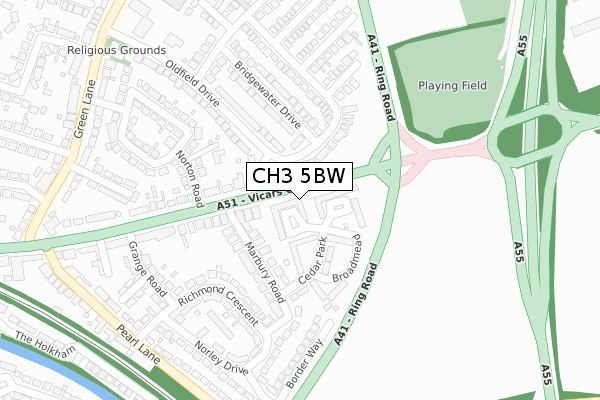
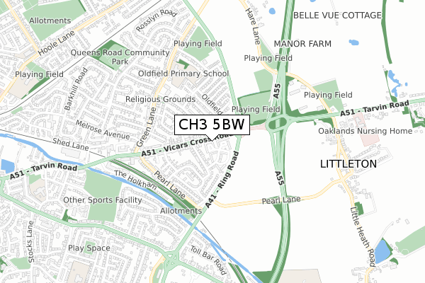
CH3 5BW is located in the Great Boughton electoral ward, within the unitary authority of Cheshire West and Chester and the English Parliamentary constituency of City of Chester. The Sub Integrated Care Board (ICB) Location is NHS Cheshire and Merseyside ICB - 27D and the police force is Cheshire. This postcode has been in use since August 2018.


GetTheData
Source: OS Open Zoomstack (Ordnance Survey)
Licence: Open Government Licence (requires attribution)
Attribution: Contains OS data © Crown copyright and database right 2024
Source: Open Postcode Geo
Licence: Open Government Licence (requires attribution)
Attribution: Contains OS data © Crown copyright and database right 2024; Contains Royal Mail data © Royal Mail copyright and database right 2024; Source: Office for National Statistics licensed under the Open Government Licence v.3.0
| Easting | 343286 |
| Northing | 366662 |
| Latitude | 53.194018 |
| Longitude | -2.850337 |
GetTheData
Source: Open Postcode Geo
Licence: Open Government Licence
| Country | England |
| Postcode District | CH3 |
| ➜ CH3 open data dashboard ➜ See where CH3 is on a map ➜ Where is Chester? | |
GetTheData
Source: Land Registry Price Paid Data
Licence: Open Government Licence
| Ward | Great Boughton |
| Constituency | City Of Chester |
GetTheData
Source: ONS Postcode Database
Licence: Open Government Licence
| January 2024 | Anti-social behaviour | On or near Petrol Station | 409m |
| January 2024 | Other theft | On or near Petrol Station | 409m |
| November 2023 | Violence and sexual offences | On or near Norley Drive | 300m |
| ➜ Get more crime data in our Crime section | |||
GetTheData
Source: data.police.uk
Licence: Open Government Licence
| Marbury Road (Vicars Cross Road) | Vicar's Cross | 81m |
| Norton Road (Vicars Cross Road) | Vicar's Cross | 183m |
| Willoway Road (Vicars Cross Road) | Vicar's Cross | 350m |
| Shaftesbury Avenue (Green Lane) | Vicar's Cross | 383m |
| Shaftesbury Avenue (Green Lane) | Vicar's Cross | 398m |
| Chester Station | 2km |
| Bache Station | 3.2km |
GetTheData
Source: NaPTAN
Licence: Open Government Licence
| Percentage of properties with Next Generation Access | 100.0% |
| Percentage of properties with Superfast Broadband | 100.0% |
| Percentage of properties with Ultrafast Broadband | 0.0% |
| Percentage of properties with Full Fibre Broadband | 0.0% |
Superfast Broadband is between 30Mbps and 300Mbps
Ultrafast Broadband is > 300Mbps
| Percentage of properties unable to receive 2Mbps | 0.0% |
| Percentage of properties unable to receive 5Mbps | 0.0% |
| Percentage of properties unable to receive 10Mbps | 0.0% |
| Percentage of properties unable to receive 30Mbps | 0.0% |
GetTheData
Source: Ofcom
Licence: Ofcom Terms of Use (requires attribution)
GetTheData
Source: ONS Postcode Database
Licence: Open Government Licence


➜ Get more ratings from the Food Standards Agency
GetTheData
Source: Food Standards Agency
Licence: FSA terms & conditions
| Last Collection | |||
|---|---|---|---|
| Location | Mon-Fri | Sat | Distance |
| Boughton Post Office | 17:00 | 11:45 | 462m |
| Toll Bar Road. | 17:41 | 12:28 | 652m |
| Littleton, | 17:34 | 07:00 | 723m |
GetTheData
Source: Dracos
Licence: Creative Commons Attribution-ShareAlike
| Facility | Distance |
|---|---|
| Oldfield Primary School Green Lane, Vicars Cross, Chester Grass Pitches | 459m |
| Thackeray Drive Playing Fields Thackeray Drive, Vicars Cross, Chester Grass Pitches | 543m |
| Chester Rugby Union Club Hare Lane, Littleton, Chester Grass Pitches, Squash Courts, Artificial Grass Pitch | 569m |
GetTheData
Source: Active Places
Licence: Open Government Licence
| School | Phase of Education | Distance |
|---|---|---|
| Oldfield Primary School Green Lane, Vicars Cross, Chester, CH3 5LB | Primary | 480m |
| Cherry Grove Primary School Cherry Grove Road, Chester, CH3 5EG | Primary | 1.1km |
| Boughton Heath Academy Becketts Lane, Great Boughton, Chester, CH3 5RW | Primary | 1.1km |
GetTheData
Source: Edubase
Licence: Open Government Licence
The below table lists the International Territorial Level (ITL) codes (formerly Nomenclature of Territorial Units for Statistics (NUTS) codes) and Local Administrative Units (LAU) codes for CH3 5BW:
| ITL 1 Code | Name |
|---|---|
| TLD | North West (England) |
| ITL 2 Code | Name |
| TLD6 | Cheshire |
| ITL 3 Code | Name |
| TLD63 | Cheshire West and Chester |
| LAU 1 Code | Name |
| E06000050 | Cheshire West and Chester |
GetTheData
Source: ONS Postcode Directory
Licence: Open Government Licence
The below table lists the Census Output Area (OA), Lower Layer Super Output Area (LSOA), and Middle Layer Super Output Area (MSOA) for CH3 5BW:
| Code | Name | |
|---|---|---|
| OA | E00092744 | |
| LSOA | E01018381 | Cheshire West and Chester 036C |
| MSOA | E02003804 | Cheshire West and Chester 036 |
GetTheData
Source: ONS Postcode Directory
Licence: Open Government Licence
| CH3 5PS | Watling Court | 25m |
| CH3 5PP | Stamford Court | 59m |
| CH3 5LW | Oldfield Drive | 60m |
| CH3 5NP | Vicars Cross Road | 88m |
| CH3 5PW | Cedar Park | 99m |
| CH3 5PT | Broadmead | 121m |
| CH3 5PH | Marbury Road | 122m |
| CH3 5NN | Vicars Cross Road | 126m |
| CH3 5PJ | Marbury Road | 139m |
| CH3 5LN | Oldfield Drive | 156m |
GetTheData
Source: Open Postcode Geo; Land Registry Price Paid Data
Licence: Open Government Licence