CF44 6BF maps, stats, and open data
CF44 6BF is located in the Aberaman electoral ward, within the unitary authority of Rhondda Cynon Taf and the Welsh Parliamentary constituency of Cynon Valley. The Local Health Board is Cwm Taf Morgannwg University and the police force is South Wales. This postcode has been in use since August 2018.
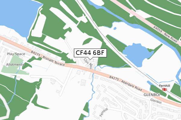
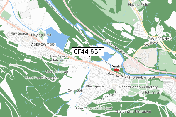
CF44 6BF maps


Licence: Open Government Licence (requires attribution)
Attribution: Contains OS data © Crown copyright and database right 2025
Source: Open Postcode Geo
Licence: Open Government Licence (requires attribution)
Attribution: Contains OS data © Crown copyright and database right 2025; Contains Royal Mail data © Royal Mail copyright and database right 2025; Source: Office for National Statistics licensed under the Open Government Licence v.3.0
CF44 6BF geodata
| Easting | 303176 |
| Northing | 199704 |
| Latitude | 51.687719 |
| Longitude | -3.402066 |
Where is CF44 6BF?
| Country | Wales |
| Postcode District | CF44 |
Politics
| Ward | Aberaman |
|---|---|
| Constituency | Cynon Valley |
House Prices
Sales of detached houses in CF44 6BF
4, CLOS AFON, ABERCWMBOI, ABERDARE, CF44 6BF 2023 17 FEB £245,000 |
2022 5 AUG £300,000 |
1, CLOS AFON, ABERCWMBOI, ABERDARE, CF44 6BF 2020 13 JAN £299,950 |
18, CLOS AFON, ABERCWMBOI, ABERDARE, CF44 6BF 2019 28 NOV £320,000 |
12, CLOS AFON, ABERCWMBOI, ABERDARE, CF44 6BF 2019 15 NOV £268,000 |
4, CLOS AFON, ABERCWMBOI, ABERDARE, CF44 6BF 2019 12 JUN £169,950 |
5, CLOS AFON, ABERCWMBOI, ABERDARE, CF44 6BF 2019 15 FEB £270,000 |
9, CLOS AFON, ABERDARE, CF44 6BF 2019 17 JAN £260,000 |
3, CLOS AFON, ABERCWMBOI, ABERDARE, CF44 6BF 2018 30 NOV £295,000 |
15, CLOS AFON, ABERCWMBOI, ABERDARE, CF44 6BF 2018 18 OCT £255,000 |
Licence: Contains HM Land Registry data © Crown copyright and database right 2025. This data is licensed under the Open Government Licence v3.0.
Transport
Nearest bus stops to CF44 6BF
| The Lodge (Aberdare Road) | Fernhill | 72m |
| The Lodge (Aberdare Road) | Fernhill | 87m |
| Terminus (Bronallt Terrace) | Abercwmboi | 286m |
| Fernhill Estate Middle (Fernhill) | Fernhill | 297m |
| Fernhill Estate Middle (Fernhill) | Fernhill | 303m |
Nearest railway stations to CF44 6BF
| Fernhill Station | 0.4km |
| Cwmbach Station | 1.8km |
| Mountain Ash Station | 1.9km |
Broadband
Broadband access in CF44 6BF (2020 data)
| Percentage of properties with Next Generation Access | 94.1% |
| Percentage of properties with Superfast Broadband | 94.1% |
| Percentage of properties with Ultrafast Broadband | 0.0% |
| Percentage of properties with Full Fibre Broadband | 0.0% |
Superfast Broadband is between 30Mbps and 300Mbps
Ultrafast Broadband is > 300Mbps
Broadband speed in CF44 6BF (2019 data)
Download
| Median download speed | 40.0Mbps |
| Average download speed | 38.6Mbps |
| Maximum download speed | 76.49Mbps |
Upload
| Median upload speed | 10.0Mbps |
| Average upload speed | 10.8Mbps |
| Maximum upload speed | 20.00Mbps |
Broadband limitations in CF44 6BF (2020 data)
| Percentage of properties unable to receive 2Mbps | 0.0% |
| Percentage of properties unable to receive 5Mbps | 0.0% |
| Percentage of properties unable to receive 10Mbps | 0.0% |
| Percentage of properties unable to receive 30Mbps | 0.0% |
Deprivation
87.6% of Welsh postcodes are less deprived than CF44 6BF:Food Standards Agency
Three nearest food hygiene ratings to CF44 6BF (metres)


➜ Get more ratings from the Food Standards Agency
Nearest post box to CF44 6BF
| Last Collection | |||
|---|---|---|---|
| Location | Mon-Fri | Sat | Distance |
| St Winifreds Church | 16:45 | 11:45 | 3,329m |
| High Street | 17:00 | 11:15 | 4,293m |
| Gadlys Road | 17:15 | 10:30 | 4,813m |
CF44 6BF ITL and CF44 6BF LAU
The below table lists the International Territorial Level (ITL) codes (formerly Nomenclature of Territorial Units for Statistics (NUTS) codes) and Local Administrative Units (LAU) codes for CF44 6BF:
| ITL 1 Code | Name |
|---|---|
| TLL | Wales |
| ITL 2 Code | Name |
| TLL1 | West Wales and The Valleys |
| ITL 3 Code | Name |
| TLL15 | Central Valleys |
| LAU 1 Code | Name |
| W06000016 | Rhondda Cynon Taf |
CF44 6BF census areas
The below table lists the Census Output Area (OA), Lower Layer Super Output Area (LSOA), and Middle Layer Super Output Area (MSOA) for CF44 6BF:
| Code | Name | |
|---|---|---|
| OA | W00006022 | |
| LSOA | W01001142 | Rhondda Cynon Taf 005F |
| MSOA | W02000256 | Rhondda Cynon Taf 005 |
Nearest postcodes to CF44 6BF
| CF44 6BT | 54m | |
| CF44 6BU | 216m | |
| CF45 3EG | Fernhill | 231m |
| CF45 3EF | Fernhill | 236m |
| CF44 6BP | Bronallt Terrace | 290m |
| CF45 3EH | Fernhill | 369m |
| CF45 3DG | Glenboi | 374m |
| CF45 3EE | Fernhill | 389m |
| CF44 6BW | Bronallt Terrace | 404m |
| CF45 3ER | Fernhill | 442m |