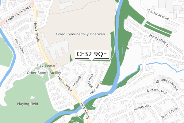
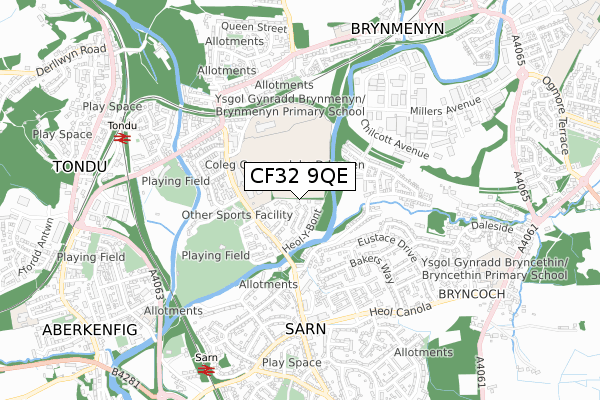
CF32 9QE is located in the St Bride's Minor and Ynysawdre electoral ward, within the unitary authority of Bridgend and the Welsh Parliamentary constituency of Ogmore. The Local Health Board is Cwm Taf Morgannwg University and the police force is South Wales. This postcode has been in use since August 2019.


GetTheData
Source: OS Open Zoomstack (Ordnance Survey)
Licence: Open Government Licence (requires attribution)
Attribution: Contains OS data © Crown copyright and database right 2024
Source: Open Postcode Geo
Licence: Open Government Licence (requires attribution)
Attribution: Contains OS data © Crown copyright and database right 2024; Contains Royal Mail data © Royal Mail copyright and database right 2024; Source: Office for National Statistics licensed under the Open Government Licence v.3.0
| Easting | 290271 |
| Northing | 184115 |
| Latitude | 51.545229 |
| Longitude | -3.583794 |
GetTheData
Source: Open Postcode Geo
Licence: Open Government Licence
| Country | Wales |
| Postcode District | CF32 |
| ➜ CF32 open data dashboard ➜ See where CF32 is on a map ➜ Where is Sarn? | |
GetTheData
Source: Land Registry Price Paid Data
Licence: Open Government Licence
| Ward | St Bride's Minor And Ynysawdre |
| Constituency | Ogmore |
GetTheData
Source: ONS Postcode Database
Licence: Open Government Licence
| January 2024 | Public order | On or near Terfyn Ynysawdre | 287m |
| December 2023 | Possession of weapons | On or near Terfyn Ynysawdre | 287m |
| November 2023 | Violence and sexual offences | On or near Terfyn Ynysawdre | 287m |
| ➜ Get more crime data in our Crime section | |||
GetTheData
Source: data.police.uk
Licence: Open Government Licence
| Heol Y Bont (Heol-yr-ysgol) | Sarn | 215m |
| Heol-y-bont (Heol-yr-ysgol) | Ynysawdre | 221m |
| Heol-yr-ysgol | Tondu | 251m |
| Eustace Drive | Sarn | 266m |
| Eustace Drive | Sarn | 268m |
| Sarn Station | 0.8km |
| Tondu Station | 0.9km |
| Wildmill Station | 2.7km |
GetTheData
Source: NaPTAN
Licence: Open Government Licence
GetTheData
Source: ONS Postcode Database
Licence: Open Government Licence


➜ Get more ratings from the Food Standards Agency
GetTheData
Source: Food Standards Agency
Licence: FSA terms & conditions
| Last Collection | |||
|---|---|---|---|
| Location | Mon-Fri | Sat | Distance |
| Heol Y Groes | 17:30 | 12:00 | 2,088m |
| Pendre | 17:15 | 12:00 | 3,098m |
| Coity | 17:00 | 12:00 | 3,263m |
GetTheData
Source: Dracos
Licence: Creative Commons Attribution-ShareAlike
| School | Phase of Education | Distance |
|---|---|---|
| Brynmenyn Primary School Heol-Yr-Ysgol, Bridgend, CF32 9EL | Not applicable | 735m |
| Bryncethin Primary School Heol Canola, Bryncethin, Bridgend, CF32 9TH | Not applicable | 823m |
| Portfolio PRU Abergarw Road, Bryncethin Campus, Brynmenyn, Bridgend, CF32 9NZ | Not applicable | 876m |
GetTheData
Source: Edubase
Licence: Open Government Licence
The below table lists the International Territorial Level (ITL) codes (formerly Nomenclature of Territorial Units for Statistics (NUTS) codes) and Local Administrative Units (LAU) codes for CF32 9QE:
| ITL 1 Code | Name |
|---|---|
| TLL | Wales |
| ITL 2 Code | Name |
| TLL1 | West Wales and The Valleys |
| ITL 3 Code | Name |
| TLL17 | Bridgend and Neath Port Talbot |
| LAU 1 Code | Name |
| W06000013 | Bridgend |
GetTheData
Source: ONS Postcode Directory
Licence: Open Government Licence
The below table lists the Census Output Area (OA), Lower Layer Super Output Area (LSOA), and Middle Layer Super Output Area (MSOA) for CF32 9QE:
| Code | Name | |
|---|---|---|
| OA | W00005601 | |
| LSOA | W01001057 | Bridgend 006B |
| MSOA | W02000223 | Bridgend 006 |
GetTheData
Source: ONS Postcode Directory
Licence: Open Government Licence
| CF32 9JZ | Maesglas | 74m |
| CF32 9EY | Heol Y Bont | 119m |
| CF32 9EU | Ynysteg | 137m |
| CF32 9ES | Heol Y Fferm | 190m |
| CF32 9PH | Willowturf Court | 223m |
| CF32 9NQ | Clos Tyn Y Coed | 224m |
| CF32 9PQ | Clos Tyn Y Coed | 230m |
| CF32 9ET | Heol Yr Ysgol | 233m |
| CF32 9GG | Heol Bryncethin | 263m |
| CF32 9EN | Terfyn Ynysawdre | 285m |
GetTheData
Source: Open Postcode Geo; Land Registry Price Paid Data
Licence: Open Government Licence