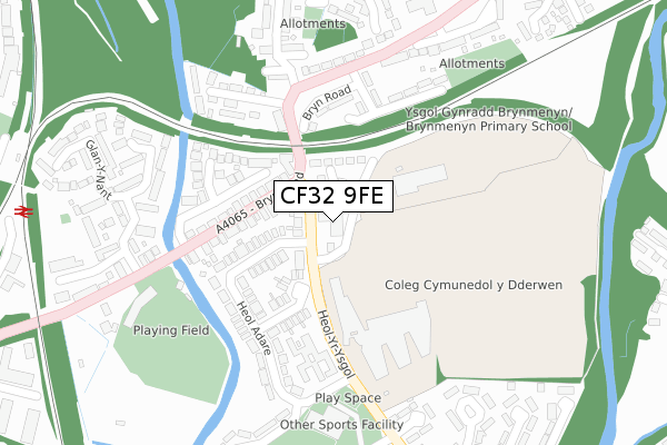
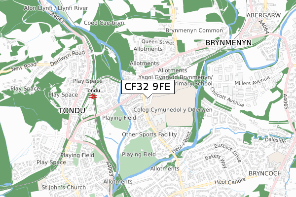
CF32 9FE is located in the St Bride's Minor and Ynysawdre electoral ward, within the unitary authority of Bridgend and the Welsh Parliamentary constituency of Ogmore. The Local Health Board is Cwm Taf Morgannwg University and the police force is South Wales. This postcode has been in use since January 2019.


GetTheData
Source: OS Open Zoomstack (Ordnance Survey)
Licence: Open Government Licence (requires attribution)
Attribution: Contains OS data © Crown copyright and database right 2024
Source: Open Postcode Geo
Licence: Open Government Licence (requires attribution)
Attribution: Contains OS data © Crown copyright and database right 2024; Contains Royal Mail data © Royal Mail copyright and database right 2024; Source: Office for National Statistics licensed under the Open Government Licence v.3.0
| Easting | 289959 |
| Northing | 184360 |
| Latitude | 51.547370 |
| Longitude | -3.588368 |
GetTheData
Source: Open Postcode Geo
Licence: Open Government Licence
| Country | Wales |
| Postcode District | CF32 |
| ➜ CF32 open data dashboard ➜ See where CF32 is on a map ➜ Where is Sarn? | |
GetTheData
Source: Land Registry Price Paid Data
Licence: Open Government Licence
| Ward | St Bride's Minor And Ynysawdre |
| Constituency | Ogmore |
GetTheData
Source: ONS Postcode Database
Licence: Open Government Licence
| January 2024 | Vehicle crime | On or near Glan-Y-Nant | 342m |
| January 2024 | Vehicle crime | On or near Glan-Y-Nant | 342m |
| January 2024 | Vehicle crime | On or near Glan-Y-Nant | 342m |
| ➜ Get more crime data in our Crime section | |||
GetTheData
Source: data.police.uk
Licence: Open Government Licence
| Comprehensive School (Heol-yr-ysgol) | Ynysawdre | 52m |
| Comprehensive School (Heol-yr-ysgol) | Ynysawdre | 120m |
| Gas Works (Bryn Road) | Brynmenyn | 211m |
| Gas Works (Bryn Road) | Brynmenyn | 211m |
| Heol-yr-ysgol | Tondu | 234m |
| Tondu Station | 0.5km |
| Sarn Station | 1km |
| Wildmill Station | 3km |
GetTheData
Source: NaPTAN
Licence: Open Government Licence
| Percentage of properties with Next Generation Access | 100.0% |
| Percentage of properties with Superfast Broadband | 100.0% |
| Percentage of properties with Ultrafast Broadband | 100.0% |
| Percentage of properties with Full Fibre Broadband | 100.0% |
Superfast Broadband is between 30Mbps and 300Mbps
Ultrafast Broadband is > 300Mbps
| Percentage of properties unable to receive 2Mbps | 0.0% |
| Percentage of properties unable to receive 5Mbps | 0.0% |
| Percentage of properties unable to receive 10Mbps | 0.0% |
| Percentage of properties unable to receive 30Mbps | 0.0% |
GetTheData
Source: Ofcom
Licence: Ofcom Terms of Use (requires attribution)
GetTheData
Source: ONS Postcode Database
Licence: Open Government Licence


➜ Get more ratings from the Food Standards Agency
GetTheData
Source: Food Standards Agency
Licence: FSA terms & conditions
| Last Collection | |||
|---|---|---|---|
| Location | Mon-Fri | Sat | Distance |
| Heol Y Groes | 17:30 | 12:00 | 2,408m |
| Pendre | 17:15 | 12:00 | 3,410m |
| Coity | 17:00 | 12:00 | 3,647m |
GetTheData
Source: Dracos
Licence: Creative Commons Attribution-ShareAlike
| School | Phase of Education | Distance |
|---|---|---|
| Brynmenyn Primary School Heol-Yr-Ysgol, Bridgend, CF32 9EL | Not applicable | 664m |
| Portfolio PRU Abergarw Road, Bryncethin Campus, Brynmenyn, Bridgend, CF32 9NZ | Not applicable | 854m |
| Tondu Primary School Meadow Street, Aberkenfig, Bridgend, CF32 9BE | Not applicable | 1.1km |
GetTheData
Source: Edubase
Licence: Open Government Licence
The below table lists the International Territorial Level (ITL) codes (formerly Nomenclature of Territorial Units for Statistics (NUTS) codes) and Local Administrative Units (LAU) codes for CF32 9FE:
| ITL 1 Code | Name |
|---|---|
| TLL | Wales |
| ITL 2 Code | Name |
| TLL1 | West Wales and The Valleys |
| ITL 3 Code | Name |
| TLL17 | Bridgend and Neath Port Talbot |
| LAU 1 Code | Name |
| W06000013 | Bridgend |
GetTheData
Source: ONS Postcode Directory
Licence: Open Government Licence
The below table lists the Census Output Area (OA), Lower Layer Super Output Area (LSOA), and Middle Layer Super Output Area (MSOA) for CF32 9FE:
| Code | Name | |
|---|---|---|
| OA | W00005600 | |
| LSOA | W01001057 | Bridgend 006B |
| MSOA | W02000223 | Bridgend 006 |
GetTheData
Source: ONS Postcode Directory
Licence: Open Government Licence
| CF32 9EG | Heol Yr Ysgol | 75m |
| CF32 9ER | Heol Cae Glas | 134m |
| CF32 9EF | Bryn Road | 142m |
| CF32 9HL | Gasworks Terrace | 174m |
| CF32 9EP | Heol Adare | 177m |
| CF32 9EQ | Andrews Close | 186m |
| CF32 9LT | Haul Fryn | 213m |
| CF32 9HG | River Way | 257m |
| CF32 9LU | Bryn Road | 266m |
| CF32 9HN | Cae Bryn Terrace | 270m |
GetTheData
Source: Open Postcode Geo; Land Registry Price Paid Data
Licence: Open Government Licence